South Korea, located in East Asia, occupies the southern part of the Korean Peninsula. It shares a border with North Korea to the north and is surrounded by the East Sea (Sea of Japan) to the east, the East China Sea to the south, and the Yellow Sea to the west. The Korea Strait separates it from the Japanese island of Tsushima to the southeast. South Korea comprises approximately 45% of the Korean Peninsula’s land area.
Geographically, South Korea’s landmass is approximately 38,751 square miles (100,364 Sq Km) including the land mass from its islands. 110 square miles (290 Sq Kms ) of South Korea is occupied by water. South Korea alone is about the size of Portugal or Hungary.
Korea’s geological landscape is a result of a complex interplay of tectonic plate movement, volcanic activity, and erosion. Approximately 30 million years ago, the East Sea formed, separating the Korean Peninsula from Japan and causing the eastern side of the peninsula to rise to a higher elevation than the western side. This geological evolution has left its mark on Korea’s diverse topography, characterized by mountains, valleys, and coastal plains.
The Korean Peninsula is divided by the Demilitarized Zone (DMZ), a 2.5-mile-wide buffer established in 1953 to halt the fighting in the Korean War. The DMZ, which stretches approximately 150 miles along the 38th parallel, marks the military cease-fire line between South Korea and North Korea. It runs from the Han River estuary on the west coast to just south of the North Korean town of Kosong on the east coast.
Mountains and Mountain Ranges

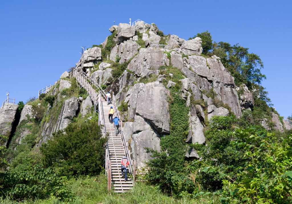
About 3/4ths of the land of South Korea is made up of mountains. The mountains are more abundant towards the east of the country. Many tall mountains exceeding 1,000 m (3,281 ft), which are concentrated in the north and the east, form the “topological backbone” of the country. There are two major mountain ranges within South Korea: the Taebaek Mountains, and the Sobaek Mountains.
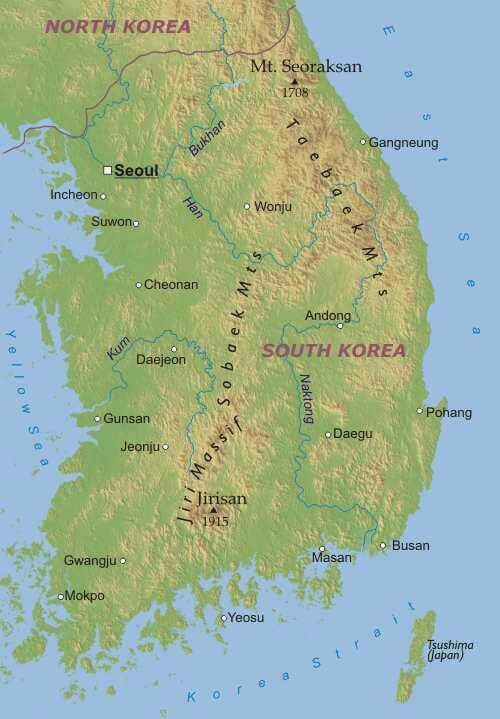
The Taebaek Mountains
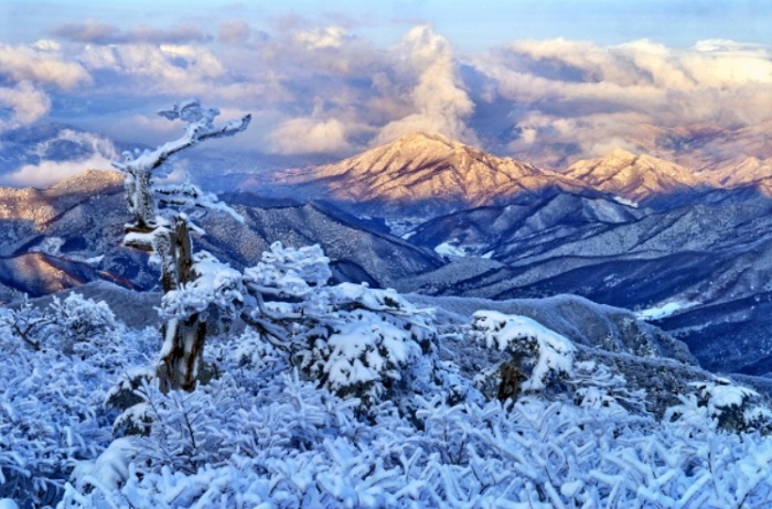
The Taebaek Mountains form a prominent ridge along the eastern edge of the Korean Peninsula, extending from the Hwangnyong Mountain in North Korea (1,268 meters) to Busan in the south. This range spans over 500 kilometers with an average height of 1,000 meters.
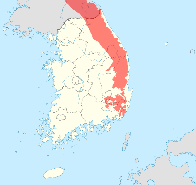
Among the Taebaek Mountains’ 2,085 peaks, Daecheongbong (1,708 meters) stands as the tallest and most prominent. Located on Mount Seoraksan within Seoraksan National Park, Daecheongbong is also part of the UNESCO-designated Mount Sorak Biosphere Reserve. Other notable peaks in the range include Mount Seoraksan (1,708 meters), Mount Kumgangsan (1,638 meters), Mount Taebaeksan (1,566.7 meters), and Mount Odaesan (1,563 meters).

The eastern side of the range descends sharply toward the sea, while the western side features gentler slopes and numerous spurs extending southwest.
Here is what they look like in the winter time:

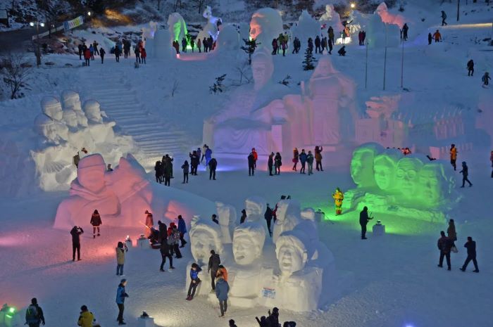
There is a winter festival held within the mountains every year at Gangwon-do. They have ice sculptures, sledding and delicious comforting foods.

The Sobaek Mountains
The Sobaek Mountains extend southwest from the Taebaek Mountains, traversing approximately 350 kilometers across the Gyeongsangnam-do, Sancheong-gun, and Hamyang-gun provinces in South Korea. The range’s highest peak is Cheonwangbong (1,918 meters), also known as Jirisan, which holds the title of the country’s second-tallest mountain. Cheonwangbong literally translates as “Sky King Peak”.
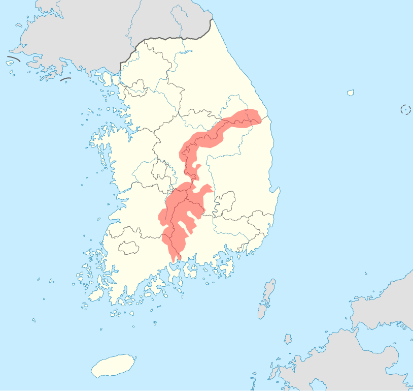
The Sobaek Mountains, stretching approximately 350 kilometers in a distinctive S-shape, form a southwestern extension of the Taebaek Mountains in South Korea. Primarily composed of metamorphic and sedimentary rock, the Sobaek Mountains offer a diverse geological landscape shaped over millions of years by tectonic forces and erosion. Their unique geological composition has contributed to the formation of various landforms, including rugged peaks, deep valleys, and scenic river gorges.
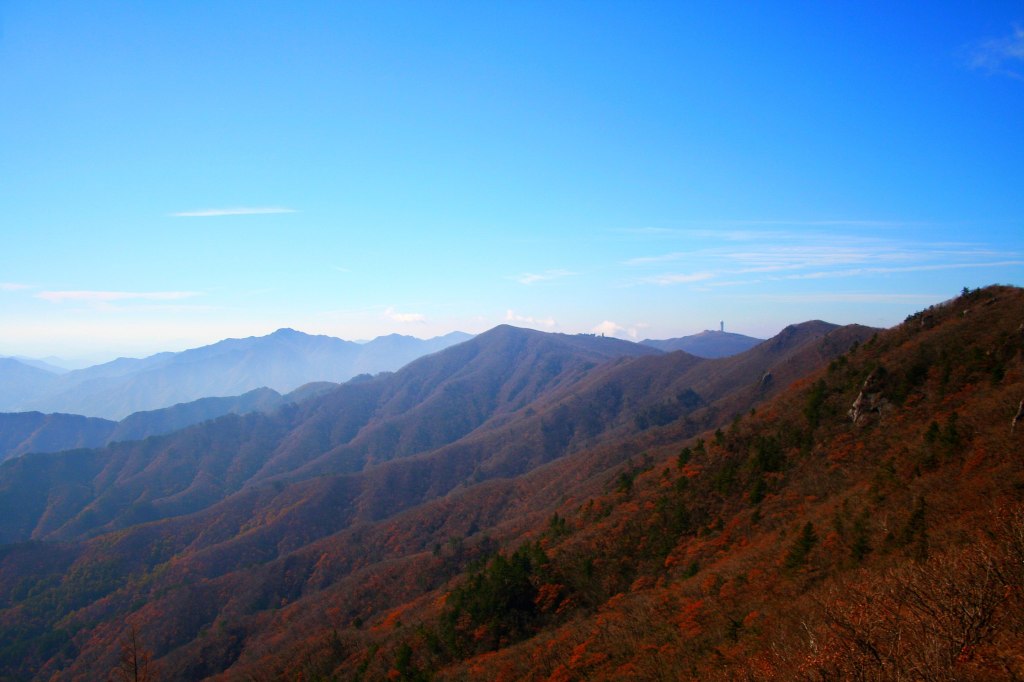
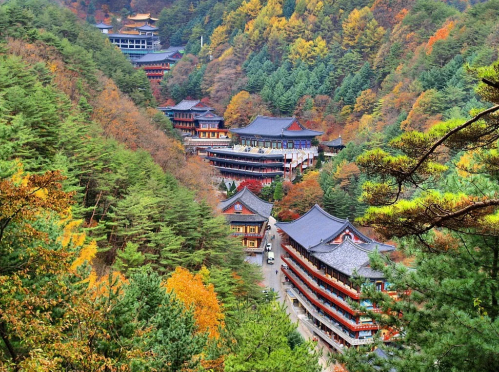
Isn’t this place magnificent! Check out someone’s spiritual retreat at this temple HERE.
And this video is very nice, helps you feel like you are there:

The Coast and Islands
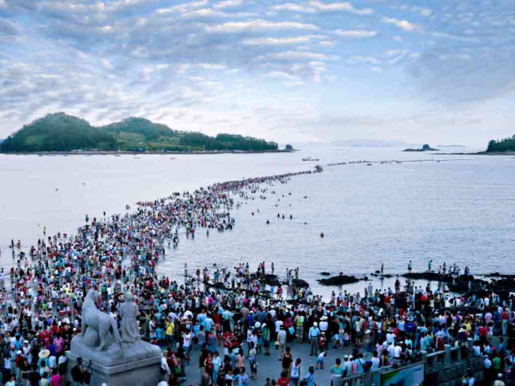
The 8,640-kilometer coastline is highly indented. Some 3,579 islands lie adjacent to the peninsula. Most of them are found along the south and west coasts.
Korea’s coastline is characterized by extensive lowlands along the lower reaches of its major rivers. The eastern coast is relatively linear, while the western and southern coasts are highly indented with numerous islands, forming a jagged coastline. The shallow Yellow Sea and the intricate Korean coastline produce some of the world’s most dramatic tidal fluctuations, reaching a maximum of approximately 30 feet (9 meters) at Incheon, the gateway port for Seoul.

The Yellow Sea receives its name due to sand and silt brought by the rivers through the Bohai Sea (Liao River, Yellow River, Hai He) and the Korea Bay (Yalu River).
Notable islands in the Korean Sea include Anmado, Baengnyeongdo, Daebudo, Deokjeokdo, Gageodo, Ganghwado, Hauido, Heuksando, Hongdo, Jejudo, Jindo, Muuido, Sido, Silmido, Sindo, Wando, Yeongjongdo, and Yeonpyeongdo, all located within South Korea.

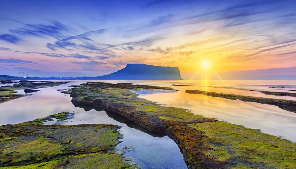
The most famous is Jeju Island, where the highest peak of South Korea is located: the volcano Mount Halla that seats at 6,398 feet (1,950 meters) above sea level. (It is extinct.)


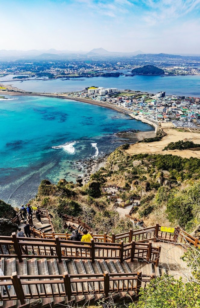
Would you like to go to Jeju Island? I’m planning a virtual trip there for my next post! Please come along! For now enjoy this beautiful photo taken there: