Tunisia is a North African country occupying approximately 63,170 square miles (163,610 km2) total, with approximately 3,185 square miles (8,250 km2) of water. It borders the Mediterranean Sea and is flanked by Algeria to the west and Libya to the southeast.
Tunisia has the northernmost point of continental Africa: Cape Angela (also known as Ras Angela or Rās ben Sakka), a rocky headland located in the Governorate of Bizerte. The city Bizerte (in Tunisia) is also the northernmost city in the continent of Africa.
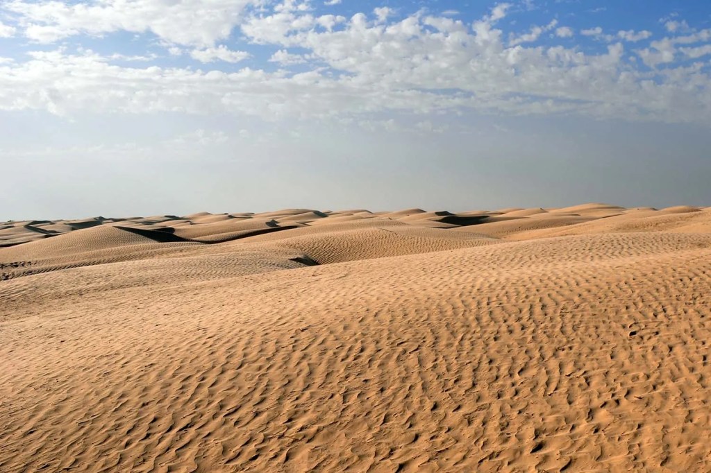
The country’s land area tapers toward the southwest into the Sahara Desert. Its complex coastline includes the curved Gulf of Gabès, which marks the western edge of Africa’s larger Gulf of Sidra (whose main coast is Libya, including the city of Sirte).
The country’s reliable river systems and diverse plant cover are predominantly found in the northern plain, where rainfall supports irrigated agriculture and where the principal rivers, many originating in north-eastern Algeria, flow.
Tunisia’s Geographical Regions
Tunisia is home to five terrestrial ecoregions: Mediterranean conifer and mixed forests, Mediterranean dry woodlands and steppe, Mediterranean woodlands and forests, North Saharan steppe and woodlands and the Saharan halophytics.

The Mediterranean Conifer and Mixed Forests
The “Mediterranean Conifer and Mixed Forests” (a distinct ecoregion within the larger Mediterranean forests biome) is characterized by relict stands of conifers and broadleaf trees found in the most humid, higher-elevation areas of the Northwestern African mountain ranges. These ranges include.
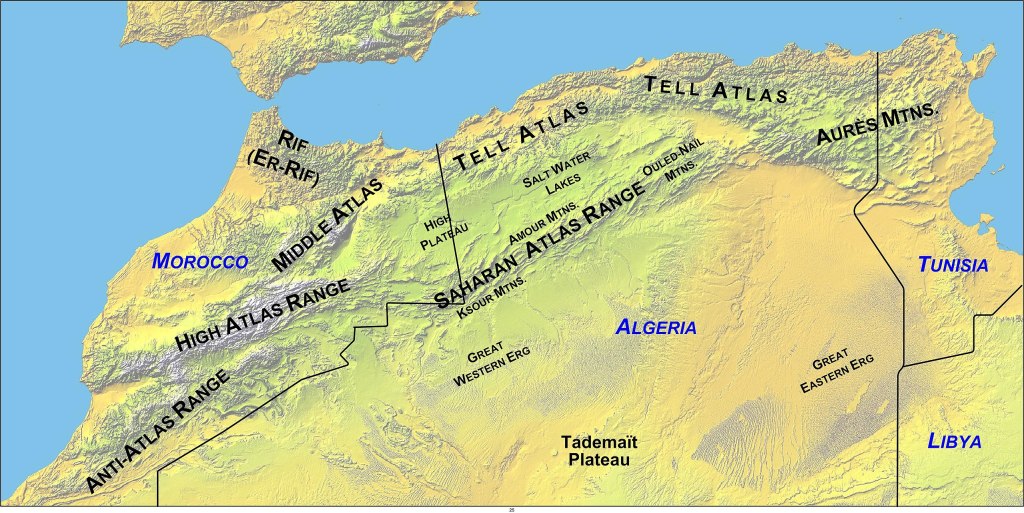
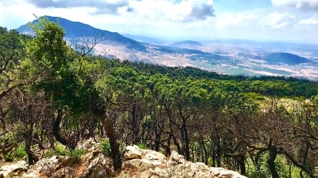
The Eastern Subrange of the Atlas Mountains: The Eastern Subrange of the Atlas Mountains constitutes the final, northeastern termination of the great mountain chain, predominantly divided in Tunisia into two parallel sections: the wetter, more temperate Tell Atlas (including the Kroumirie mountains) near the northern coast, and the drier Saharan Atlas (including the Aurès Mountains) further inland. This range runs diagonally across the country from the Algerian border, acting as a crucial hydrological and climatic barrier; the highest rainfall in North Africa occurs in the humid Kroumirie region (part of the Tell Atlas), supporting dense forests of cork oak and Aleppo pine, while the more arid mountains to the south, such as Jebel ech Chambi (Tunisia’s highest peak at 1,544 meters), are covered in steppes and less dense woodlands.

Kroumerie Mountains: The Kroumirie is an eastern extension of the Atlas Mountains. The region is named after its people, the Khumayr (locally Khmīr). Known for high humidity and being the location of the most significant broadleaf forests. It has extensive forest cover, over 70% of the trees being cork oak and 20% zean oak. Other species include wild olive and the undergrowth comprises mostly ferns.

Mogod Mountain Ranges: A coastal range that also hosts these mixed forest communities.
These areas receive significant annual rainfall, often averaging over 1,000 mm, creating sharp microclimate changes between the humid northern slopes and the drier southern slopes.
Key Tree Species
The vegetation is typically stratified into two zones, though there is considerable overlap:
1. Conifer Zone (Higher Elevations)
While the Atlas Cedar (Cedrus atlantica) is a flagship species in Morocco and Algeria, Tunisia’s conifer forests are dominated by:
Aleppo Pine (Pinus halepensis): This is the most widespread conifer in Tunisia’s forests, particularly on the Dorsal Mountains and in semi-arid central Tunisia. It is highly valued for reforestation due to its resilience to drought and poor soils.
Stone Pine (Pinus pinea): Also a significant pine species used in forestry.
Junipers (Juniperus species): Such as Juniperus oxycedrus and Juniperus phoenicea, which form small woodlands or are mixed with other species.
2. Mixed/Broadleaf Zone (Lower, More Humid Elevations)
The mixed forests are dominated by species of oak, which thrive in the warm, humid conditions:
Cork Oak (Quercus suber): Found in the warmest and most humid areas, particularly in the Kroumerie-Mogod ranges. Cork forests are vital both ecologically and historically for their economic value.
Zean/Algerian Oak (Quercus canariensis): A dominant broadleaf species, also prominent in the Kroumerie Mountains.
Afares Oak (Quercus afares): An endemic oak found in the Krumerie Mountains and parts of Algeria.
Berber Thuya (Tetraclinis articulata): An endemic conifer (often grouped with the broadleaves due to its location) that forms woodlands mainly on limestone soils along the northeastern coast.
Fauna and Biodiversity
These forests host a rich mix of Palaearctic (Eurasian) and North African animal taxa. The Kroumerie-Mogod forests are home to the last existing populations of the only endemic African deer species: the Atlas Deer (Cervus elaphus barbarus). Other species include the African wildcat, red fox, golden jackal, and various endemic reptiles.
Conservation and Threats
The Mediterranean Conifer and Mixed Forests ecoregion is considered to have a Vulnerable/Endangered conservation status across North Africa. In Tunisia, major threats include: deforestation, overgrazing, wildfires and climate change.
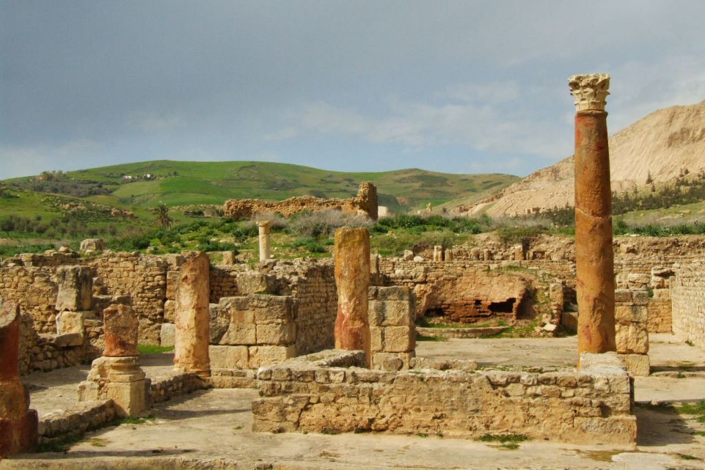
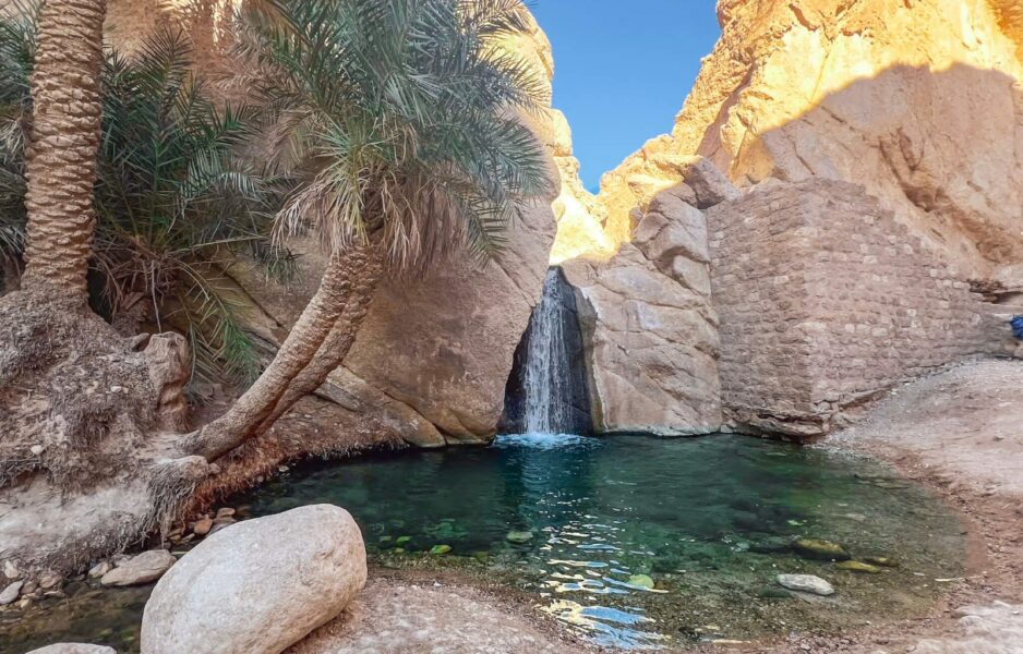
Tunisia has established protected areas to conserve these ecosystems, such as El Feija National Park and Oued Zeen National Park, which protect these vital forest habitats.
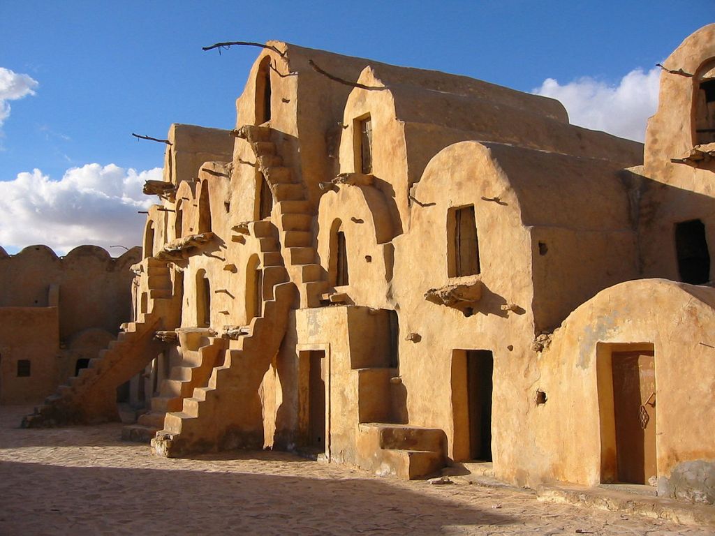
These photos are from El Feija National Park:
The Atlas deer is the only species of deers found in Africa. It lives in the forests of Algeria, Morocco, and Tunisia. The establishment of the National Park El Feija in the province of Jendouba led to the proliferation of its numbers in Tunisia.

The Mediterranean Dry Woodlands and Steppe
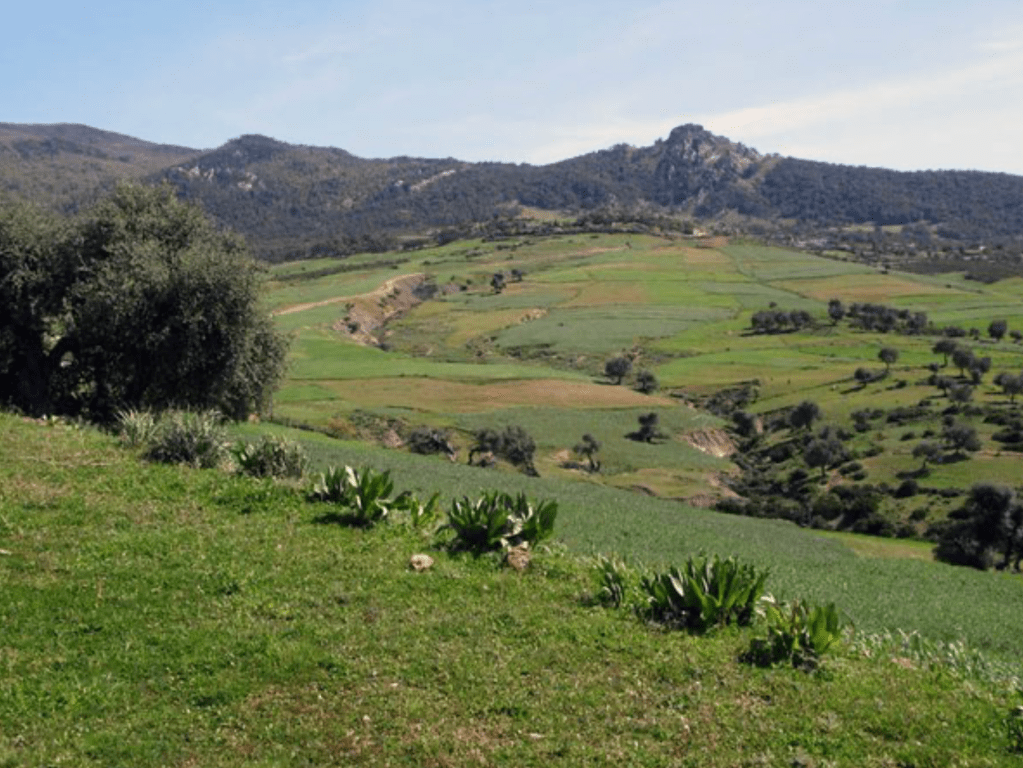
The Mediterranean Dry Woodlands and Steppe is a significant ecoregion in Tunisia, representing the transitional belt between the humid Mediterranean forests of the north and the arid conditions leading to the Sahara Desert in the south. A steppe is an ecoregion characterized by vast, flat, treeless grassland plains with a semi-arid climate.

Location and Climate
This ecoregion covers the interior plateaus and mountain ranges of Tunisia, primarily extending across the central portion of the country:
Location: It runs along the southern slopes of the higher mountains (like the Tunisian Dorsal), covering the high plains (Steppes) between the mountain chains and the Saharan regions. It stretches from the Algerian border eastward, meeting the Mediterranean coast near the Gulf of Gabès.
Climate: The region is semi-arid, with annual rainfall generally ranging between 100 and 300 mm. Rainfall is concentrated in the cooler winter months, and the summers are long, hot, and dry, with temperatures often climbing to 40∘C (104∘F). This harsh, dry environment limits the growth of dense forests.
Vegetation and Key Species
The landscape is primarily a mosaic of steppe, sparse scrubland, and open woodland, with the specific dominant vegetation depending heavily on local soil, elevation, and rainfall variability.
Steppe Grasses: Large areas are covered by tough, drought-resistant grasses that form the characteristic steppe landscape.
Esparto Grass (Stipa tenacissima): Known locally as Alfa grass, this is a dominant species, particularly on the higher plateaus and slopes. It’s historically important as a source of fiber.
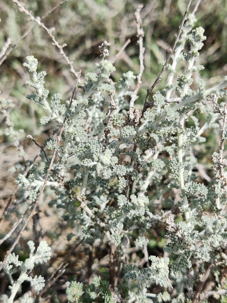
–Artemisia herba-alba (White Wormwood): Dominates the silty slopes and depressions.
–Lygeum spartum: Another grass species found across the steppe.
Dry Woodlands: Patches of trees and shrubs, often open and scattered, survive in the slightly wetter depressions, foothills, and higher elevations:
Aleppo Pine (Pinus halepensis): The main coniferous tree, forming open woodlands, especially on the slopes of the Atlas Mountains.
Holm Oak (Quercus ilex): Found in more favorable conditions.
Juniper (Juniperus phoenicea): A significant conifer in drier areas.
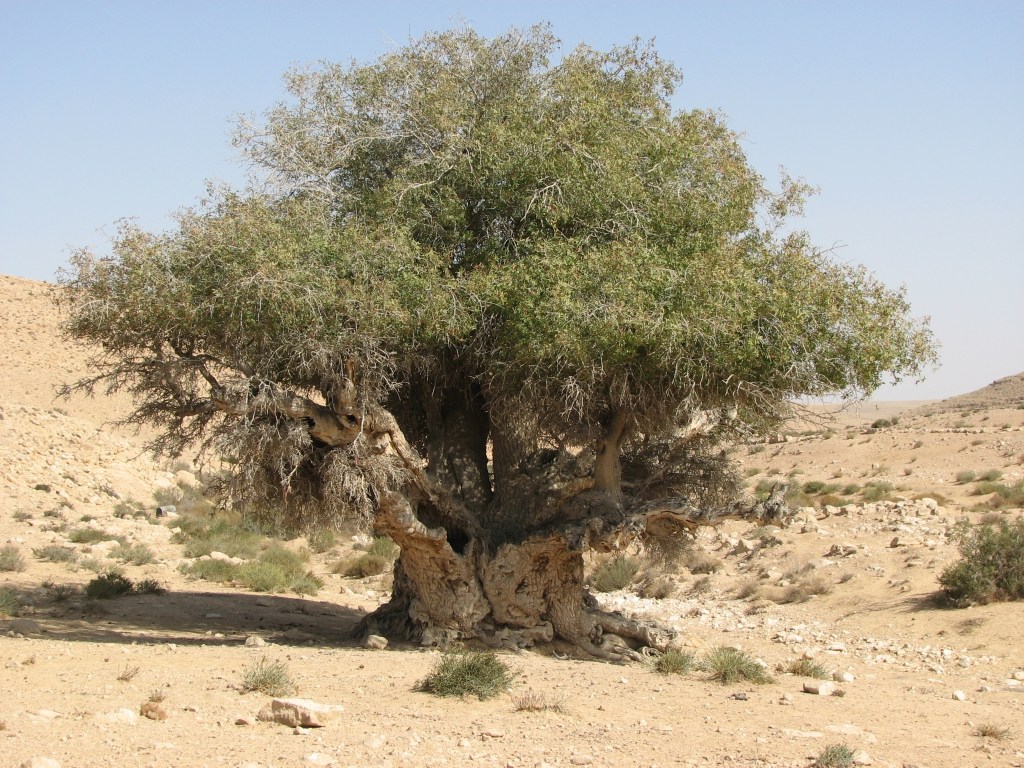
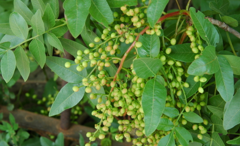
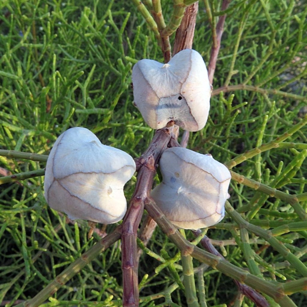
Pistachio (Pistacia atlantica): A drought-tolerant tree found in scrub and scattered formations. This is a Pistachio plant… first time seeing one! It reminds me of olive trees!
And this is the Pistachio… fruit!
I wondered if Tunisia was a major producer and exporter of Pistachios. And they are not compared to the United States, Iran and Turkey but it is still produced and very valued by Tunisians. Pistachio cultivation has a long history in Tunisia, potentially dating back to the Carthaginians, with older trees (up to five hundred years old!!!) still found in some regions like the El Guettar oasis. Sadly I could not find a single photo of one of these trees.
Human Use and Conservation
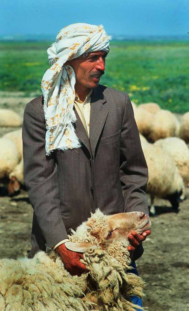
Pastoralism: The dry woodlands and steppe are traditionally used for extensive pastoralism, with sheep and goats grazing on the steppe grasses and shrubs. This has historically been a critical economic activity but also leads to widespread overgrazing, which degrades the fragile steppe environment and contributes to soil erosion.
Agriculture: Settled agriculture is largely restricted to valleys and areas (dayas) with a reliable water supply, supporting the cultivation of fodder and food crops, though this is often precarious due to irregular rainfall. The region is also key for extensive olive cultivation in certain transitional zones like the Sahel.
Threats: The ecoregion faces high pressure from grazing, firewood collection, and climate change (increased drought), all of which threaten to further degrade the dry woodlands and accelerate desertification at the boundary with the Sahara.
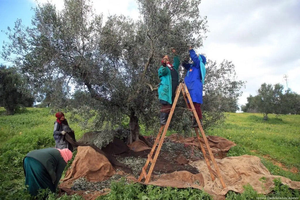
I read about their olive production and sadly this country has been impacted by sever drought in the last years. You can see a video HERE to learn about their struggle and what they have been doing to survive.
Here are a couple of photos depicting farmers picking the olives in the traditional way:

Mediterranean woodlands and forests
The Mediterranean woodlands and forests ecoregion in Tunisia, part of the larger Maghreb region, is a diverse biome characterized by its typical Mediterranean climate and rich flora. This region is a part of the global Mediterranean Basin Hotspot, one of the planet’s most biologically rich and endangered areas.
It is primarily located in the northern half of Tunisia, particularly along the coastal plains, hills, and lower mountain slopes, where it receives the highest rainfall.
The ecoregion is defined by its adaptation to the Mediterranean climate, which features hot, dry summers and mild, wet winters. The varied topography and climate create several distinct forest and woodland types. Some of the vegetation found features Cork Oak Forests (Quercus suber) (overlapping with the first region), Aleppo Pine Forests (Pinus halepensis), Berber Thuya/Sandarac Forests (Tetraclinis articulata) and Wild Olive and Carob Woodlands.
The Sandarac forests are characterized by the unique coppicing ability of the sandarac gum tree (Tetraclinis articulate), allowing it to regrow from stumps after being cut or burned, a valuable adaptation to wildfire. The wood is prized for its scent and is used for luxury items, while the resin has traditional uses in varnishes. This tree grows all over the north of Africa and it is known by many other names: Araar tree, alerce, sandarac gum tree, Barbary arborvitae, Mediterranean alerce, citron, and African juniper.

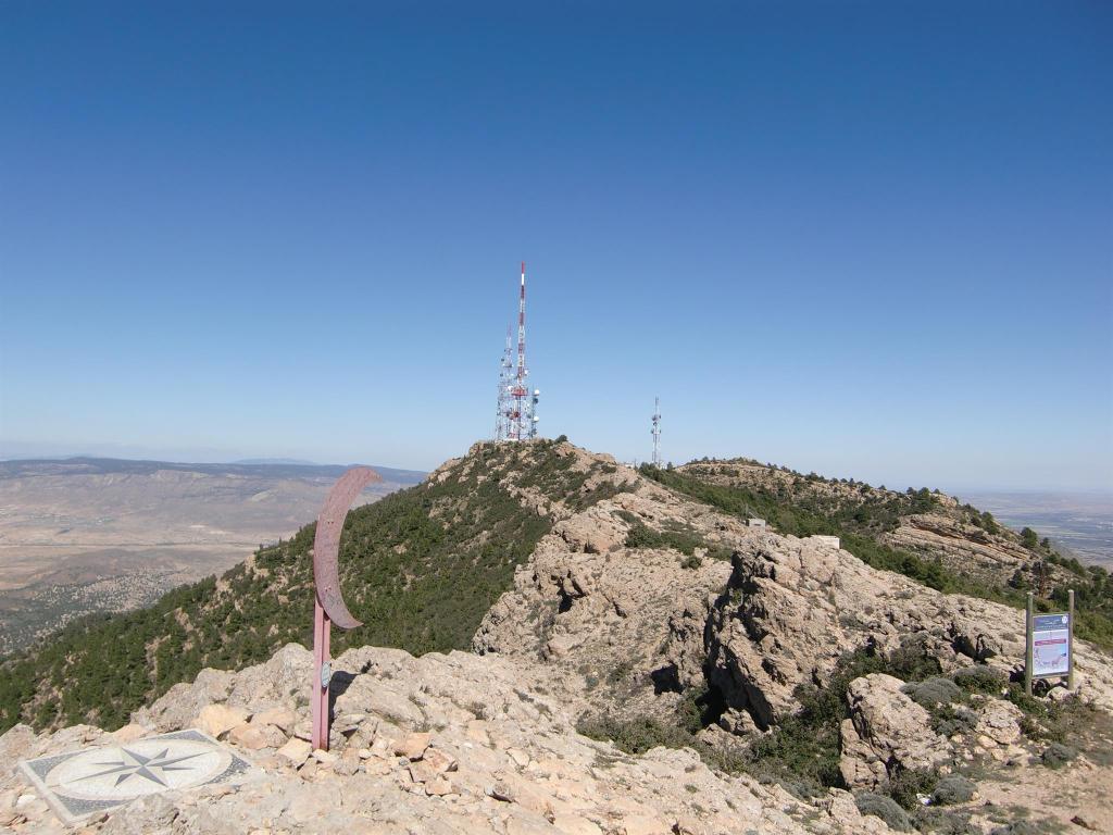
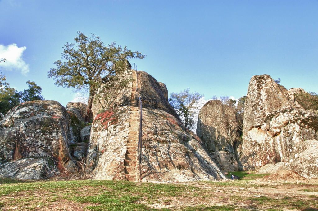
In this ecoregion way on the north, we find the closest national parliament to the city of Tunis: The Djebel Boukornine National park.
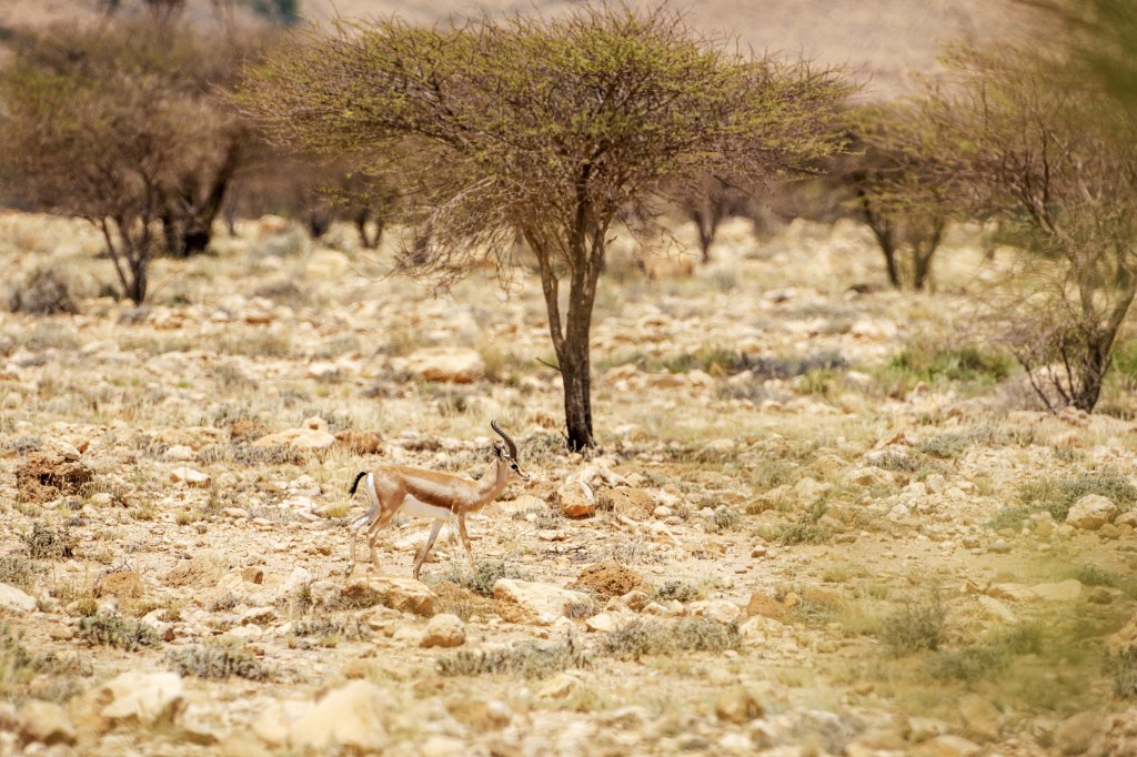
The Djebel Boukornine National Park is a highly accessible natural oasis located just 15-20 km south of Tunisia’s capital, Tunis, centered around the 576-meter-high Jebel Boukornine (Mountain of the Two-Horned). Established in 1987, the park is a vital fragment of the Mediterranean woodlands and forests ecoregion, featuring dense Aleppo pine and Holm oak forests along with unique flora, notably the rare Persian cyclamen and various orchids. Its biodiversity is significant, housing 25 mammal species including the Mountain Gazelle and the tiny Etruscan Shrew (the world’s smallest mammal), while its trails offer hikers and nature enthusiasts panoramic views of the Gulf of Tunis and the surrounding coastal plains, making it a popular recreational and conservation site.

You can see this video about it:
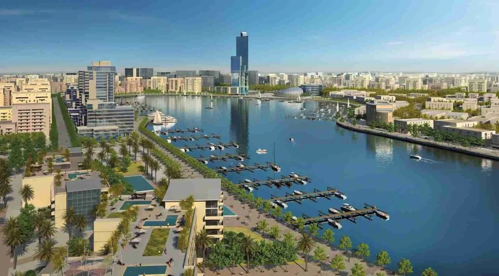
This video made me realize how close it was to the city of Tunis. Tunis is the capital and largest city of Tunisia, it is the country’s economic, political, and cultural heart, boasting a large urban agglomeration of approximately 2.4 million people. The dominant language is Tunisian Arabic (known as Derja), which serves as the national vernacular, though Modern Standard Arabic is the official language used in formal contexts.
Tunisia’s demographics are around 98% Arab-Berber, with a tiny minority of Berbers still speaking indigenous Berber languages in some regions. Due to the country’s past as a French protectorate, French is widely used in business, education, and government, and a small number of Europeans, primarily French and Italian, along with a historical Jewish community, contribute to the city’s cosmopolitan mix.
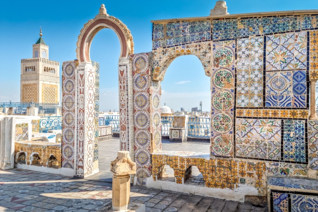
Here are some views of this city. The first two are the Old City:

This is the modern part of the city:

The North Saharan steppe and woodlands
The North Saharan steppe and woodlands is an extensive ecoregion that forms a crucial ecotone (transition zone) between the Mediterranean climate regions to the north and the hyper-arid Sahara Desert to the south. It stretches across North Africa, covering parts of Western Sahara, Mauritania, Morocco, Algeria, Tunisia, Libya, and Egypt.
This ecoregion is part of the Deserts and Xeric Shrublands biome and is defined by its hot, dry conditions with some winter rainfall.
The climate in the North Saharan ecoregion is semi-arid and continental. Summers are intensely hot and dry, with temperatures often rising to 40∘C to 45∘C. Winters are cooler, and what little precipitation the region receives typically falls between October and April, averaging 100 to 250 mm annually in the north, but rapidly decreasing toward the south. Evaporation far exceeds precipitation, making water the primary limiting factor for life.
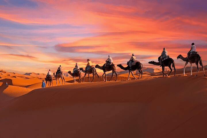
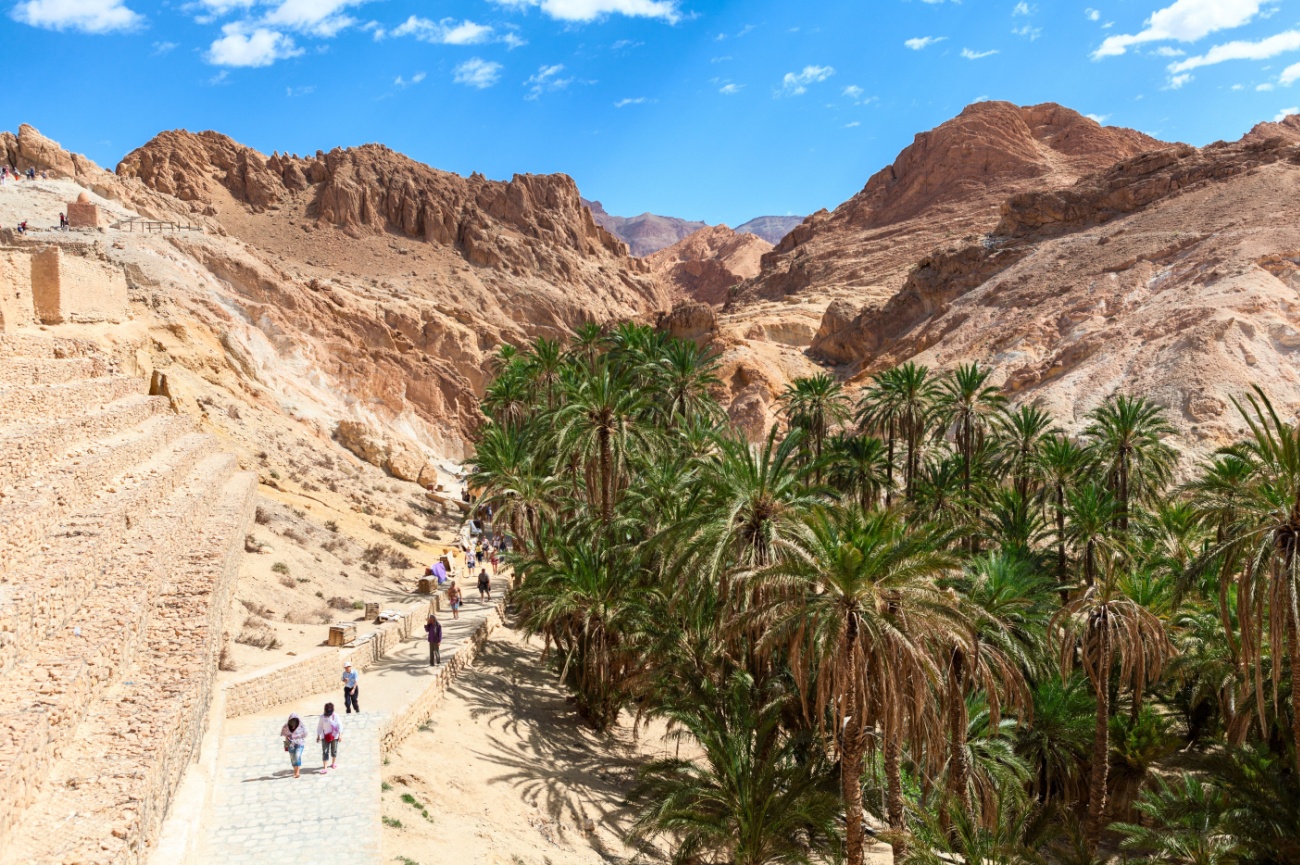
Something I found out is that there is such a thing as an Oasis in the desert! Tunisia has an incredible area called Tozeur. Tozeur is a captivating oasis city in southwestern Tunisia, often called the “Gateway to the Sahara” and the heart of the country’s Djerid (Land of Palms) region. It is globally famous for its massive date palm oasis, unique traditional architecture, and surrounding desert landscapes that have served as iconic filming locations. It also has a city by the same name. Take a look:


I tried finding a video about this place, and this is the best one I found:
The region is renowned for producing the high-quality, translucent Deglet Nour date variety, which is a major national export. The oasis is a vibrant, green ecosystem fed by an ancient, complex irrigation system designed by the 13th-century engineer Ibn Chabbat.
The Tozeur palmeraie (palm grove) is immense, containing hundreds of thousands of date palms that create a cool, shaded microclimate where other crops like pomegranate, fig, and vegetables can grow. Visitors often explore this tranquil area by foot or horse-drawn carriage.
Tozeur is located near the spectacular Chott el Djerid, a vast, shimmering salt lake that is the largest in the Sahara. This dried-up ancient sea is known for its intense mirages and provides one of the most otherworldly landscapes in the region. So this region overlaps with…
The Saharan Halophytics
The Saharan Halophytics is a distinct ecoregion found in Tunisia, characterizing the unique plant life that thrives in extremely salty and arid conditions at the northern edge of the Sahara Desert.
This ecoregion is defined by its ability to host specialized halophytes (salt-tolerant plants) that survive in environments where most other vegetation cannot.
The Saharan Halophytics ecoregion in Tunisia is centered around large, low-lying, evaporite depressions and wetlands, which collect runoff and groundwater, leading to high salt concentration.
The most significant areas in Tunisia are the great salt lakes, known locally as chotts or sebkhahs:
Chott el Djerid: The largest salt lake in Tunisia, often appearing as a vast white expanse.
Chott el Gharsa
Chott Fedjedj
Coastal sebkhahs near the Gulf of Gabès in the south.
Climate: The region has a Hot Desert Climate (BWh). It is characterized by high summer temperatures (often exceeding 40∘C), cold winter nights, and extremely low, irregular annual rainfall (typically 10–100 mm). Evaporation significantly exceeds precipitation, which concentrates the soluble salts in the clay soils.
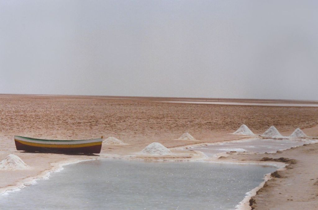
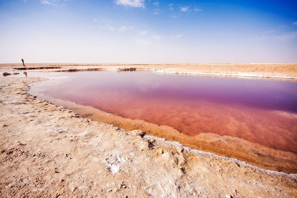
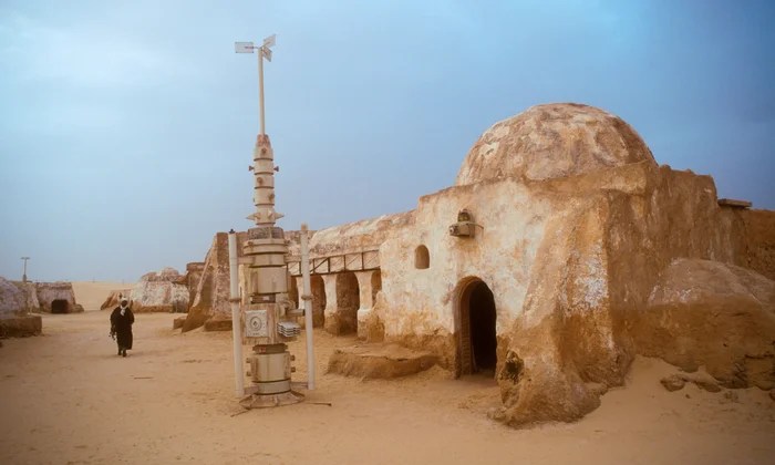
Let’s take a look at the largest Chott:
Chott el Djerid
This salt lake that in English translates to “Lagoon of the Land of Palms” is the largest salt pan of the Sahara Desert, with a surface area of over 7,000 km2(some sources state 5,000 km2). The site has a typical hot desert climate. Due to the harsh climate with mean annual rainfall of below 100 mm and daytime temperatures sometimes reaching 50 °C (122 °F) or more during summer with dense solar radiation, water evaporates from the lake. In summer Chott el Djerid is almost entirely dried up.
Do you recognize this:
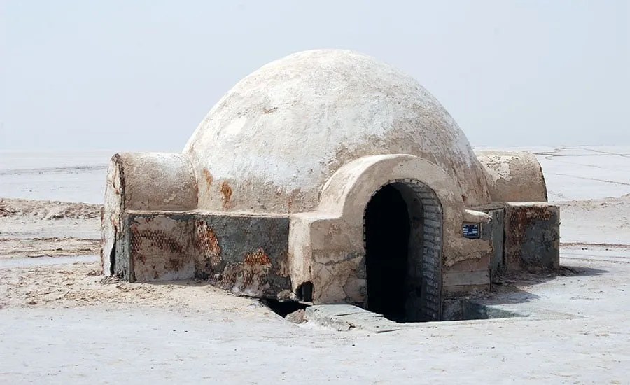
Yes! It is Luke Skywalker’s home! … the exterior filming location for the Lars Family Homestead on Tatooine in the Star Wars movies. Travelers from Tozeur can drive about 35 km to the chott to find the iconic igloo structure. A large crater was excavated adjacent to the igloo to visually suggest an underground section of the dwelling for the audience. However, the interior scenes of the homestead were actually filmed approximately 300 km away, within the Hotel Sidi Driss in Matmata.
Geez! I hope that they filmed in the winter for their sake!
And you know what I just found out… there is a city called Tataouine in Southern Tunisia. For real! It is the capital of the Tataouine Governorate. The below-ground “cave dwellings” of the native Berber population, designed for coolness and protection. The name Taṭaouine means ‘water springs’ in the Berber language.

What an incredible place… and talking about incredible…
…One of the incredible characteristics of the Chotts are its plants. Halophytic plants have special adaptations to cope with the severe conditions of salinity, drought (xerophytic conditions), and high temperatures. These adaptations often include storing water in fleshy leaves (succulence) and excreting salt. The following are some of the plants found there:
Haloxylon articulatum: A prominent halophytic shrub used in traditional medicine.
Dominant Families: The vegetation is typically low-growing, sparse, and contains low species richness, though it is ecologically important. The most represented plant families are those adapted to salinity, particularly the Amaranthaceae (formerly Chenopodiaceae).
Characteristic Genera/Species:
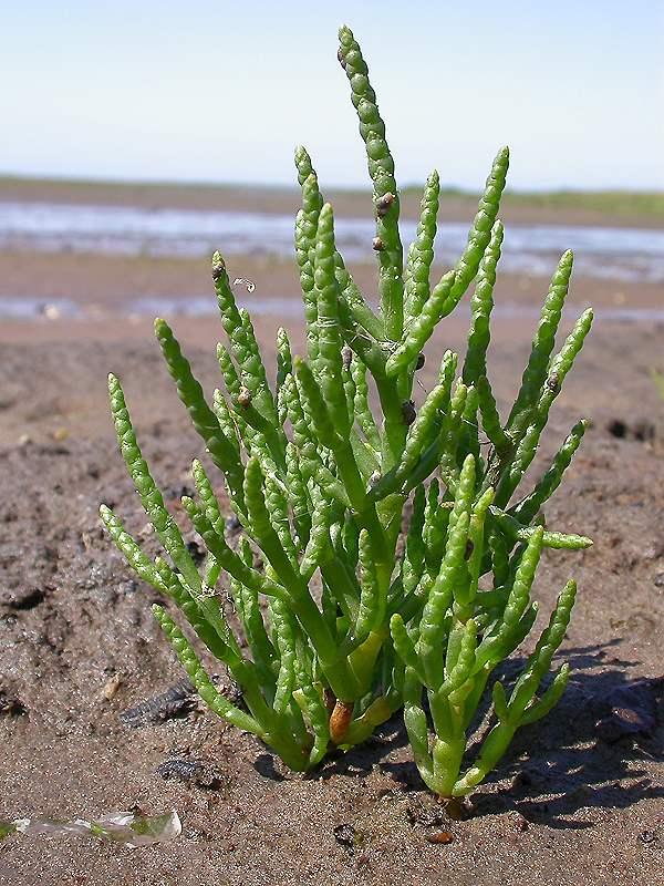
Pickleweed (Salicornia spp.) and Glasswort (Halocnemum strobilaceum): These are extremely salt-tolerant, often found closest to the center of the salt pan. Looking in the internet there were many species of Salicornia. (This is what that spp. abbreviation means: species pluralis (spp). This is what Salicornia perennials Mill looks like:
Saltbush (Atriplex spp.): Such as Atriplex halimus (Mediterranean Saltbush), a shrub highly tolerant of saline and arid conditions.
Seablite (Suaeda spp.): Another succulent genus common in salt marshes.
White Wormwood (Artemisia herba-alba): While not exclusively halophytic, it is a dominant steppe plant mixed with halophytes in transition zones. (I included a photo of this plant towards the beginning of this post.)
W have come to the end of this post, I hope you enjoyed getting to know about the geography of Tunisia. Soon, I will create another post about its unique animals.
