
As I stated in my lastest post, Argentina is the eighth-largest country in the world. It is located in the southern half of South America. Argentina covers an area of 2,780,400 km2 (1,073,500 Sq. mi ). It shares the bulk of the Southern part of South America with Chile to the west, and it is also bordered by Bolivia and Paraguay to the north, Brazil to the northeast, Uruguay and the South Atlantic Ocean to the east, and the Drake Passage to the south.
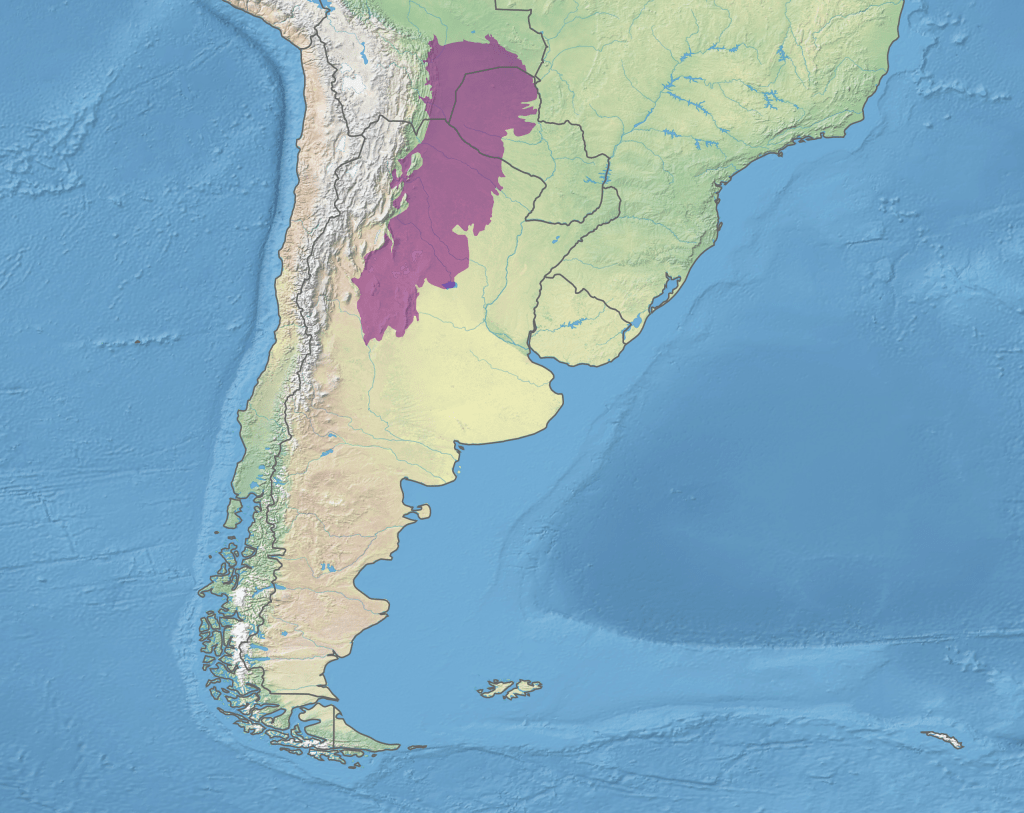
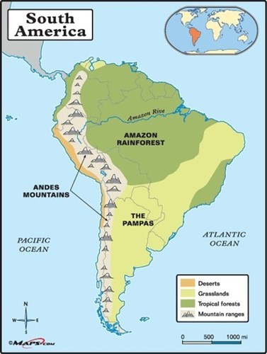
Argentina’s varied landscapes can be grouped into four major regions: the Eastern plains of the Pampas, the area of the North including Gran Chaco, the Andes all along its Western border and Patagonia to the South.

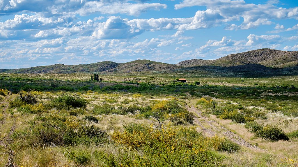
The Pampas
Pampa is a Quechua Indian term meaning “flat plain.” It is a term used widely in southeastern South America from Uruguay, where grass-covered plains commence south of the Brazilian Highlands, to Argentina. In Argentina the Pampas broaden out west of the Río de la Plata to meet the Andean forelands, blending imperceptibly to the north with the Chaco Austral and southern Mesopotamia and extending southward to the Colorado River. The eastern boundary is the Atlantic coast. (1)


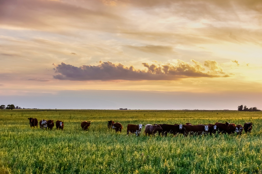
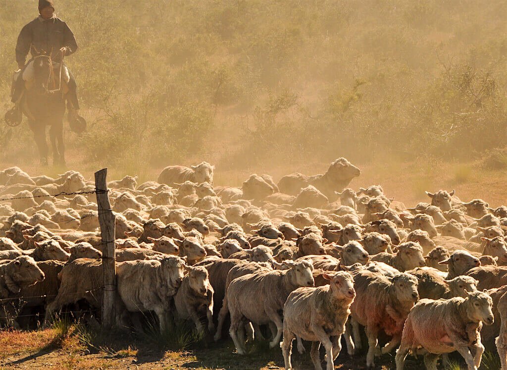
The Pampas has some of the world’s richest topsoil and is Argentina’s most important agricultural region. Fields of corn, soybeans, and wheat cover much of the land. Great herds of cattle graze on the pastures of the Pampas.
The Pampas has about two-thirds of Argentina’s people and most of its urban centers, industries, and transportation facilities. Buenos Aires and Rosario, Argentina’s third largest city, stand at the edge of the Pampas. Beyond these cities, plains stretch as far as the eye can see. Large estates owned by wealthy ranchers cover much of the thinly settled rural Pampas. Westward toward the Andes, the land grows drier. (2)
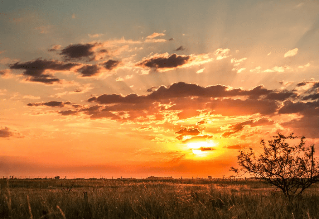
Here are some photos:
Right in the Pampas one of the most visited towns is San Antonio de Areco. You can go HERE and it will drop you right in its downtown center where you can get a feel for this the most visited Gaucho Town.
El Gran Chaco and Mesopotamia in Northern Argentina
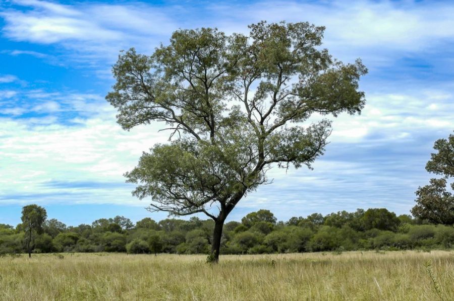
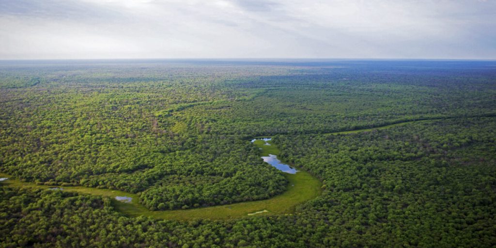
El Gran Chaco is the second largest forest in South America. It is shared by Argentina, Paraguay and Bolivia. The name Chaco comes from a word in Quechua, an indigenous language from the Andes and highlands of South America. The Quechua word chaqu meaning “hunting land” comes probably from the rich variety of animal life present throughout the entire region.
Scrub forests cover much of the Chaco, and few people live in the region. The land is dry for most of the year, but heavy rains fall in summer, causing riverbeds to overflow to the point that most roads become unusable and it is very hard to get around. Farmers plant mostly cotton, soybeans, and sunflowers. They also plant corn, wheat, and other crops after the summer rains. (2)
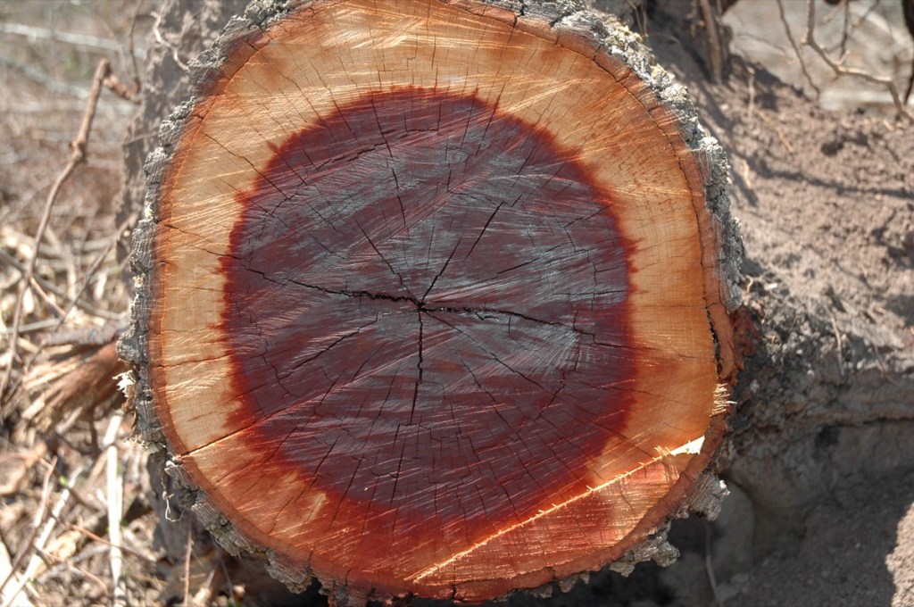
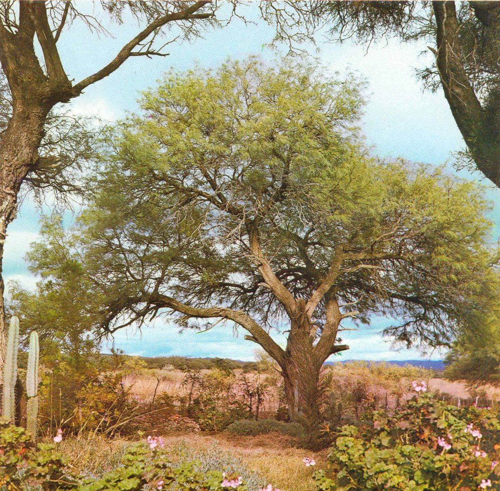
The western Gran Chaco has growths of thorn forest dominated by algaroba (carob trees) in the drier and often saline zones. Quebracho trees are present, but not to the extent that they are farther east. The wood in these trees is very dense and they are often referred as “ax breakers”. They have a vivid reddish wood color that is use for tanning leather.
No plants survive in areas with finer salt at the surface. Coarse bunchgrasses are common in the dry steppe, which also supports dense scrub forests intermixed with prickly pear, barrel, and many other types of cactus. (1)
The vegetation of the Chaco becomes increasingly lush toward the east. The thorn forests are gradually replaced by dense quebracho forests (though of a less-valuable species than those in the west), and there are some pure stands of algaroba. Some 90 miles (150 km) west of the Paraná River, a few massive trees begin to appear. The rich wildlife of the Chaco includes deer, peccaries, monkeys, tapirs, jaguars, pumas, ocelots, armadillos, capybaras, and agoutis. The vast birdlife includes the flightless rheas, which are protected by a refuge in the area. Streams harbour numerous fish species, including piranhas, and snakes and other reptiles abound. (2)

Go HERE and you can enjoy and learn about the beautiful fauna of el Gran Chaco. And HERE to learn more about the efforts by World Wild Fund to help protect the region.


Here is a short video that will take you there… the birds are so beautiful!
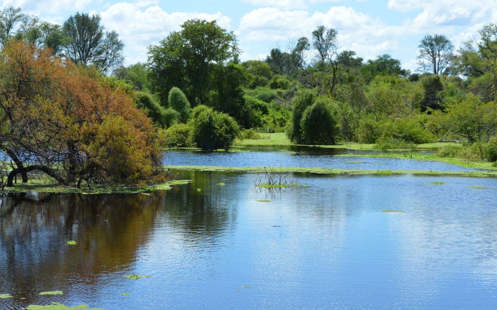
Mesopotamia
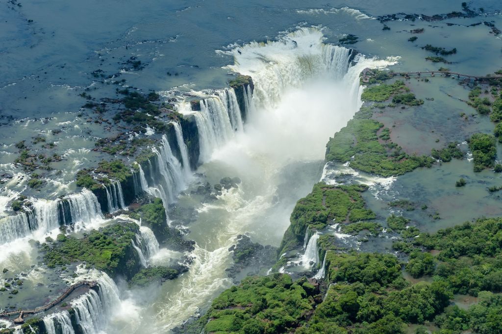
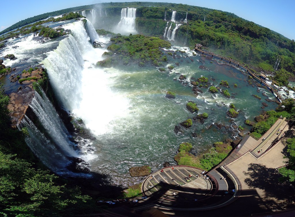
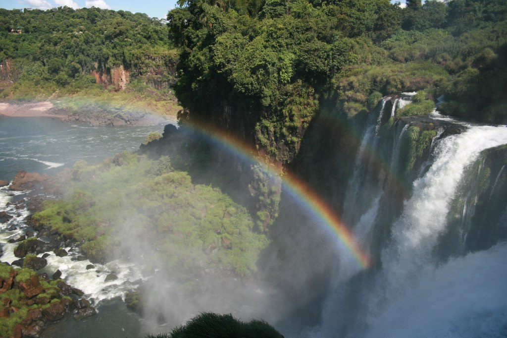
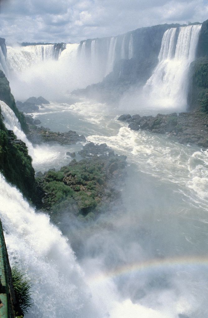
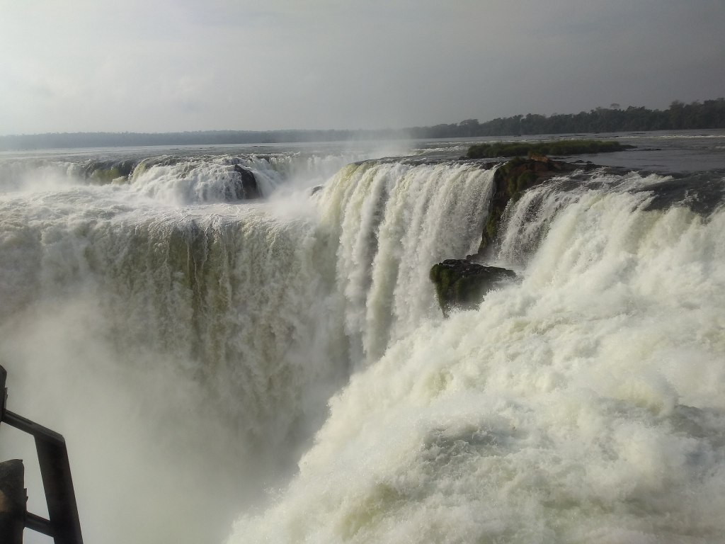
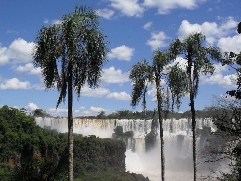
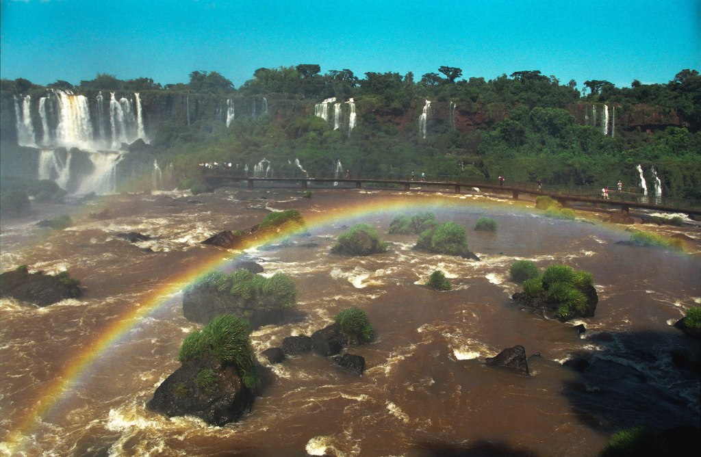
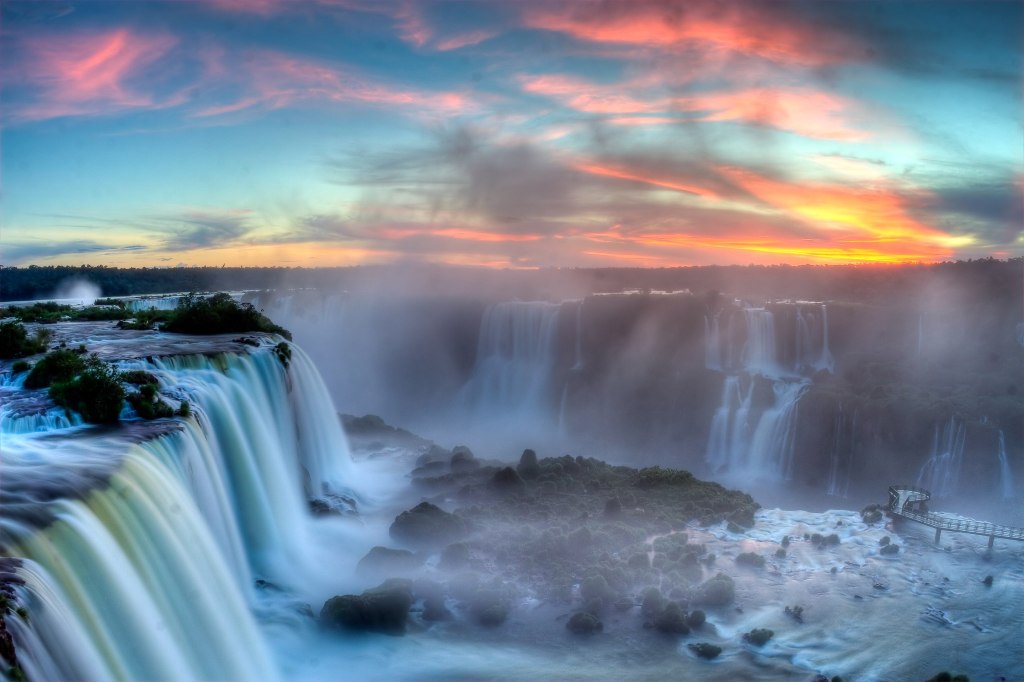
Mesopotamia like its ancient Middle Eastern namesake, is a fertile region between two rivers. The Argentine Mesopotamia lies between the Paraná and Uruguay rivers. The Paraná River basin is the second largest in South America, after the Amazon basin. Rivers from Bolivia, Brazil, and Paraguay enter the Paraná River. The river originates in Brazil and flows 2,485 miles (3,999 kilometers), emptying into the Atlantic Ocean near Buenos Aires. Along the region’s northern border, the Iguazú (spelled Iguaçu in the Portuguese language) River empties into the Paraná. Near the junction of the two rivers, 275 waterfalls form the spectacular Iguazú Falls.
Iguazú Falls or Iguaçu Falls (Guarani: Chororõ Yguasu), Spanish: Cataratas del Iguazú; Portuguese: Cataratas do Iguaçu are waterfalls of the Iguazu River on the border of the Argentine province of Misiones and the Brazilian state of Paraná. Together, they make up the largest waterfall system in the world. The falls divide the river into the upper and lower Iguazu. The Iguazu River rises near the heart of the city of Curitiba. For most of its course, the river flows through Brazil; however, most of the falls are on the Argentine side. Below its confluence with the San Antonio River, the Iguazu River forms the border between Argentina and Brazil. (3)
Go HERE for a great walk around Iguazú Falls via Google Arts and Culture. GO HERE to explore on the Iguazú Falls on Google Maps. And HERE to be right in the middle of it… you can move it around. It is breath taking! Here are some photos, all from Wiki Commons. Just WOW!

And just when you think …it can’t get any better… there is this:
Here is a video, it is touristic but very well done:
80 % of the falls are on the Argentinian side. 13,000 cubic meters of water go by every second!!!
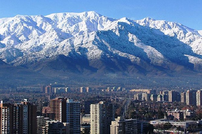
Los Andes
The Andes mountains are the second longest mountain range in the world extending over seven countries. They run along the western coast of Argentina and it separates Argentina from Chile.
Their highest peaks include the tallest mountain in the Western Hemisphere, Aconcagua. It towers 22,841 feet (6,962 meters) above sea level just inside the Argentine border.
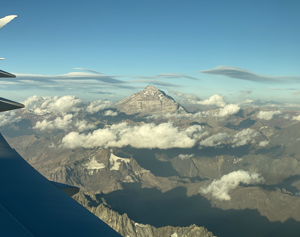
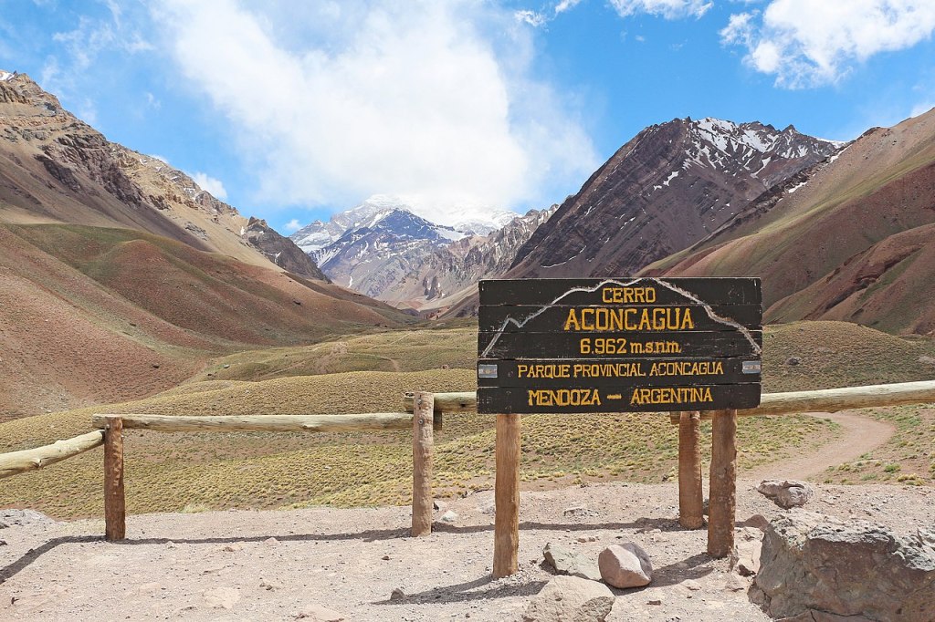
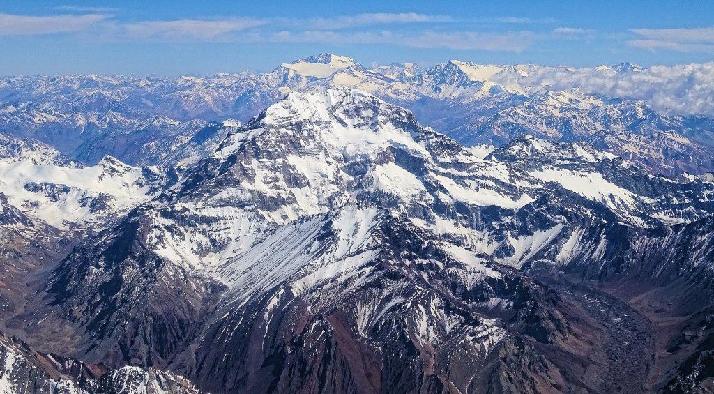

So impressive isn’t it?
HERE is a blog with incredible photos of someone who went near it to take photos.
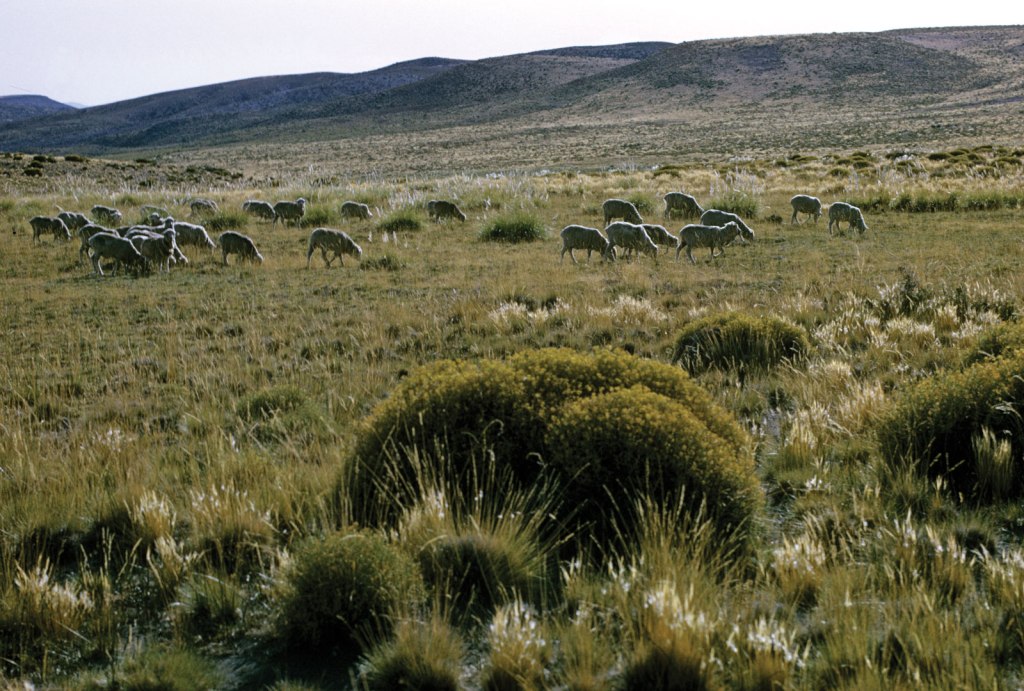
A small indigenous population raises sheep in an area of broad plateaus called the Puna in the northern part of the Argentine Andes. In the south, snow-capped peaks, active glaciers, and beautiful lakes attract crowds of vacationers who come to ski and hike.
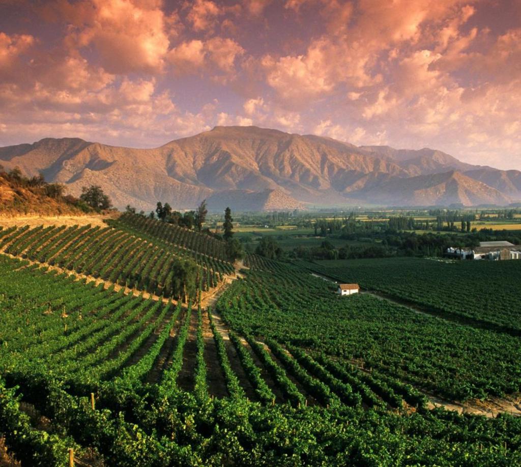
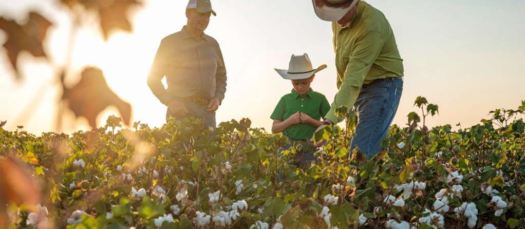
The Piedmont is a region of low mountains and desert valleys east of the Andes. Mountain streams provide water for irrigation and make the Piedmont a productive farming area. Farmers grow sugar cane and corn near Tucumán and alfalfa and cotton near Córdoba. Vineyards in Mendoza and San Juan provinces produce grapes for most Argentine wines, which are exported worldwide. Argentina is one of the largest producers of wine in the world. The cities of the Piedmont are some of the oldest Spanish settlements in Argentina. (2)
These are some photos of Mendoza at the foot of the Andes with its famous wine area.


Here is a good video to get an idea of what the city and the wine scene is in Mendoza. According to it, Mendoza is among the nine top producing wine areas in the world. It is impressive to see the Andes mountains in so many takes… they look so, so big!
Patagonia
I’m just in awe how blessed this country is in beauty geographically! Already having a huge part of the Andes is more than enough… but they also have this incredibly gorgeous place: Patagonia!
Patagonia is a flat and dry plateau that occupies more than a quarter of Argentina. Poor soil and scarce rainfall make most of Patagonia unsuitable for crop farming. Thank goodness! (said all the animals and plants there! ^ ^) The extraction of oil and natural gas and sheep ranching are the major economic activities.
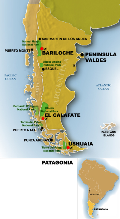
Patagonia is so vast and varied that I decided to dedicate a separate post to it. Here is a bit of it for the sense of completion of this post about the geography of Argentina.
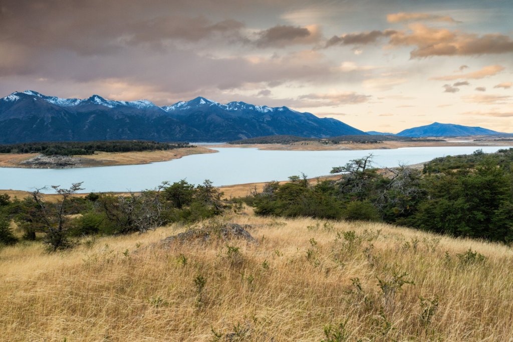
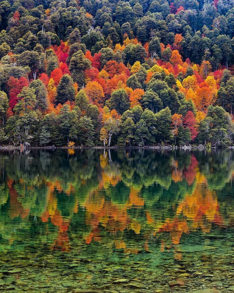
In Patagonia there is a lake district area where you can take an amazing road trip and visit its seven most famous and beautiful lakes. The upcoming photo is Lago Hermoso in Neuquen. It is absolutely stunning in the fall:
There is also a National Park called Lanín in Neuquen. This is a photo there in the fall:

Most Patagonians live near the region’s two northern rivers—the Colorado and the Negro. Farmers grow cotton, alfalfa, apples, and pears in the river valleys. (2)
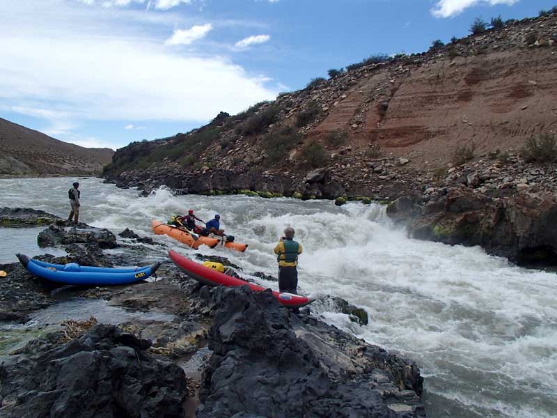
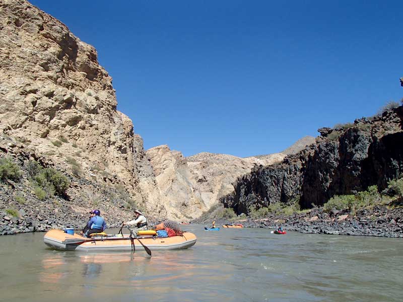
Many people enjoy water rafting in the Colorado and Grande rivers.
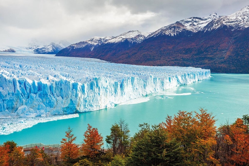
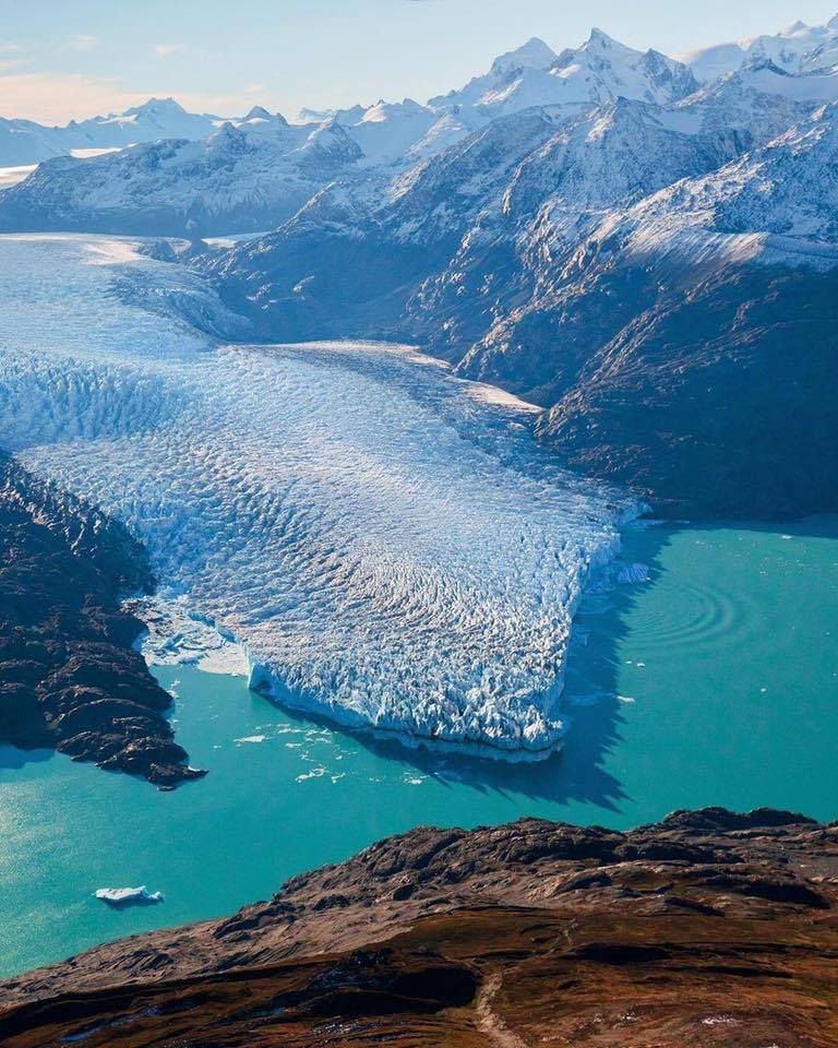
This was one of the places that impressed me the most. There is a Glacier National park called Los Glaciares. The photos from there are just unreal!
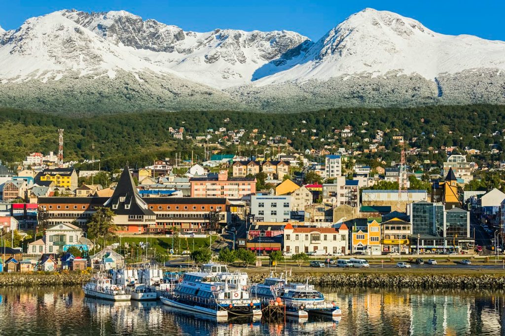
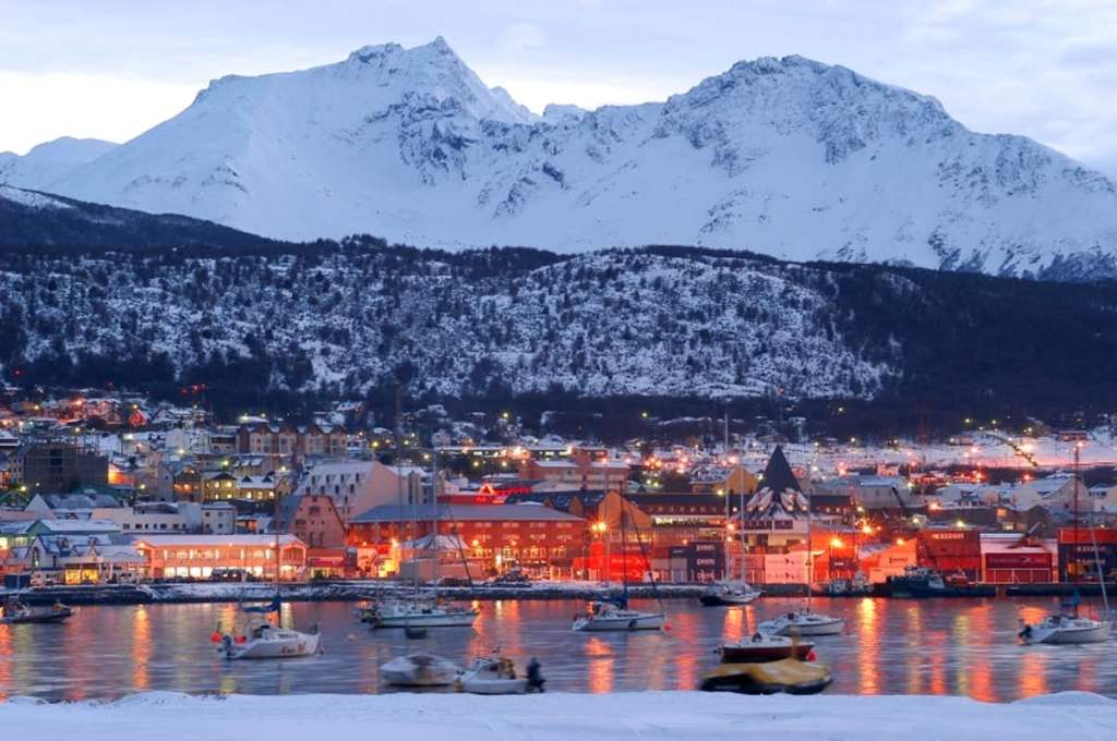
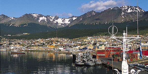
And way at the bottom, Tierra del Fuego, the island of Tierra del Fuego lies at the southern tip of South America. The Strait of Magellan separates it from the mainland. The island is divided between Argentina and Chile. Ushuaia, one of the southernmost towns in the world, is on Argentina’s part of the island.
In these photos you can see it during the day and dusk.
We will travel into Patagonia more in depth very soon! ¡Hasta entonces!
