
Even though Israel has a small land area 290 miles (470 km) north-to-south and 85 miles (135 km) east-to-west at its widest point, it has four defined geographic regions: the hill regions of northern and central Israel, the Mediterranean coastal plain, the Great Rift Valley, and the Negev desert. (2)
The Hill Regions of the North
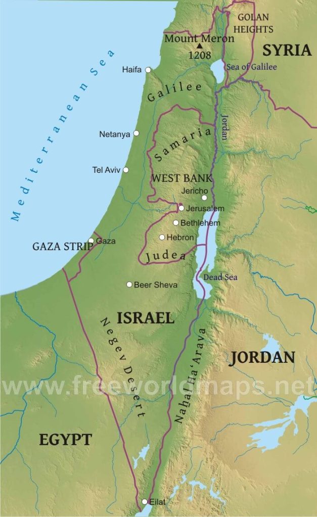
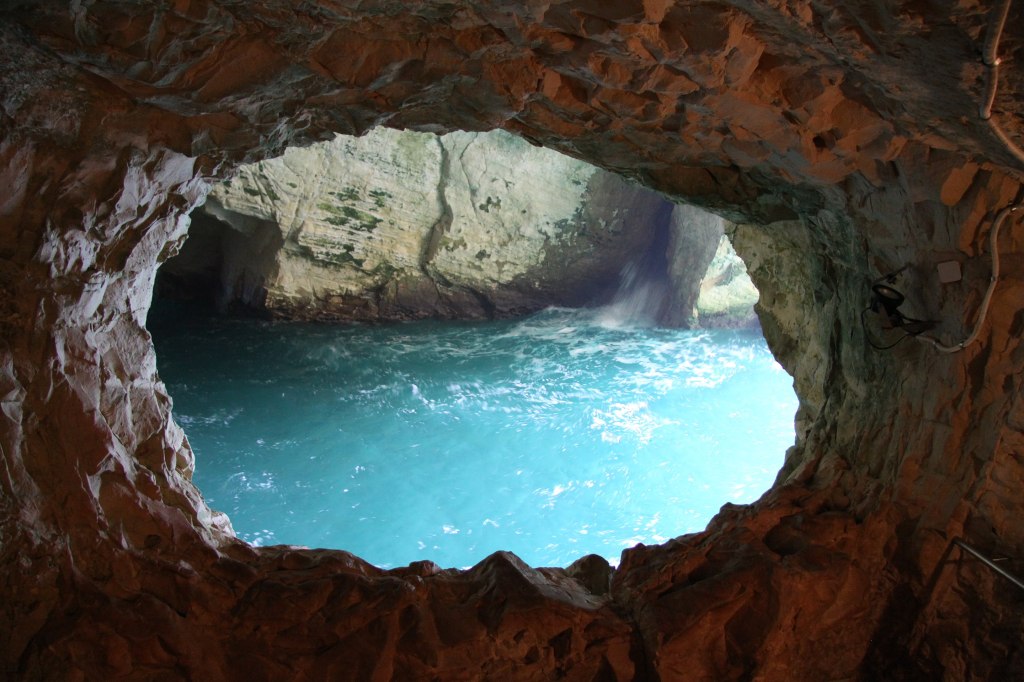
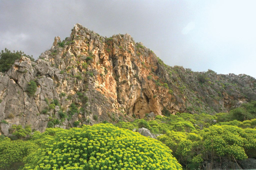
(And Central Israel) In the north of the country, the mountains of Galilee constitute the highest part of Israel, reaching an elevation of 3,963 feet (1,208 metres) at Mount Meron (Arabic: Jebel Jarmaq). The following photos are all from advisor.travel. com. (2)


The tallest mountain in Israeli-occupied territory (meaning not Internationally recognized) is Mount Hermon, at 9,232 feet (2,814m). It is a mountain cluster constituting the southern end of the Anti-Lebanon mountain range located in the border between Syria and Lebanon. On the top, in the United Nations buffer zone between Syrian and Israeli-occupied territories, is the highest permanently manned UN position in the world, known as “Hermon Hotel”, located at 2,814 m altitude.
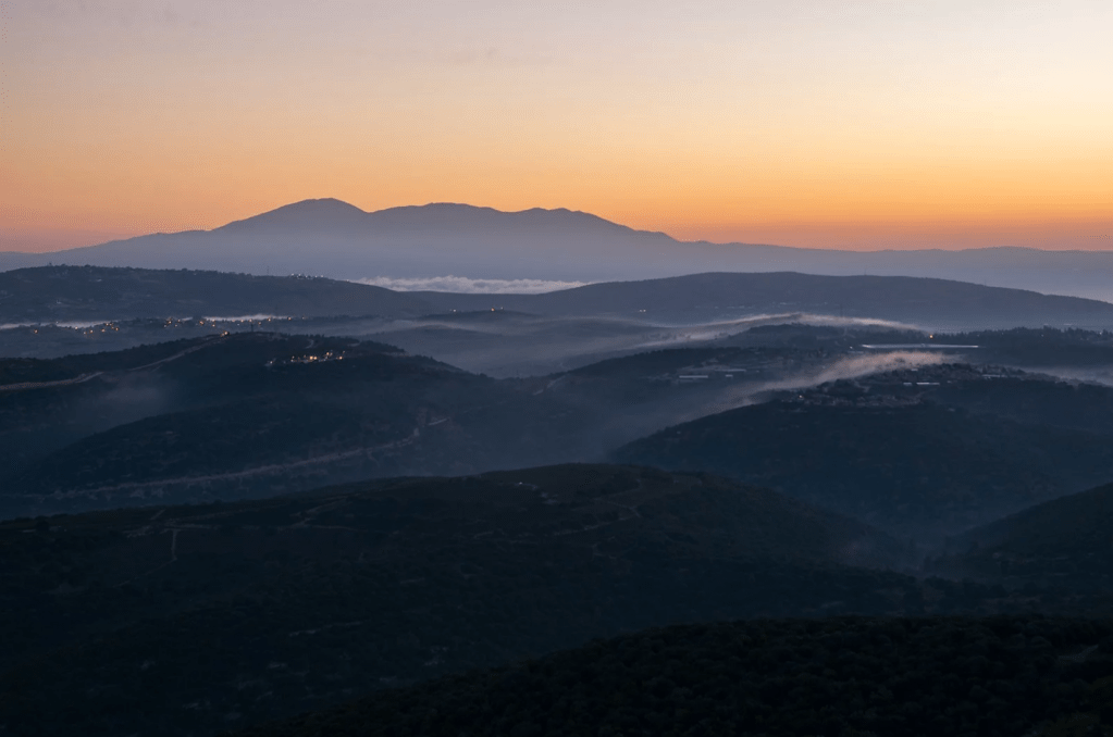
The southern slopes of Mount Hermon extend to the Israeli-occupied portion of the Golan Heights, where the Mount Hermon ski resort is located with a top elevation of 6,690 feet (2,040 m). A peak in this area rising to 7,336 ft (2,236 m) is the highest elevation in Israeli-occupied territory. (1)

The Hermon Ski Resort
The mountains of Galilee are separated from the hills of the Israeli-occupied West Bank to the south by the fertile Plain of Esdraelon that connects the coastal plain with the Great Rift Valley, running approximately northwest to southeast.
The Coastal Plains
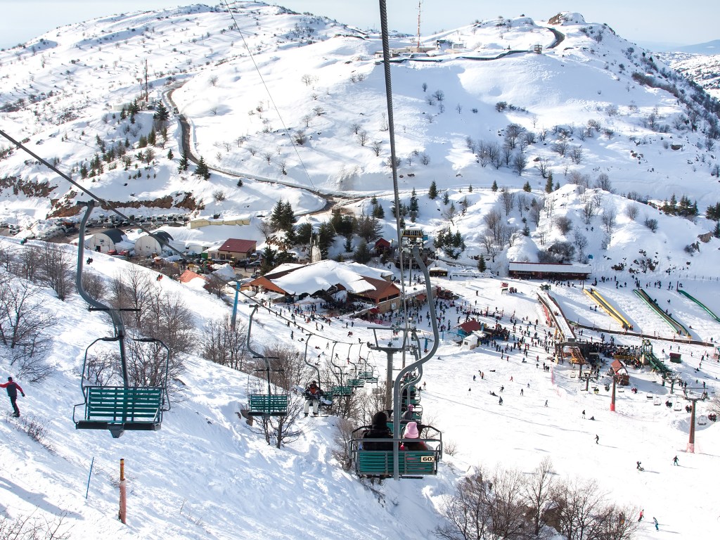
The Israeli Coastal Plain stretches from the Lebanese border in the north to Gaza in the south, interrupted only by Cape Carmel at Haifa Bay. It is about 40 kilometers (25 mi) wide at Gaza and narrows toward the north to about 5 kilometers (3.1 mi) at the Lebanese border. It has many beaches facing the Mediterranean Sea. As you move inland to the East, there are many agricultural settlements and the cities of Tel Aviv and Haifa.
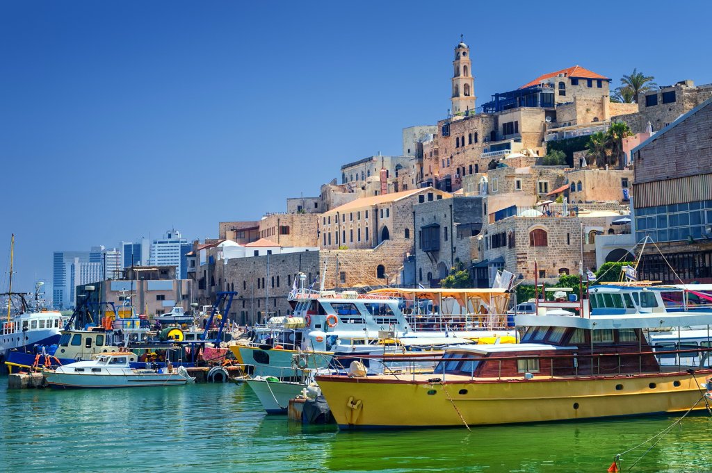

I really liked Tel Aviv, it’s a city with beaches!!! According to an article by NBC News, Tel Aviv was the most expensive city to live in the world! Article HERE.
Jordan Rift Valley
Also known as the Jordan Valley is a huge depression (like a crack) on the Earth’s Surface between Israel, West Bank and Jordan. The Jordan River runs on it – from its sources, through the Hula Valley, through the Sea of Galilee (or Lake Tiberias), the (Lower) Jordan Valley, all the way to the Dead Sea, the lowest land elevation on Earth – and then continues through the Arabah depression, the Gulf of Aqaba whose shorelines it incorporates, until finally reaching the Red Sea proper at the Straits of Tiran.
I explored a bit of Galilee and Mount Meron in Google Maps HERE. As Easter and Passover approach this coming weekend I feel it is so spiritual to be looking at Galilee in this moment. This is the Sea of Galilee:

This lake is the lowest freshwater lake on Earth and the second-lowest lake in the world (after the Dead Sea, a saltwater lake), at levels between 705 ft (215 m) and 686 ft (209 m) below sea level. It is here that Jesus is believed to have walked on water, calmed a storm, and showed his miraculous catch of fish, and his feeding five thousand people (in Tabgha). Jesus apostles are also all from this region, Galilee.
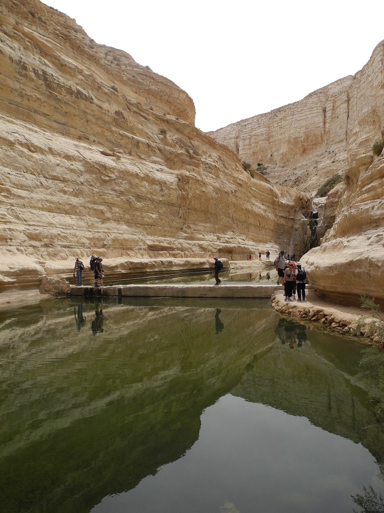
The Negev Desert
The Negev Desert contains the oldest discovered surface on Earth, with an approximate age of 1.8 million years. It covers more than half of Israel, over some 4,700 sq mi (13,000 km2) or at least 55% of the country’s land area. It forms an inverted triangle shape whose western side is contiguous with the desert of the Sinai Peninsula, and whose eastern border is the Arabah valley.


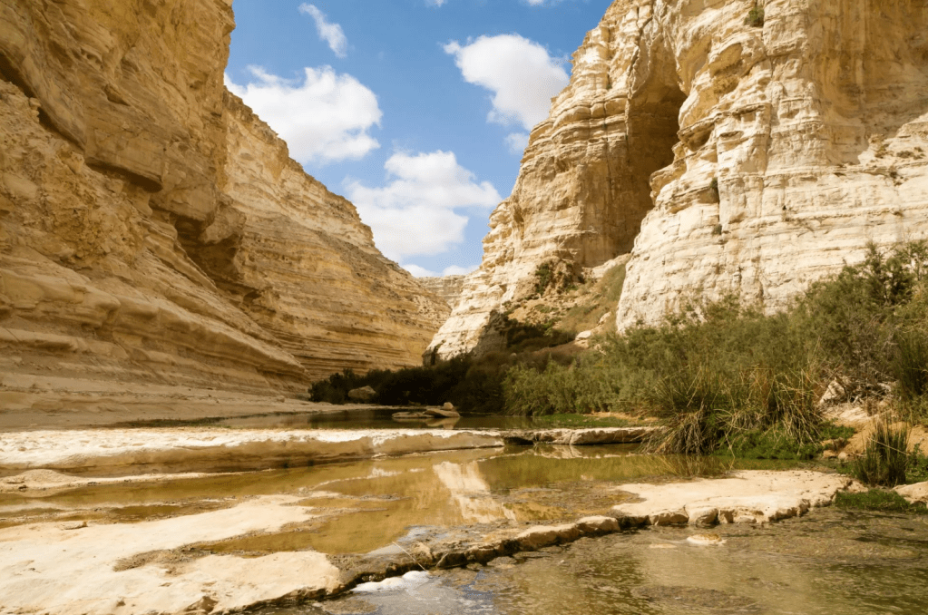
There is a national park here called Ein Avdat that has a spactacular canyon formed by a spring which makes for a very impressive sight in a desert.
This photo was taken on April 13, 2012 and today is almost 10 years… I’m writing this on April 12, 2022! ^ ^
Because of how big this desert is respect Israel’s total land, there are plans in place that are populating it by making it greener and creating small communities “Kibbutz” where people can work the land and live there independently. One of the people that led this idea was the first Israel first Prime MIinister, David Ben-Gurion. He moved to this desert in 1953 to a Kibbutz named ‘Sde Boker.’ This means “Herding Field’ in Hebrew. He believed that eventually the Negev would be home to many Jews who would move to Israel, and he felt that Sde Boker was a trailblazer and example for what should follow. His home was later turned into a museum.
This is what a photo of the Kibbutz:

This is a famous speech David Ben-Gurion gave respect the development of the Negev:
“It is in the Negev that the creativity and pioneer vigor of Israel will be tested, and this will be a crucial test. Israel’s capacity for science and research will be tested in the Negev and it is incumbent upon our scientists and researchers to focus on new areas of research which residents of the North will have need of: research to desalinate seawater with inexpensive processes; to exploit solar energy which is so abundant in our country, and especially in the Negev; to use wind power to generate electric power; to prevent the wastage of scarce rain water which flows unused to the Mediterranean or to the Dead Sea; to build ponds across the length and breadth of the Negev for collecting precious rain water, to investigate the vegetation found in the Negev, despite its aridity….it is incumbent upon Israel’s scientists to reveal the secrets of nature that are unique to our land….“
In 1969, a David Ben-Gurion university was founded to serve as an engine for the development of this area. HERE is the university’s website if you are curious.
The following video shows how they are harnessing the use of water in this desert… it’s incredible what they are accomplishing!
And on this positive note, I take my leave. More to come soon!
Thank you for hanging out with me in the beautiful landscapes of Israel!
