Usually I write about the capital city of the country but Myanmar will be an exception as all these cities have been the capital of Myanmar at some point in its history and they still are all well capital to this country. One could say that currently the government’s capital is Nay Pyi Taw, the commercial capital is Yangon and the cultural capital is Mandalay.
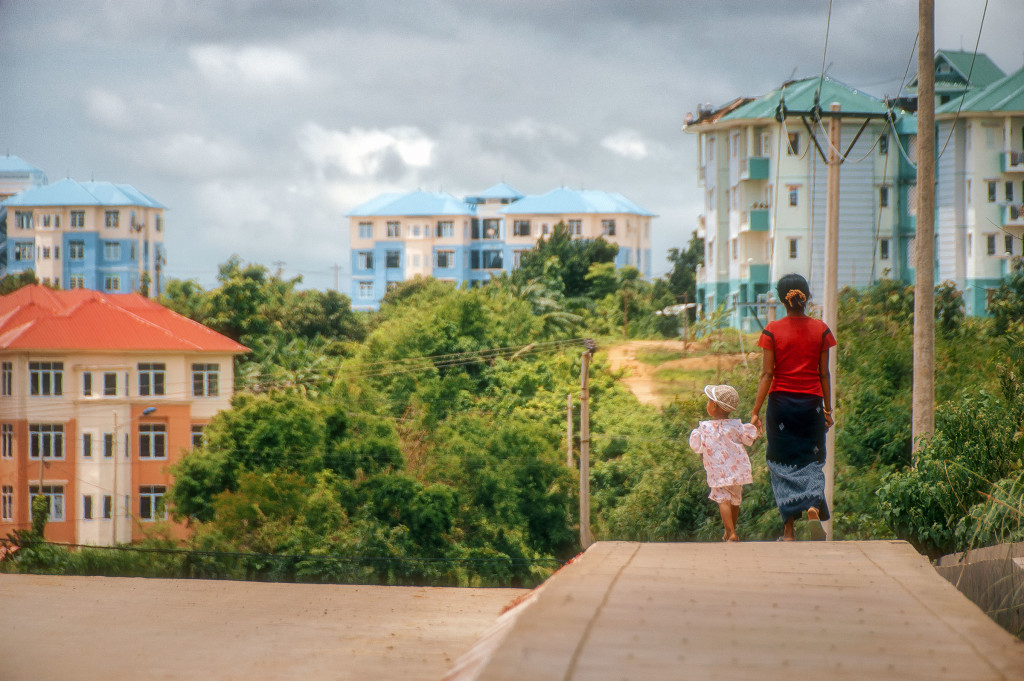
So let’s start with the what is considered the country’s official capital to some: Nay Pyi Taw.
Nay Pyi Taw (နေပြည်တော်)
Nay Pyi Taw or Naypyitaw became the capital of Myanmar very recently. Recently as in 2006. It seems that the government saw themselves constricted because of its location, not central enough and because of its lack of space for additional growth. So in 2004 its construction began about 200 miles (320 Km) north from Yangon. It was officially prclaimed capital in March of 2006.
Nay Pyi Taw means “abode of the king” and it can be translated as the seat of the king or the royal capital. This city has a population of around one million people and mostly are military or government workers. Many of whose families remain in Yangon however, because of the lack of shops, restaurants, and other amenities in the new capital. In fact, according to Wikipedia there were about 50 mansions for high ranking officials in 2019 and most are unused and in a neglected state. (1).
The Presidential Palace
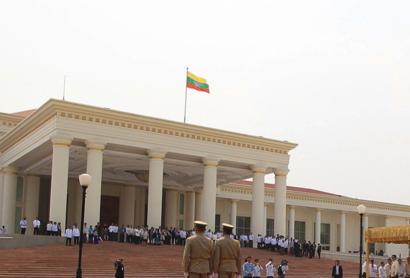
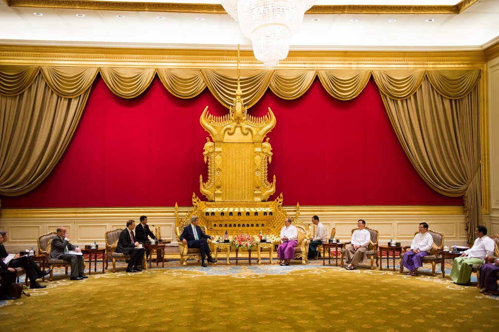
The city’s Ministry zone contains the headquarters of Myanmar’s government ministries. All the ministry buildings are identical in appearance. A parliamentary complex consisting of 31 buildings and a 100-room presidential palace are also located there. The zone also contains the city hall building, which has many characteristics of Stalinist architecture, but with a Burmese-style roof.

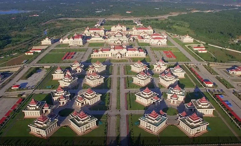
Something interesting I found out was that the residential areas are carefully organized, and apartments are allotted according to rank and marital status. The city has 1,200 four-story apartment blocks. The roofs of apartment buildings are color-coded by the jobs of their residents. For example, Ministry of Health employees live in buildings with blue roofs and Ministry of Agriculture employees live in those with green roofs.
There is a military zone that is about 11 miles away from these apartments of regular governement employees and it is off limits to the general public. Only high-ranking military officers live in this complex and it is said to consist of tunnels and bunkers. (1)
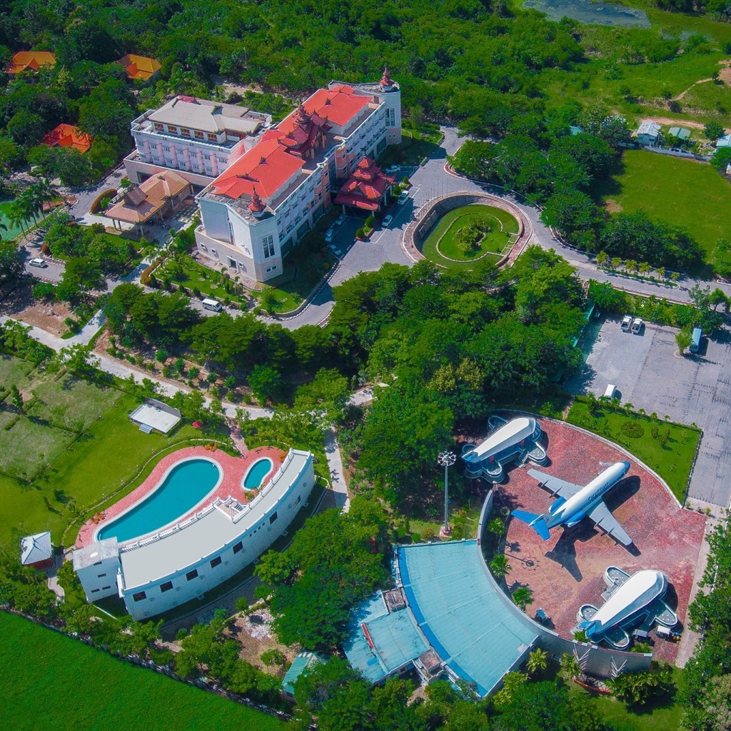
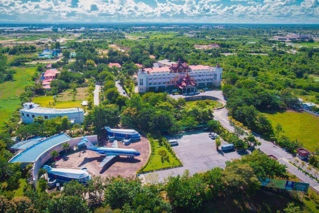
There is a hotel zone as well. The hotel zone has a handful of villa-style hotels on the hilly outskirts of the city. There are twelve hotels located in or near Naypyidaw. Eight of these are located within the Naypyidaw Hotel Zone, and two are located in Laeway (Lewe) on the Yangon-Mandalay Road. Also a total of 348 hotels and 442 inns were constructed to house the athletes and spectators of the 2013 Southeast Asian Games, which was hosted in Naypyidaw. (1)
This is one of the hotels:
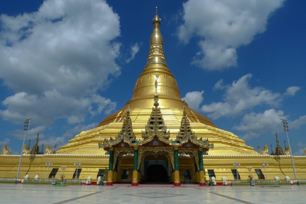
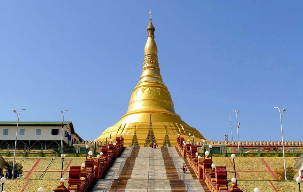
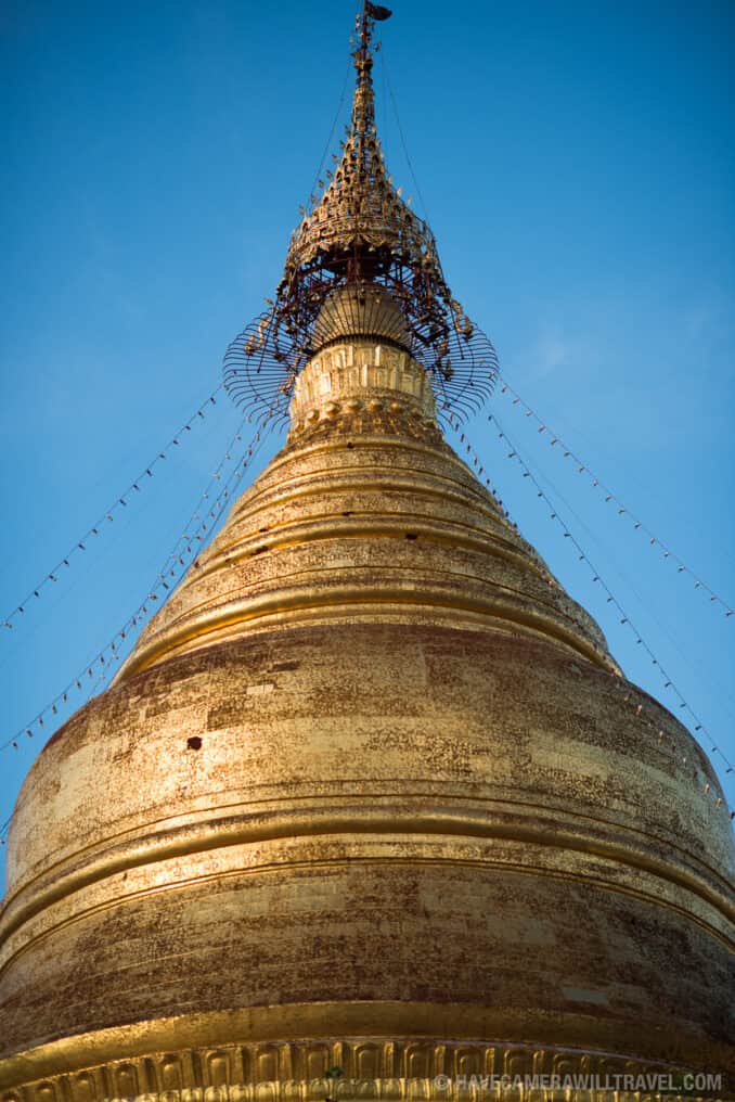
The Uppatasanti Pagoda
The most important religious temple in this city is the Pagoda Uppatasanti. This pagoda was built inspired greatly by the Schwedagon Pagoda in Yangon. It is 30cms shorter than the Schwedagon Pagoda of Yangon. It is also called called the Peace Pagoda. It houses an important relic of the Buddha that came from China: a tooth.
This is what it looks like inside:

Yangon (ရန်ကုန်;)
Formerly known as Rangoon, this is the largest city in Myanmar with a bout 7 million people. It is its most important commercial, economic and cultural city. Its name means “end of strife.”
Yangon was founded as Dagon in the early 11th century (c. 1028–1043) by the Mon people, who inhabited Lower Burma at that time. Dagon became an important pilgrimage pagoda town, starting in the 14th century, during the Hanthawaddy Kingdom. In 1755, King Alaungpaya, the founder of the Konbaung Dynasty captured Dagon, added settlements around it, and called the enlarged town “Yangon”. In the 1790s, the East India Company opened a factory in Yangon. The estimated population of Yangon in 1823 was about 30,000.
The British captured Yangon and all of Lower Burma in the Second Anglo-Burmese War of 1852, and subsequently transformed Yangon into the commercial and political hub of British Burma. After the war, the British moved the capital of British Burma from Moulmein (present-day Mawlamyine) to Yangon. Based on the design by army engineer Lt. Alexander Fraser, the British constructed a new city on a grid plan on delta land, bounded to the east by the Pazundaung Creek and to the south and west by the Yangon River.
The British also established hospitals including Rangoon General Hospital and colleges including Rangoon University. Colonial Yangon, with its spacious parks and lakes and mix of modern buildings and traditional wooden architecture, was known as “the garden city of the East.” By the early 20th century, Yangon had public services and infrastructure on par with London. Today many of these colonial buildings still survive… but they have been deteriorating by the lack of maintenance.
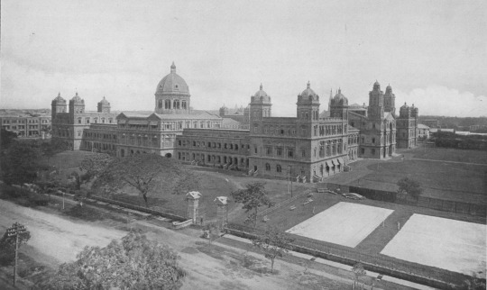
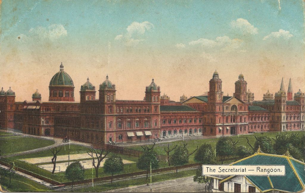
You can read HERE an article by the BBC, there is a video too that shows the struggle to save these buildings form their colonial past and how hard it is. One of the buildings that has survived relatively well is “The Secretariat.”
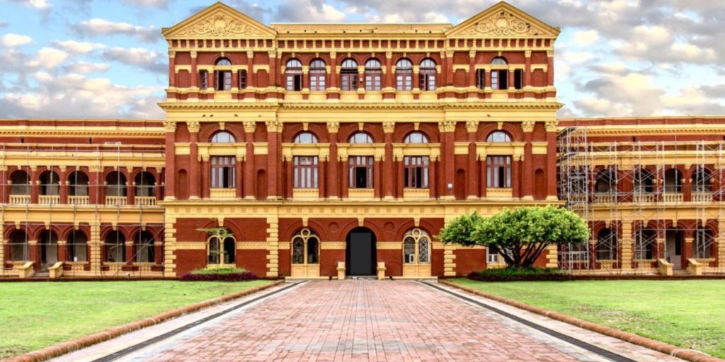
The Secretariat (or Minister’s Building)
This building was the administrative seat of British Burma. It is a Victorian-style building made from red and yellow brick and constructed in a U-shape. Construction began in the late 1889. The central building was completed in 1902, while the complex’s eastern and western wings were finished in 1905.
The Secretariat at one point was suddenly abandoned by the government in 2006, when it moved to the new capital Nay Pyi Taw. Its future was uncertain. This is what the Secretariat’s North gate looked like when it was abandoned:
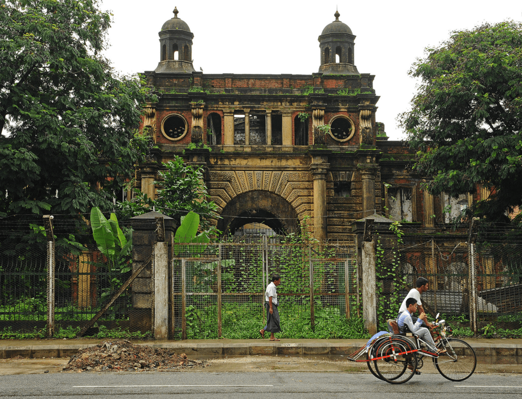

There is a great article where the last two photos come from about the uncertainty of the city of Yangon even into 2014 HERE.
Because this building was where General Aung San, the father of modern Myanmar, spent his working days and where 19 July 1947, during a meeting of the Executive Council at the Ministers Building, he and six cabinet ministers were assassinated, after much debate they decided that this building would be turned into a museum and cultural center. The building is currently on the Yangon City Heritage List and restoration work is underway, parts of the complex are open to the public and there is an informative guided tour for a fee.

Here are two videos… the first one is calmer and more photos. The second one has music and they walk all over, so it is not as steady.
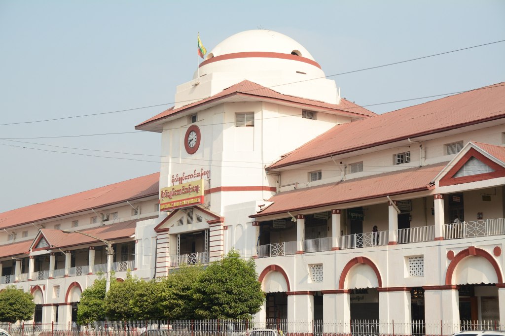
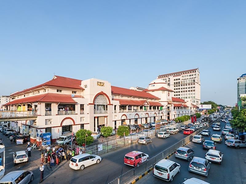
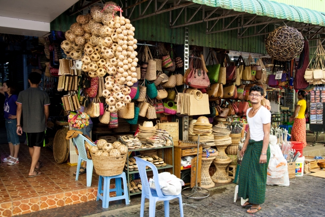
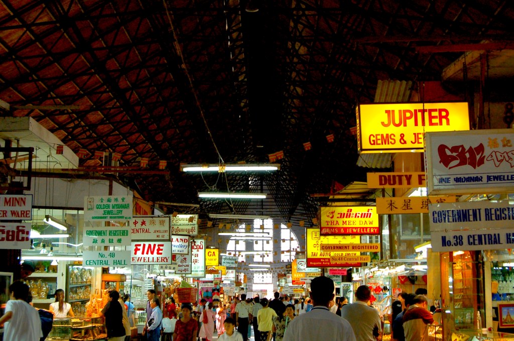
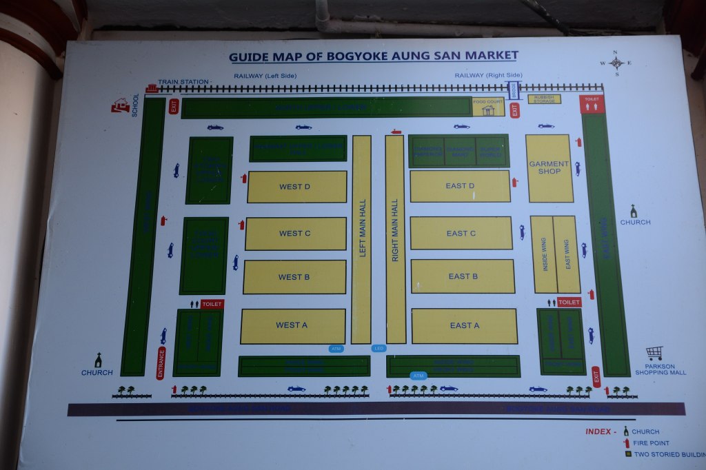
The Bogyoke Aung San Market
This is a major bazaar located in Pabedan township in central Yangon, Myanmar. Known for its colonial architecture and inner cobblestone streets. It was originally known as Scott Market and was built in 1926, late in the British rule of Myanmar. The current market is a major tourist destination as it holds antique handicrafts, jewelry, art galleries. In the past it was also known as the black market, the place to go if you wanted to change your US dollars into the local currency. However, when the semi-civilian government liberalized the banking sector, all the infamous money changers either changed their professions, or took their business elsewhere preying on unsuspecting foreign tourists. So a not of caution do not exchange your money here!
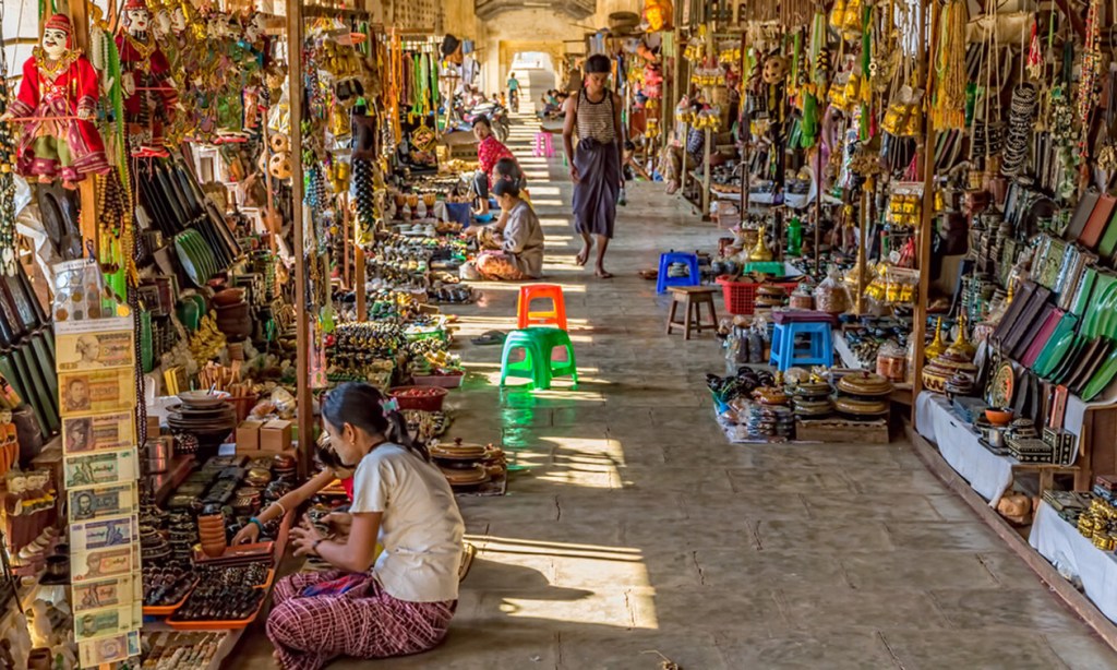
The market also has a number of stores for local shoppers, selling medicine, foodstuffs, garments and foreign goods. Moreover, it is a great place to take photos with ancient buildings. Now lets delight in the colors of this market:
Here is a video… it is so big!
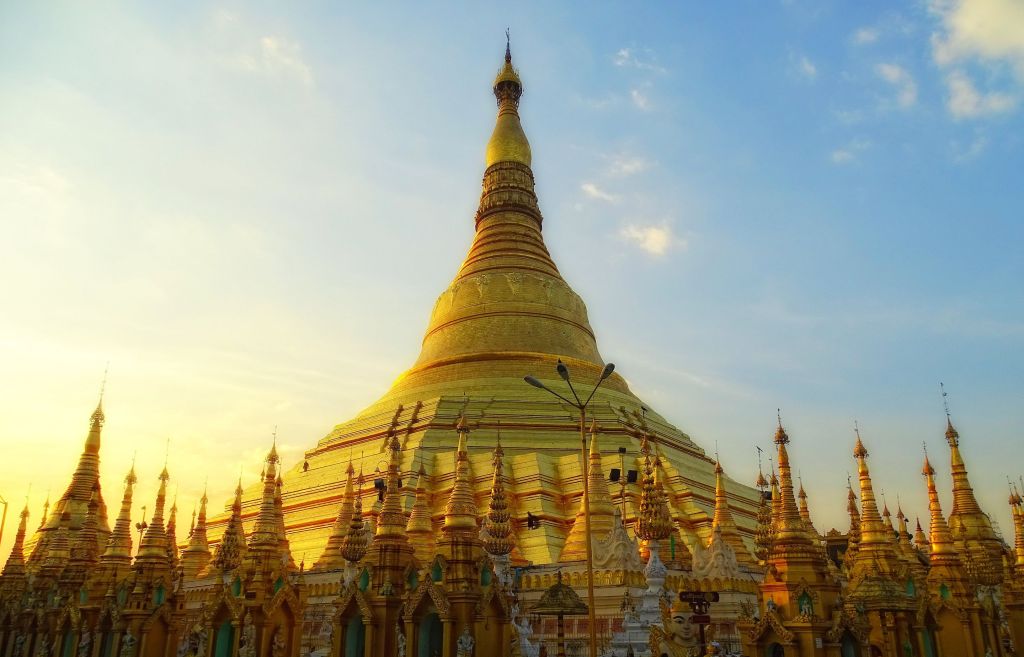
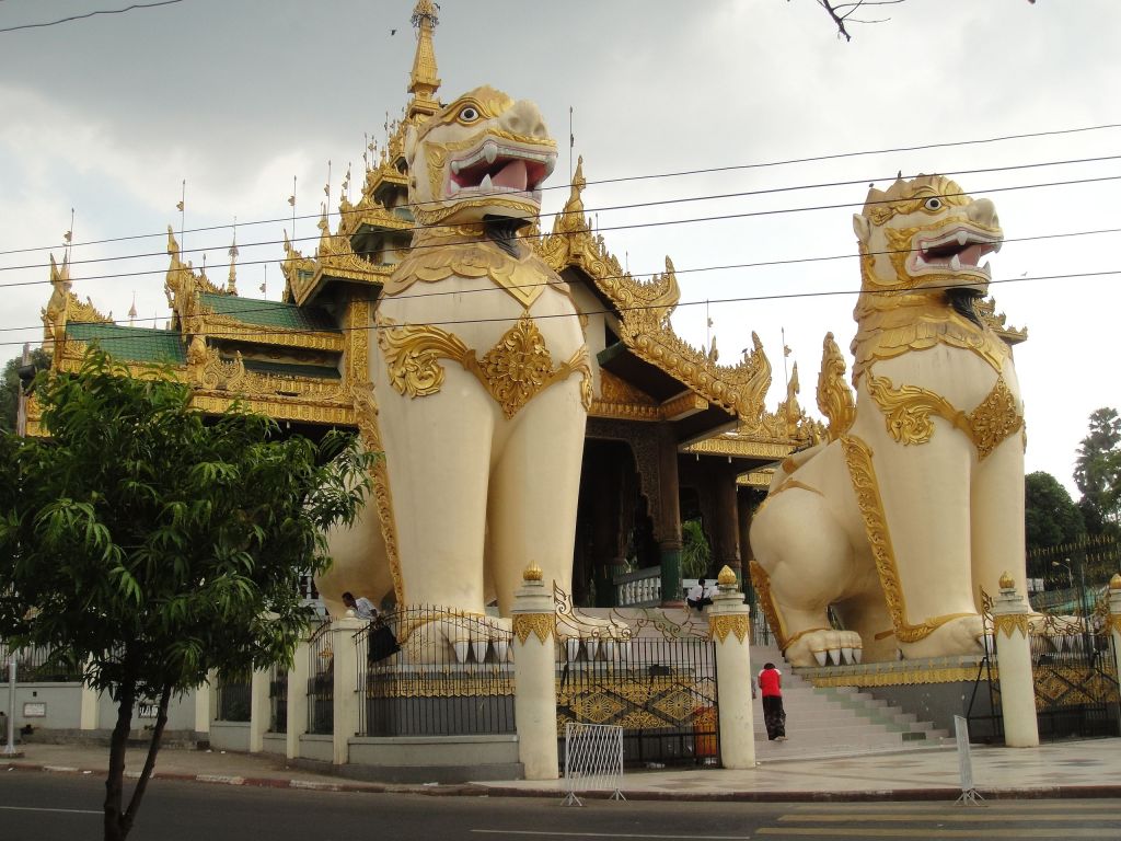
The Schwedagon Pagoda
Now if there is only one thing you could do in Yangon, most people would probably say to visit the Schwedagon Pagoda. It is the most sacred Buddhist pagoda in Myanmar, as it is believed to contain relics of the four previous Buddhas of the present kalpa. These relics include the staff of Kakusandha, the water filter of Koṇāgamana, a piece of the robe of Kassapa, and eight strands of hair from the head of Gautama. Wait what? There is more than on buddha? I have to read about buddhism! In fact I think I will write a special post about this pagoda, as it is incredible!!! Here it is in all its splendor:
Cr. Wikimedia Commons, Rockrangoon
Aside from all the attractions… I wondered what it felt to walk there. I found this video…
Mandalay (မန္တလေး)
Mandalay is the second largest city in Myanmar with a population of about 1,500,000 in 2022 according to populationstat. com. This city was founded in 1857 by King Mindon, replacing Amarapura as the new royal capital of the Konbaung dynasty. It was Burma’s final royal capital before the kingdom’s annexation by the British Empire in 1885.
To this day it is considered the economic center of Upper Myanmar and the center of Myanmar culture. A continuing influx of illegal Chinese immigrants, mostly from Yunnan, since the late 20th century, has reshaped the city’s ethnic makeup and increased commerce with China.
Mandalay gets the name from Mandalay Hill, the origin of the word Mandalay is uncertain but is there is the believe it may come from a Pali word. The root word has been speculated to be maṇḍala, referring to circular plains or Mandara, a mountain from Hindu mythology.
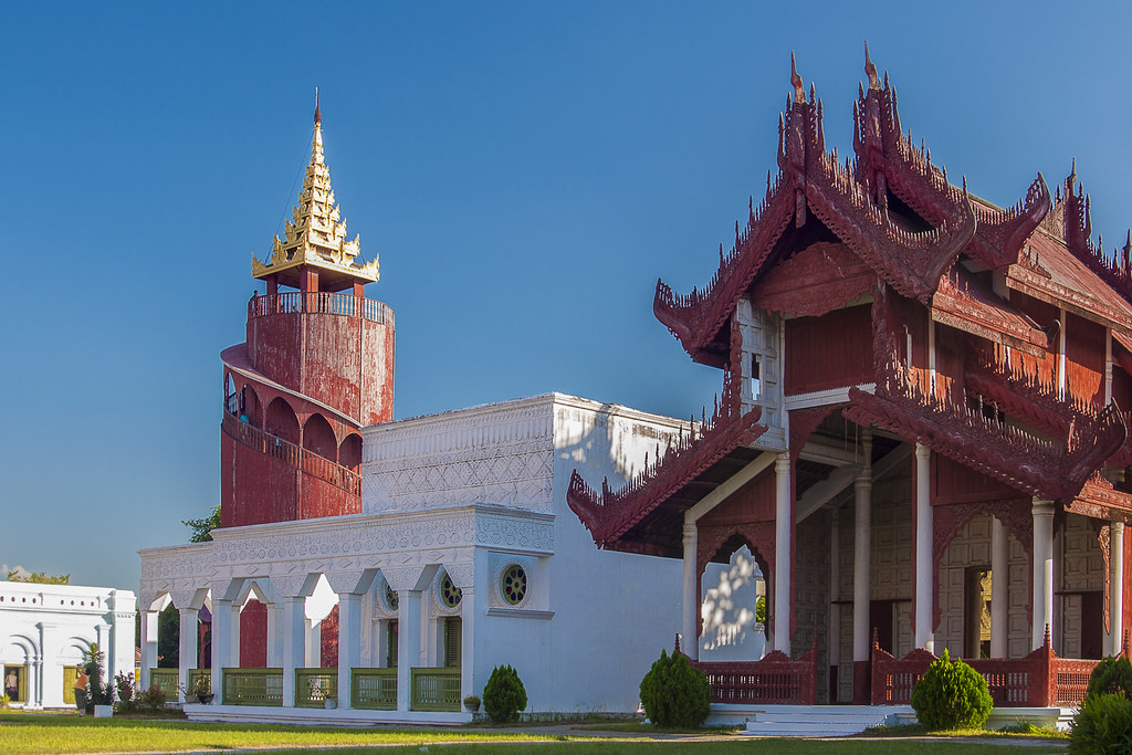
Mandalay Palace
On 13 February 1857, King Mindon founded a new royal capital at the foot of Mandalay Hill, ostensibly to fulfill a prophecy on the founding of a metropolis of Buddhism in that exact place on the occasion of the 2,400th jubilee of Buddhism.
The new capital city site was 66 km2 (25.5 sq mi) in area, surrounded by four rivers. The plan called for a 144-square block grid patterned citadel, anchored by a 16 square block royal palace compound at the center by Mandalay Hill.The 1020-acre (413-hectare) citadel was surrounded by four 2,032 m (6,666 ft) long walls and a moat 64 m (210 ft) wide, 4.6 m (15 ft) deep. At intervals of 169 m (555 ft) along the wall, were turrets with gold-tipped spires for watchmen. The walls had three gates on each side, and five bridges to cross the moat.In addition, the king also commissioned the Kuthodaw Pagoda, the Pahtan-haw Shwe Thein Ordination Hall, the Thudamma zayats or public houses for preaching Buddhism and a library for the Pāli Canon. (1)
In June 1857, the former royal palace of Amarapura was dismantled and moved by elephants to the new location at the foot of Mandalay Hill, although construction of the palace compound was officially completed only two years later, on Monday, 23 May 1859. (1)
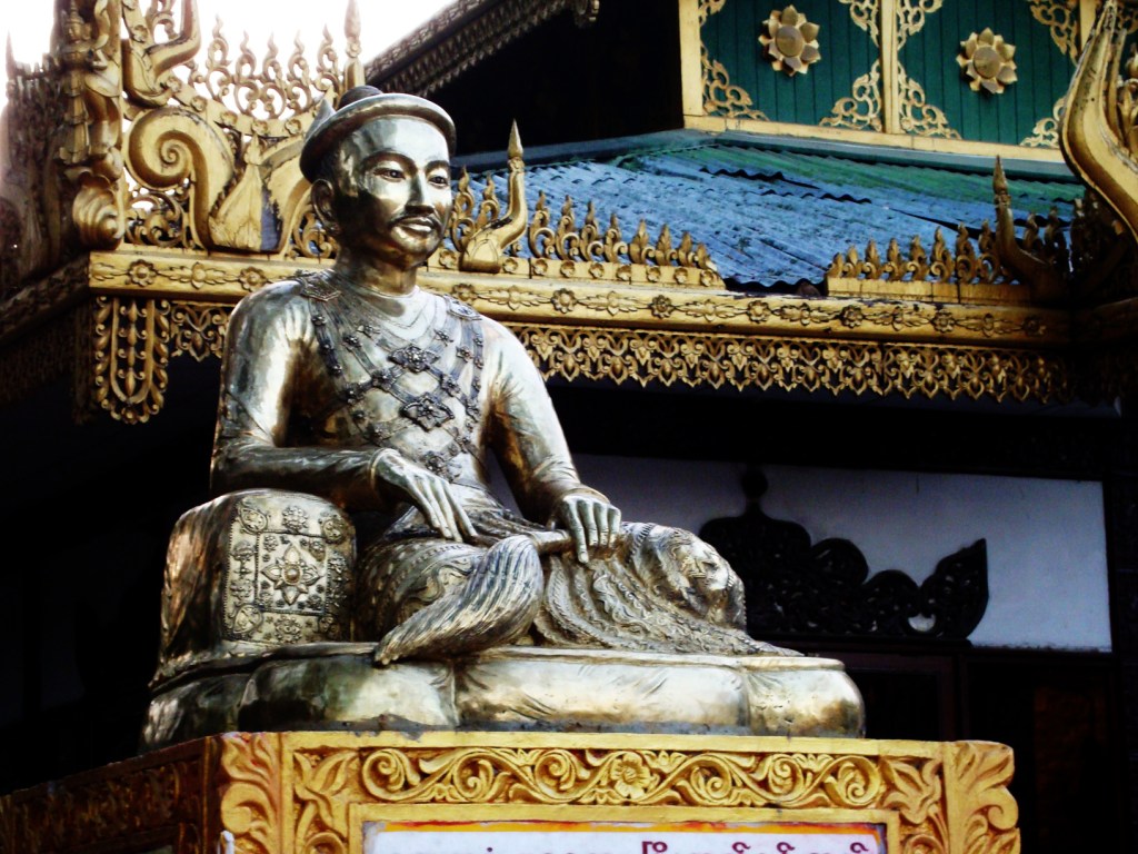
This is a statue of King Mindon:
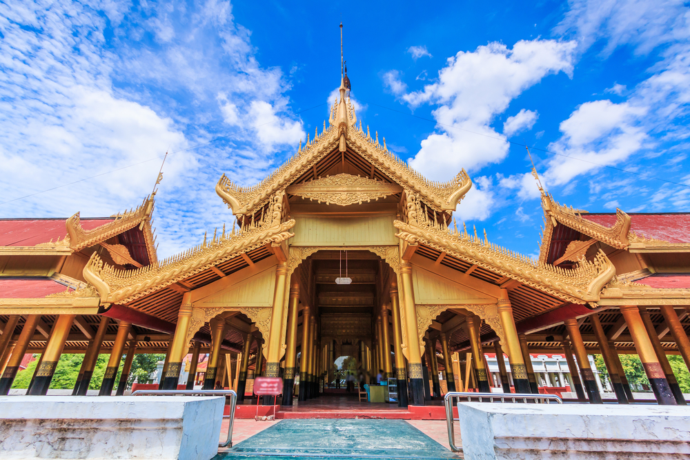
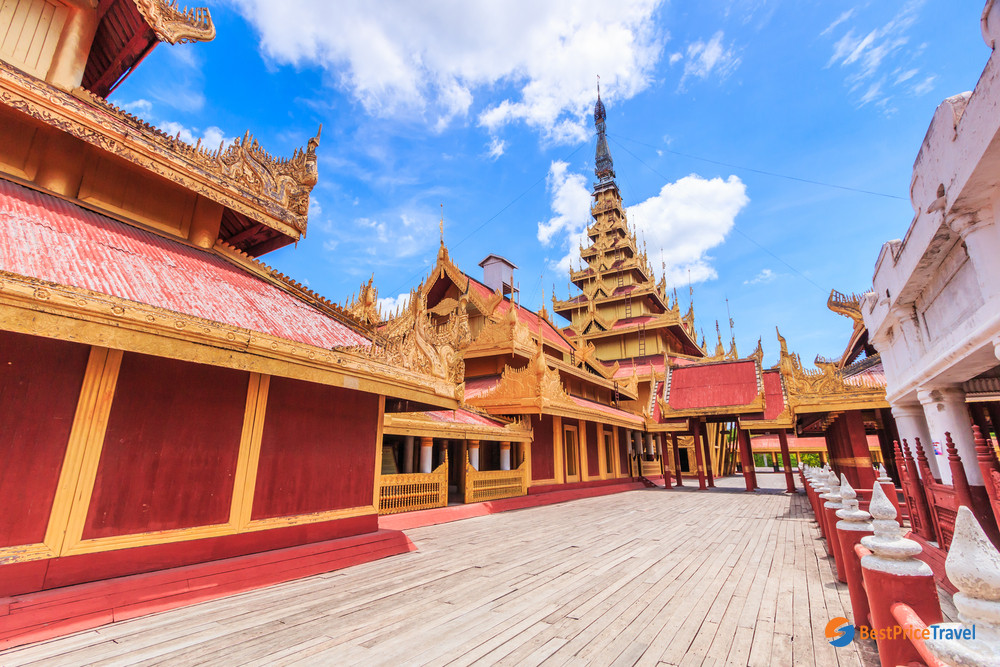
This is what the palace looks like today right on Mandalay Hill:
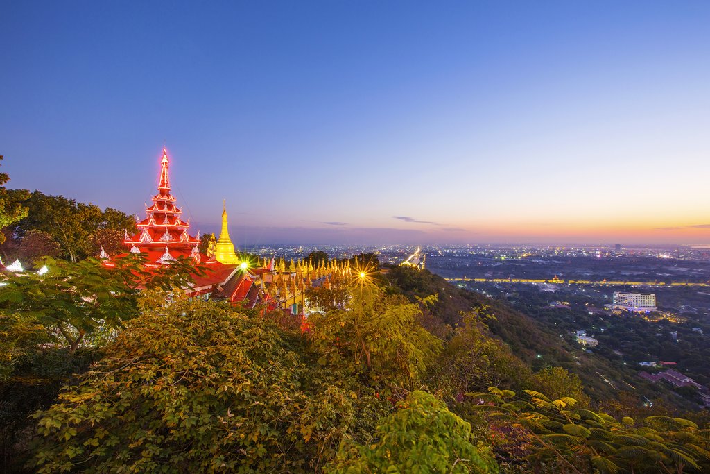
Yes! It is so beautiful!
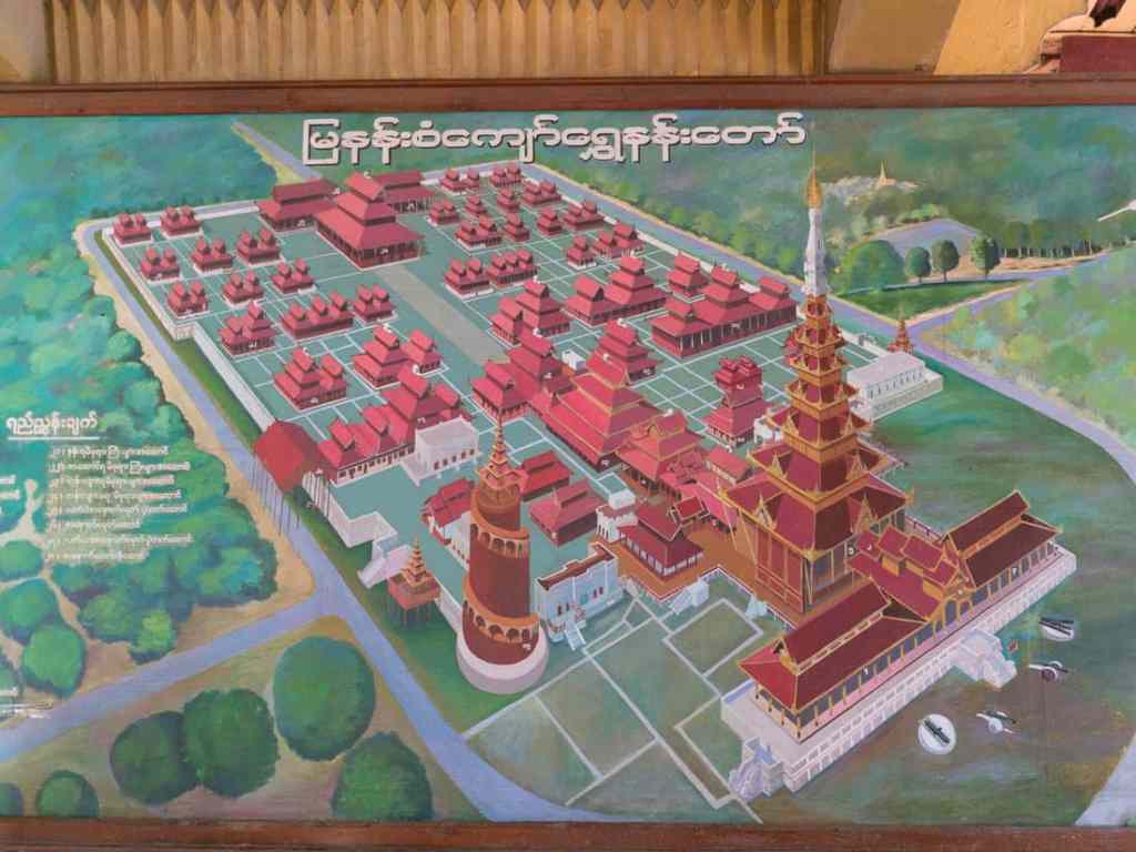
This is the layout:
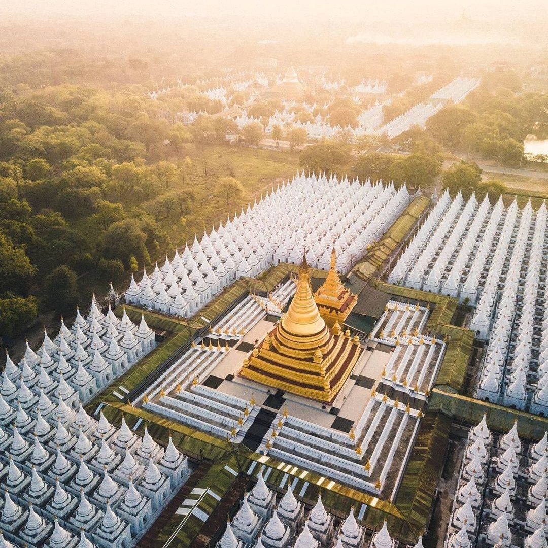
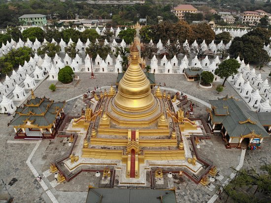
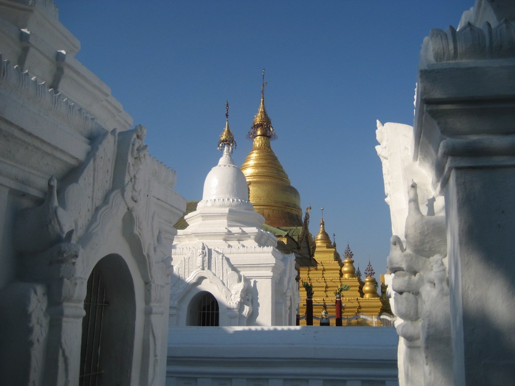
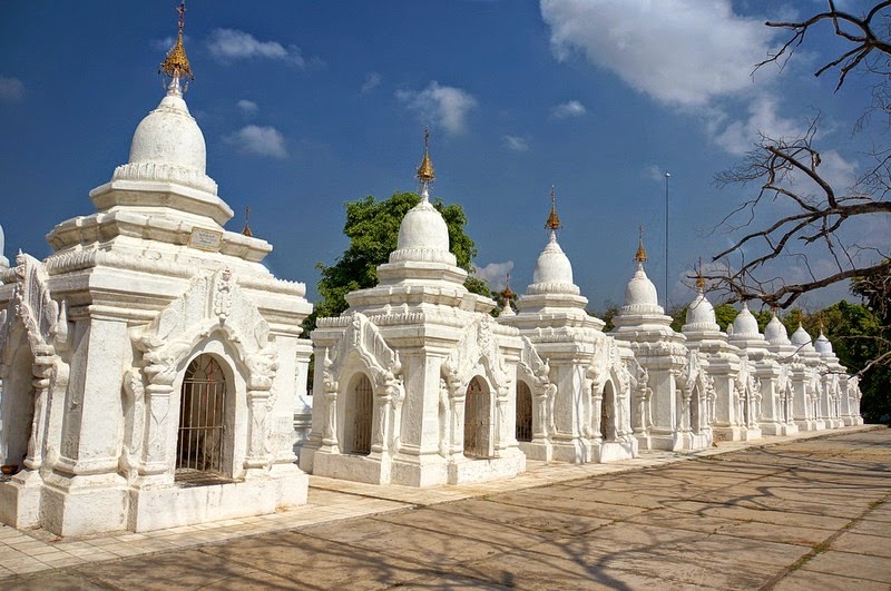
The Kuthodaw Pagoda, with the World’s Largest book: The entire Pali Canon of Theravada Buddhism.
Yes! The world’s largest book! Have you ever wondered about this? I never had so I was so surprised and impressed. Also saddened. Let me tell you all about it.
The same king that founded Mandalay the Royal city, King Mindon, also created this incredible place! He comissionned the building of this pagoda as part of the traditional foundations of the new royal city which also included a pitakat taik or library for religious scriptures, but he wanted to leave a great work of merit for posterity meant to last five millennia after the Gautama Buddha who lived around 500 BC.
The Pagoda itself, which is gilded above its terraces, is 188 feet high was modeled after the Shwezigon Pagoda at Nyaung-U near Bagan. Around it is the world’s largest book. Construction began in 1860, its hti (umbrella or crown) mounted on 19 July 1862, and the inscriptions were laid open to the public on 4 May 1868.
The world’s largest book is known as “The Tripitaka” a complex of 729 Stupas that contain 729 tablets and 1,460 pages made of stone that once had written in gold the entire Pali Canon of Theravada Buddhism. Each page is 1.07 metres (3+1⁄2 ft) wide, 1.53 metres (5 ft) tall and 13 centimetres (5+1⁄8 in) thick. Each stone tablet has its own roof and precious gem on top in a small cave-like structure of Sinhalese relic casket type called kyauksa gu (stone inscription cave in Burmese), and they are arranged around a central golden pagoda. !!! I still can’t believe I had never heard about this:


I know… my jaw is still 2 feet under! I just can’t believe such a thing exists. like my son says… “People just don’t build like they used to.” ^ ^
This is a video, but sadly the person moves the camera too much… and you can hear their breathing eventually. It must be exhausting walking all that in the heat!
Sadly, when the British conquered Myanmar and invaded the North, Mandalay Palace became Fort Dufferin, and troops were billeted all around Mandalay Hill in the monasteries, temples and pagodas. They became off-limits to the public and Burmese were no longer allowed to visit their religious sites.
One revenue surveyor called U Aung Ban then came up with the idea of appealing direct to Queen Victoria since she had promised to respect all religions practiced by her subjects. To their amazement and great joy the British queen promptly ordered the withdrawal of all her troops from religious precincts in 1890. This however turned to great sadness when they found that the pagoda had been looted from the hti (the gold umbrella on the top pf the temple), left lying on the ground stripped of its bells, gold, silver, diamonds, rubies and other precious stones, down to the Italian marble tiles from its terraces. The zayats lay in utter ruin and the bricks had been used to build a road for the troops. All the brass bells from all the kyauksa gu stupas were gone, 9 on each making it 6570 in total. The gold ink from the letters as well as the sides and top of each marble slab had also disappeared. All the biloos (ogres) along the corridors had lost their heads, and the marble eyes and claws from the masonry chinthes gone.
This made me so sad… and angry.
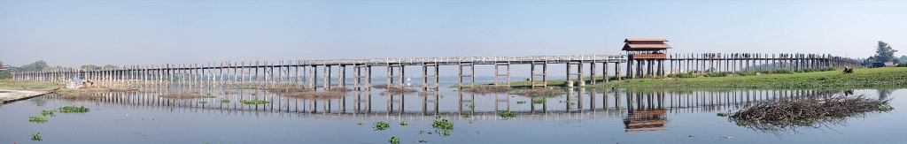
The Ubein Bridge
U Bein Bridge is a crossing that spans the Taungthaman Lake near Amarapura in Myanmar. The 1.2-kilometre bridge was built around 1850 and is believed to be the oldest and longest teakwood bridge in the world. Construction began when the capital of Ava Kingdom moved to Amarapura, and the bridge is named after Maung Bein who had it built. It is used as an important passageway for the local people and has also become a tourist attraction and therefore a significant source of income for souvenir sellers.
It is particularly busy during July and August when the lake is at its highest. The bridge was built from wood reclaimed from the former royal palace in Inwa. It features 1,086 pillars that stretch out of the water, some of which have been replaced with concrete.


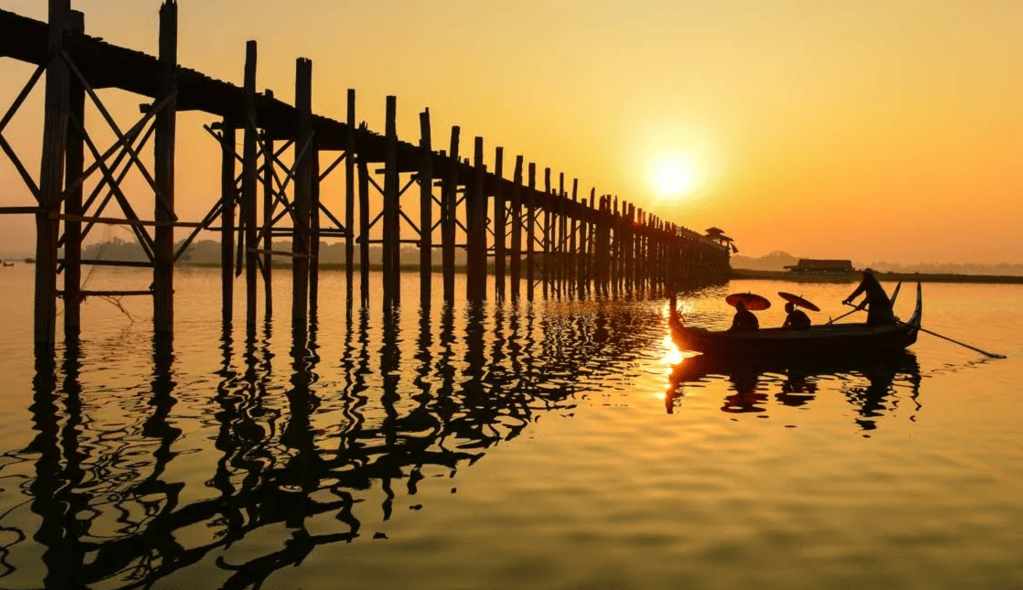
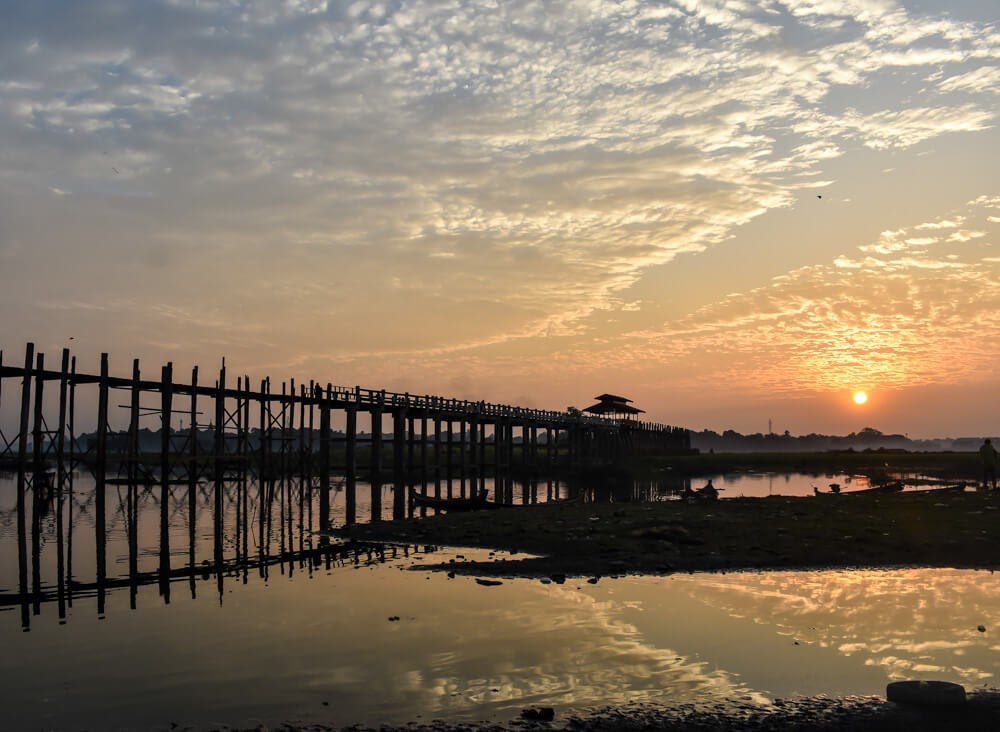
Though the bridge largely remains intact, there are fears that an increasing number of the pillars are becoming dangerously decayed. Some have become entirely detached from their bases and only remain in place because of the lateral bars holding them together. Damage to these supports have been caused by flooding as well as a fish breeding program introduced into the lake which has caused the water to become stagnant. (1)
Last but not least this video gives one a great feel for this city in general:
Well, this concludes our virtual trip through the 3 capital cities of Myanmar. Thanks so much coming along. Which was your favorite city in Myanmar? Comment below!

Increíble que Myanmar tuviera tres capitales y todas muy interesantes.
Sus templos son muy bellos y majestuosos y me encanta su artesanía.
Un poco largo el post, debido a la gran cantidad de información.
LikeLike
Muchas gracias por comentar. Si creo quedo un poco largo pero quería cubrir un poco de cada ciudad. El proximo será mas corto! ^ ^
LikeLike