Rwanda is a small land locked country located in East Africa. It is bordered to the north by Uganda, to the east by Tanzania, to the south by Burundi, and to the west by the Democratic Republic of the Congo (Kinshasa) and Lake Kivu. It is located at a high altitude as its lowest point is the Rusizi River at 3,117 ft (950 m) above sea level. It sits right below the equator line.
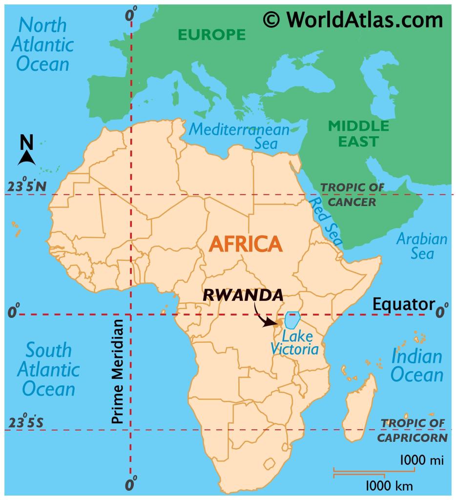
Rwanda is very small, 149th in the world (number 1 being the biggest) with a surface area of approximately 10,169 sq mi. (26,338 sq km)
Now let’s go into each of its geographic regions:
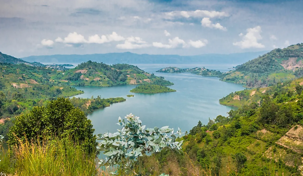
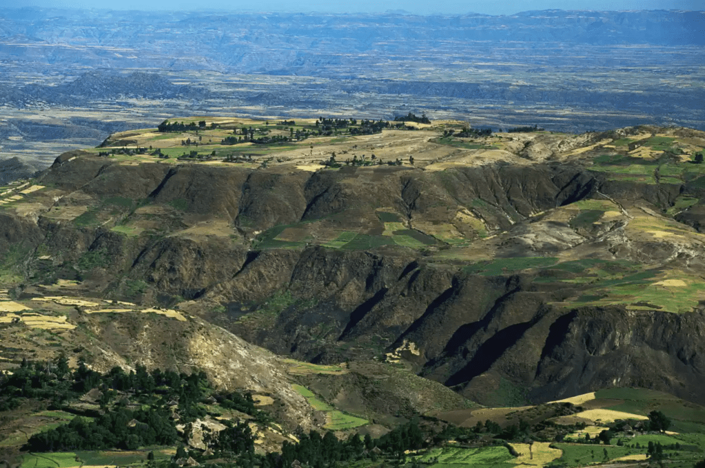
West: The Great Rift Valley and Lake Kivu.
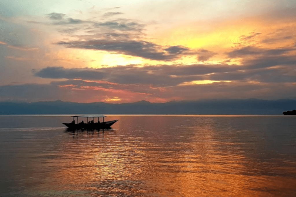
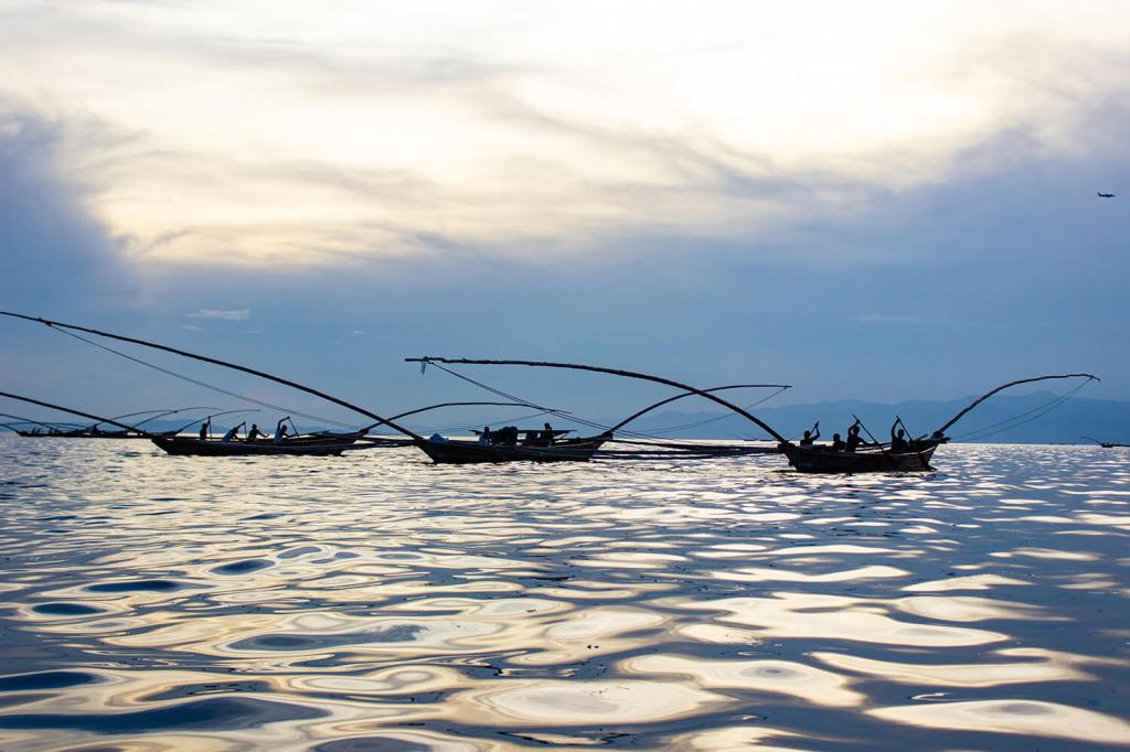
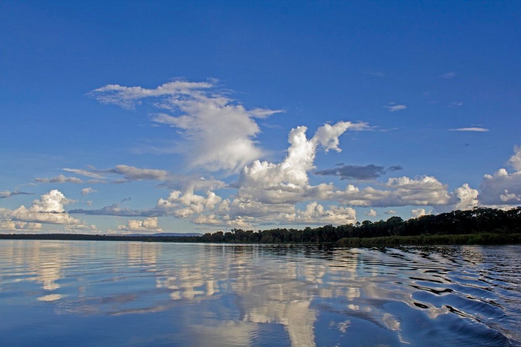
Sharing the border between Rwanda and the Democratic Republic of Congo, Lake Kivu is one of the African Great Lakes. It rests within the Albertine Rift, the western arm of the colossal East African Rift. The lake’s water eventually spills southward into Lake Tanganyika via the Ruzizi River.
Lake Kivu is approximately 26 mi (42 km) long and 31 mi (50 km) at its widest. Its irregular shape makes measuring its precise surface area difficult; it has been estimated to cover a total surface area of some 1,040 sq mi (2,700 km2), making it Africa’s eighth largest lake. However, it is the deepest fresh water lake in Africa, with average depth of 787ft (240m), maximum depth 1,575ft (480 m).
All images Cr. shadowsofafrica. com
This lake has a deadly side… as its bed sits upon a rift valley that is slowly being pulled apart, causing volcanic activity in the area. It undergoes limnic eruptions (where overturn of deepwater stratified layers releases dissolved carbon dioxide (CO2) and the lake’s bottom also contains methane (CH4)!
It is estimated that this lake holds 256 cubic kilometers (61 cubic miles) of carbon dioxide and 65 cubic kilometers (16 cubic miles) of methane. This methane resource is significant, potentially being able to generate around 40,000 megawatts of electricity for a year in a modern power plant. However, this high concentration of carbon dioxide and methane also presents a danger as a limnic eruption could trigger the release of the gasses from the depths and suffocate all of the inhabitants of the lakeshore.
Some international companies have started to extract methane for power use. In 2011 ContourGlobal, a UK-based energy company focused on emerging markets, secured project financing to initiate a large-scale methane extraction project. The project is run through a local Rwandan entity called KivuWatt, using an offshore barge platform to extract, separate, and clean the gasses obtained from the lake bed before pumping purified methane via an underwater pipeline to on-shore gas engines. Stage one of the project, powering three “gensets” along the lake shore and supplying 26 MW of electricity to the local grid, has since been completed. The next phase aims to deploy nine additional gensets at 75 MW to create a total capacity of 101 MW. (1)

A methane extraction plant at Lake Kivu. Cr. TheExchangeAfrica. com
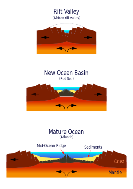
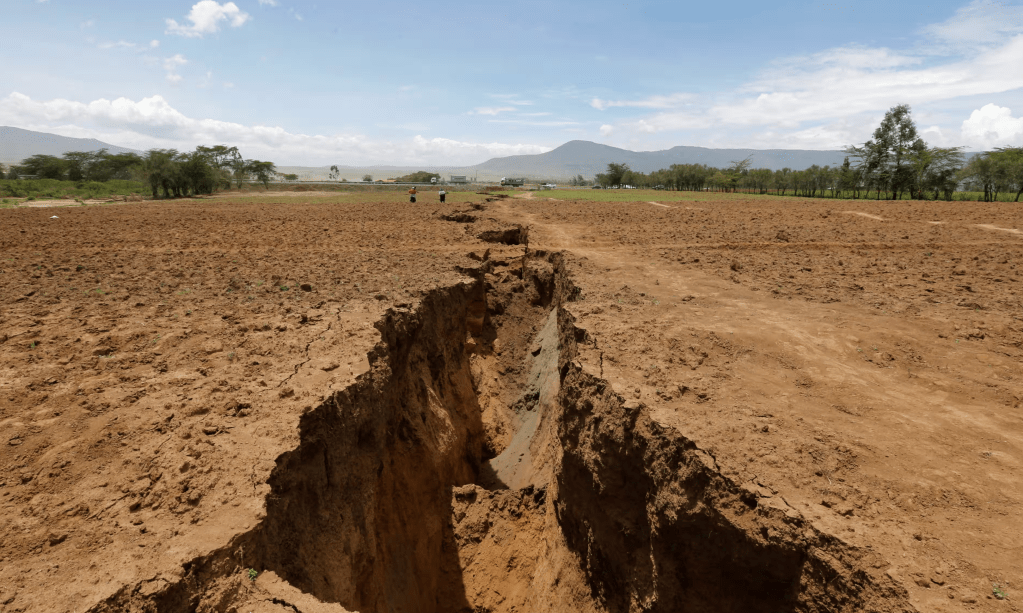
The East African Rift
The African Plate is in the process of splitting into two tectonic plates, called the Somali Plate and the Nubian Plate, at a rate of 6–7 mm (0.24–0.28 in) per year. It is part of a larger rift that extends all the way into Asia. This map shows how it is moving:
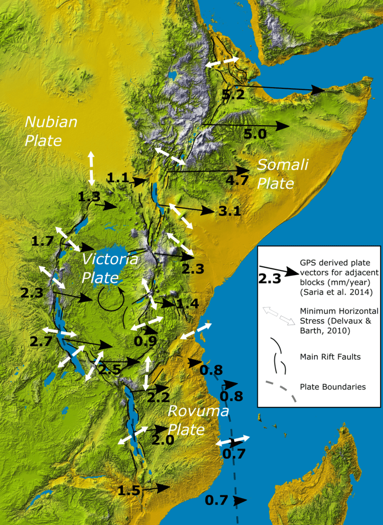
These movements are basically creating new ocean floor:
This is how it looks from Kenya:
Cr. theGuardian. com
Cr. thoughtco. com
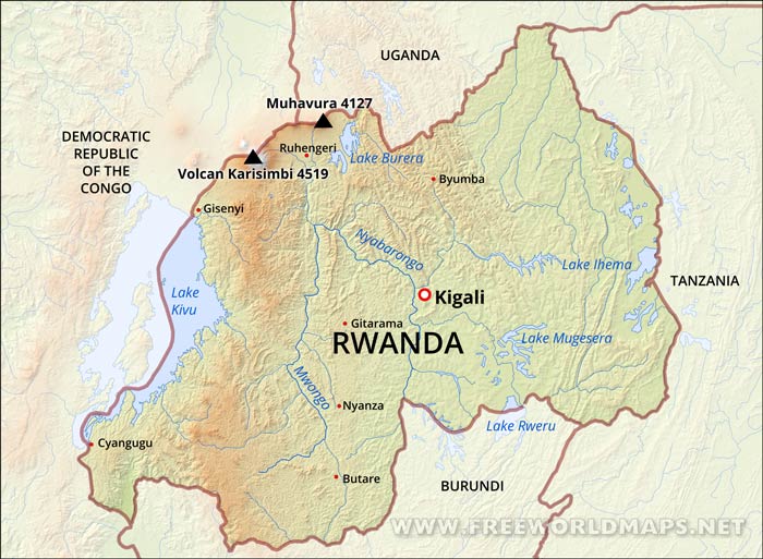
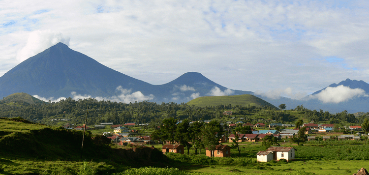
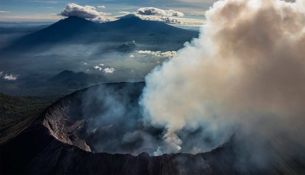
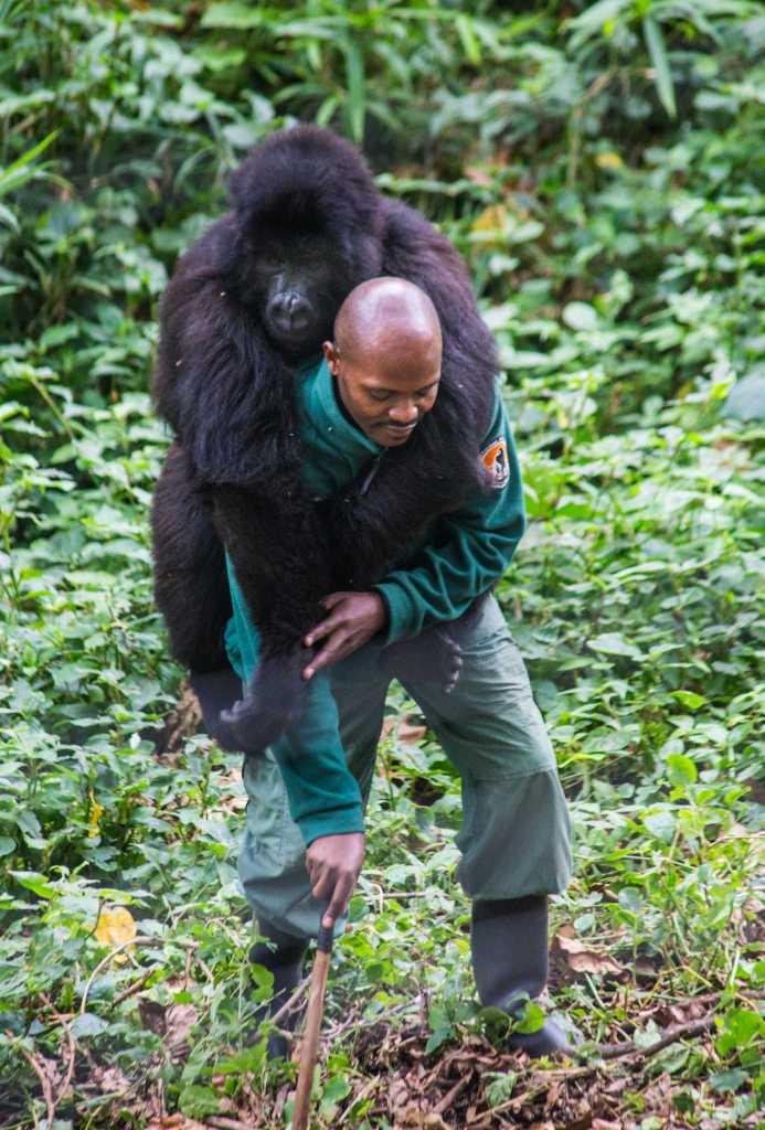
In the northwest of Rwanda, in the area where Rwanda, the Democratic Republic of the Congo (DRC), and Uganda meet there is a series of eight volcanoes that sit on the western side of the East African Rift. They are known as Virunga Mountains, (the word Virunga is an English version of the Kinyarwanda word ibirunga, which means “volcanoes”. On the Rwandan side there are five volcanoes (some shared with its neighbors Uganda and the Democratic Republic of the Congo DRC): Mount Mikeno, Mount Bisoke, Mount Sabyinyo, Mount Gahinga and the highest point in Rwanda: Mount Karisimbi (shared with DRC) at 14,787 ft (4,507 m).
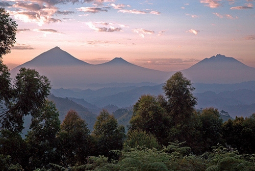
Cr. Virunga National Park .com
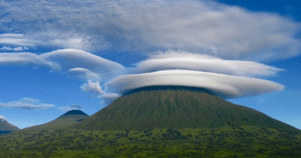
View of Mount Karisimbi Cr. insidevolcanoesnationapark. com
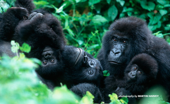
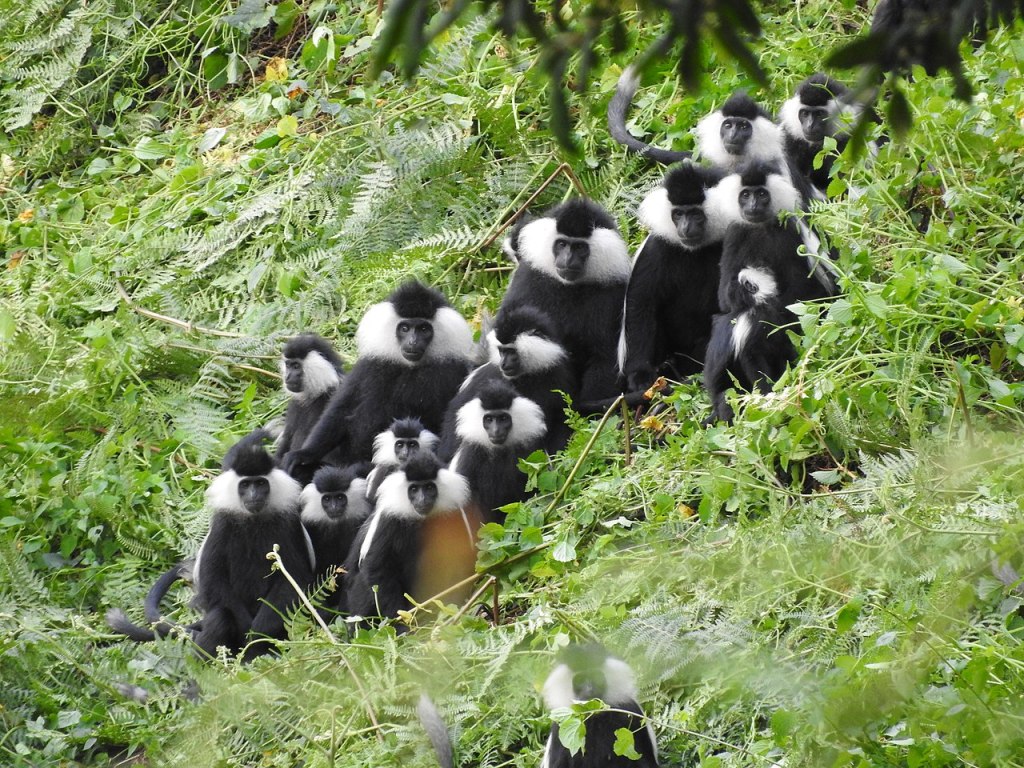
These mountains are home to a population of endangered mountain gorillas, a subspecies of the eastern gorilla. There are around 350 mountain gorillas living in the Virunga Mountains, which is more than a third of the world’s total population. These gorillas are habituated to human presence, which allows for gorilla trekking, a unique tourist experience where visitors can observe these magnificent creatures in their natural habitat.

Cr. Virunga National Park
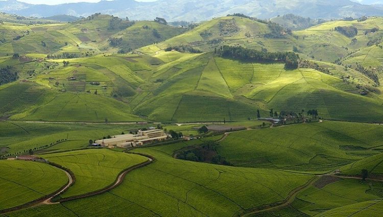
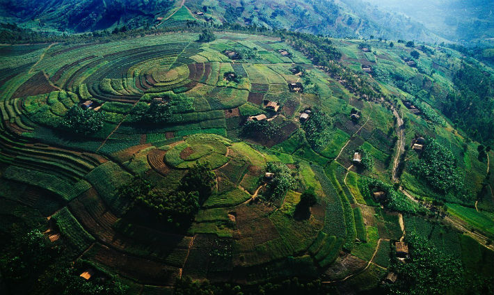
Central: Rolling Hills and Savannas.
Rwanda has the nickname “Land of a thousand hills” and this region of Rwanda illustrates it. Central Rwanda is characterized by rolling hills, green valleys, and fertile plateaus. This area sits at a high elevation, ranging from 1,500 to 2,500 meters (4,921 to 8,202 ft) above sea level. This altitude, despite Rwanda’s proximity to the equator, creates a temperate climate with comfortable year-round temperatures.
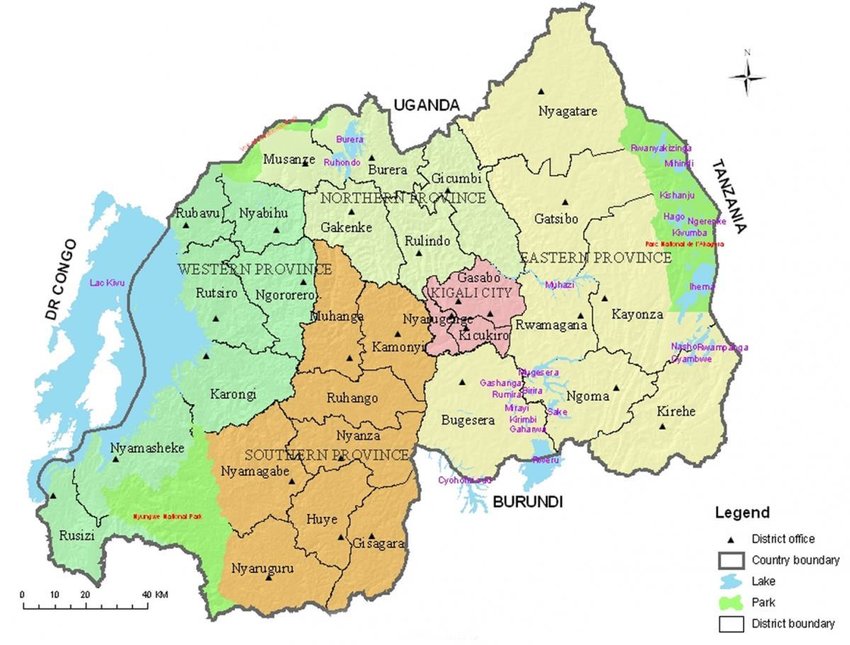
The Kigali Plateau: This plateau is home to Rwanda’s capital city, Kigali, and is a key economic and cultural center. The plateau is known for its lush green hills and fertile land.

Cr. last two photos: Rwanda Safaris .com
Cr. journeys-magazine.co.uk
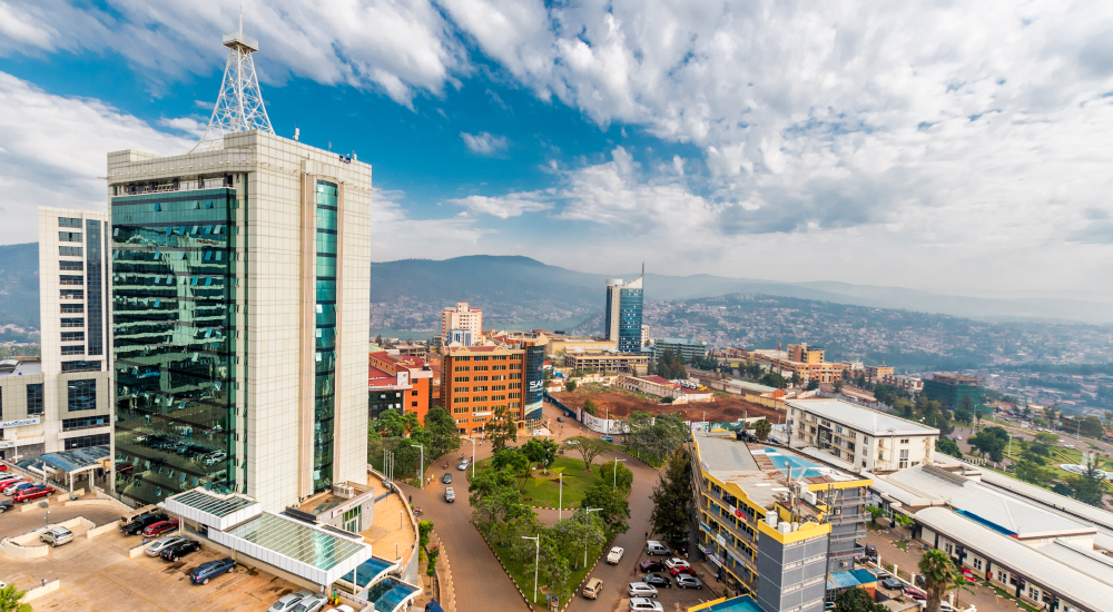
Kigali lies in a region of rolling hills, with a series of valleys and ridges joined by steep slopes. It has an area of 280 sq mi (730 sq km2). It is situated between Mount Kigali and Mount Jali, both of which have elevations of more than 5,906 ft (1,800 m) above sea level, while the lowest areas of the city have an altitude of 4,265 ft (1,300 m) This altitude, despite Rwanda’s proximity to the equator, creates a temperate climate with comfortable year-round temperatures.
Kigali is a modern and vibrant city, rebuilt after the devastation of the 1994 genocide. Today, it’s a center of commerce, culture, and government for Rwanda. The city boasts several hills, with stunning views across the Kigali Plateau.
These are some views of the city:

Cr. Discover Africa Safaris
Cr. flashglobal. com
While the Virunga Mountains with active volcanoes lie in the northwest, some extinct volcanic peaks can be found in central Rwanda, adding to the topographical variation.
South: Nyungwe Forest
Great part of the South of Rwanda is taken by the Nyungwe National Park established in 2004 that covers an area of 393 sq mi (1,019 km2) of rainforest, bamboo, grassland, swamps, and bogs.
The Nyungwe Forest is located in southwestern Rwanda, on the border with Burundi, where it is contiguous with the Kibira National Park to the south, and Lake Kivu and the Democratic Republic of the Congo to the west. The Nyungwe rainforest is probably the best preserved montane rainforest in Africa. It is located in the watershed between the basin of the Congo River to the west and the basin of the river Nile to the east.

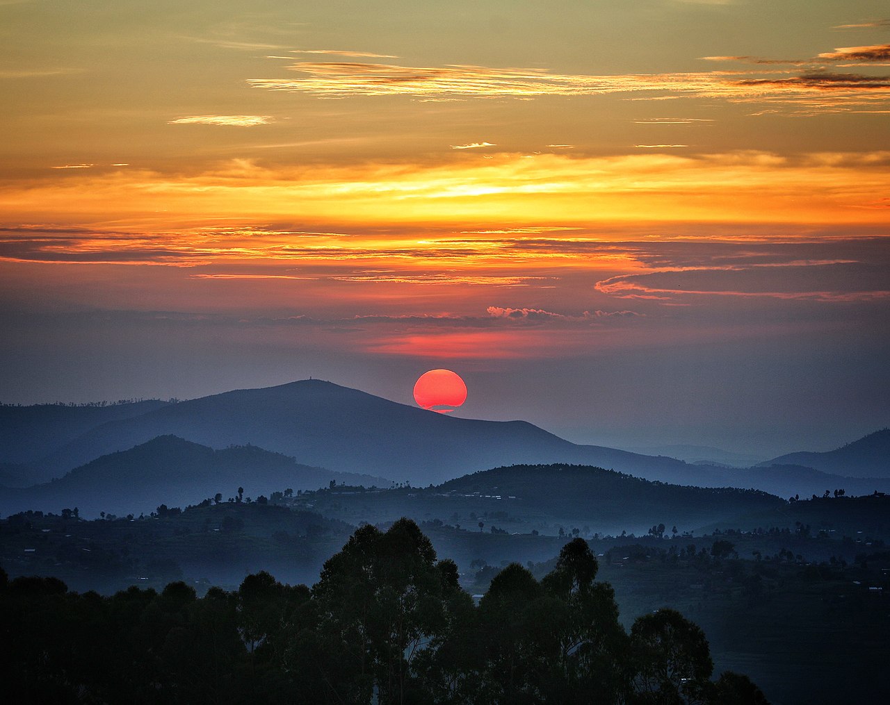
Cr. Wikimedia Commons, Jonkmania
Just WOW!!! That red sun took my breath away… imagine it for real!
Cr. Wikimedia Commons, AlexMiller12345
The park contains 13 primate species (25% of Africa’s total), more than 300 bird species including 30 Albertine Rift endemics, 1068 plant species, 85 mammal species, 32 amphibian and 38 reptile species. Many of these animals are restricted-range species that are only found in the Albertine Rift montane forests ecoregion in Africa.
This national park was just listed in the UNESCO World Heritage Site as of September 2023. Here is a gallery of photos at the UNESCO site.
And here is a video that would show me what it was like and settled on this one:
I really want to go here! ^ ^
Southeastern Rwanda has a desert-like terrain.
East: Akagera River Valley
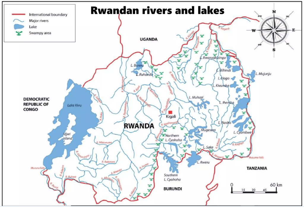
This eastern border region is characterized by savannas, plains, and lots of swamps. The Akagera River, which is part of the upper Nile basin, snakes along the border with Tanzania. This map shows how swampy Rwanda is in the northeast:
Eastern Rwanda has a generally lower elevation compared to central Rwanda’s “Land of a Thousand Hills.” This difference in altitude contributes to a warmer climate in the east.
Hugging the border with Tanzania, is Akagera National Park. Established in 1934, it’s the oldest national park in Rwanda and encompasses a diverse landscape that includes savannas, woodlands, mountains, and swamps . The park is named after the Akagera River, which flows along its eastern boundary, feeding into Lake Ihema and several smaller lakes. The complex system of lakes and linking papyrus swamps make up over a third of the park, making it the largest protected wetland in Eastern-Central Africa.
Akagera National Park had a turbulent past. In the 1990s, the park suffered from poaching and reduced size due to land allocation for returning refugees. Thankfully, since 2010, African Parks has partnered with the Rwandan Development Board to revitalize the park. This partnership has led to a significant increase in wildlife populations and a focus on community development.
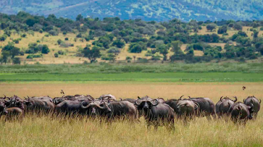
Today, Akagera National Park is a haven for wildlife viewing. Visitors can see a variety of animals, including:
- Lions
- Elephants
- Giraffes
- Zebras
- Buffaloes
- Rhinos (reintroduced)
- Baboons
- Monkeys
- Over 490 bird species
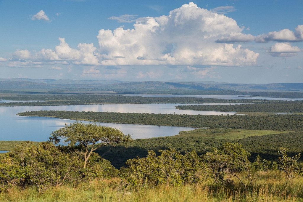
The Expansive Akagera wetlands. Cr. Scott Ramsay

Cr. Akagera National Park .com
I don’t think I could walk with lions like that…
Cr. Dana Allen http://www.Photosafari-Africa.net

Cr. Rwanda Safari .com

Impalas are the most common antelope. Cr. Scott Ramsay
Lake Ihema. Cr. Jodi van Oort
What a beautiful place! Classic Africa Safari dream! Thank you so much for coming on this virtual geography trip with me. I take my leave with this beautiful video… just animals and beautiful music. Until next post!

Me gusto conocer un poco de Rwanda.! Increíble que en un pequeño país haya tanta variedad y cantidad de Naturaleza y Geografía. Su clima privilegiado favorece que su geografía sea tan hermosa.
Me encantaron algunas bellas fotografías que complementan la parte escrita.
Felicitaciones una vez más y haber qué sigue…
LikeLike
¡Muchas Gracias! Me alegro que disfrutaste de este post!
LikeLike