
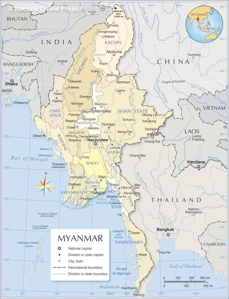
The Republic of the Union of Myanmar (formerly known as Burma) is the the northernmost country in Southeast Asia. It covers a total area of 262,000 square miles (678,500 square kilometers). Its total length from north to south is about 1,275 miles (2,050 km), and its width at the widest part, across the centre of the country at about the latitude of the city of Mandalay, is approximately 580 miles (930 km) from east to west. Myanmar is bordered by China to the north, by India to the northwest, by Thailand to the southeast, the Andaman Sea and Bay of Bengal to the south and southwest, Bangladesh to the west and Bangladesh to the west. (1) (2)
The name of this country has been a matter of dispute and disagreement, particularly in the early 21st century, focusing mainly on the political legitimacy of those using Myanmar versus Burma. Both names derive from the earlier Burmese Mranma or Mramma, an ethnonym for the majority Burman ethnic group, of uncertain etymology. The terms are also popularly thought to derive from Brahma Desha or ब्रह्मादेश/ब्रह्मावर्त (Sanskrit) after Brahma. (1)
In 1989, the military government officially changed the English translations of many names dating back to Burma’s colonial period or earlier, including that of the country itself: Burma became Myanmar. The renaming remains a contested issue. Many political and ethnic opposition groups and countries continue to use Burma because they do not recognize the legitimacy of the ruling military government or its authority to rename the country. (1)
Land
In the north, the Henduan Mountains form the border with China. Hkkabo Razi, located in KachinState, at an elevation of 5,881 meters (19,295 ft), is the highest point in Myanmar. It is also the highest point in all of Southeast Asia. Many mountain ranges, such as the Rakhine Yoma, the Bago Yoma, the Shan Hills and the Tenasserim Hills exist within Myanmar, all of which run north-to-south from the Himalayas. (1)

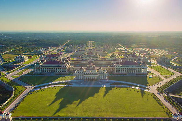
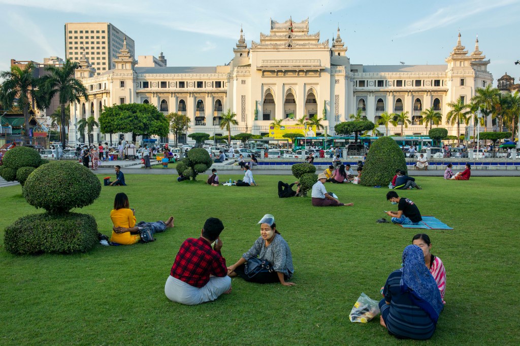
Myanmar is shaped like a kite. Its total length from north to south is about 1,275 miles (2,050 km), and its width at the widest part, across the centre of the country at about the latitude of the city of Mandalay, is approximately 580 miles (930 km) from east to west. The country’s capital city is Nay Pyi Daw (Naypyidaw), and its largest city is Yangon (formerly known as Rangoon). (2)


People
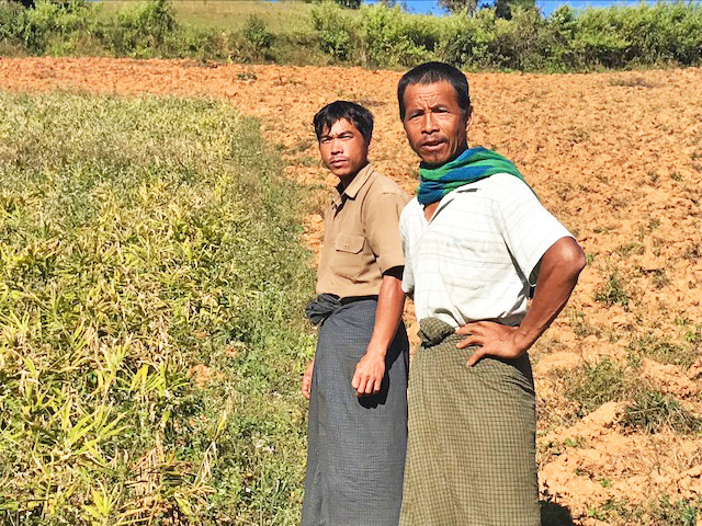
The majority of Myanmar’s population is rural, with the density of settlement in each region related to agricultural production, particularly of rice. Thus, the most populous regions are the Irrawaddy delta and the dry zone, and the highest densities are found in the upper delta, between Yangon and Hinthada (Henzada). Although city populations have been growing, the pace of urbanization has not been as rapid in Myanmar as it has been in most other countries of Southeast Asia. (2)
The population of Myanmar remains fairly youthful, with roughly one-fourth of the people under age 15. However, the proportion of young people has been decreasing steadily since the late 20th century. Life expectancy, on the contrary, has been on the rise, with most men and women living into their 60s. (2)


Flag
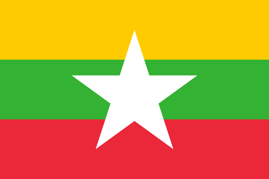
The State flag described in the 2008 Constitution of the Republic of the Union of Myanmar was adopted by enacting the 2010 Union Flag Law and the repealing of the 1974 State Flag Law on 21 October 2010. It was hoisted for the first time at 3:00 p.m. local time on 21 October 2010. (1)
The current flag is a horizontal tricolor flag of yellow, green, and red charged with a five-pointed white star in the centre of the field. The background is a yellow, green, and red tricolor meant to honor the tricolors used during the independence struggle. The yellow represents unity, conformity, wisdom, happiness, and unity of all national races amicably. The green symbolizes fertility, conformity, fairness, and being a peaceful, pleasant, and green nation. The red represents bravery and decisiveness. The white star stands for purity, honesty, fullness of compassion, and power. (1)
Coat of Arms
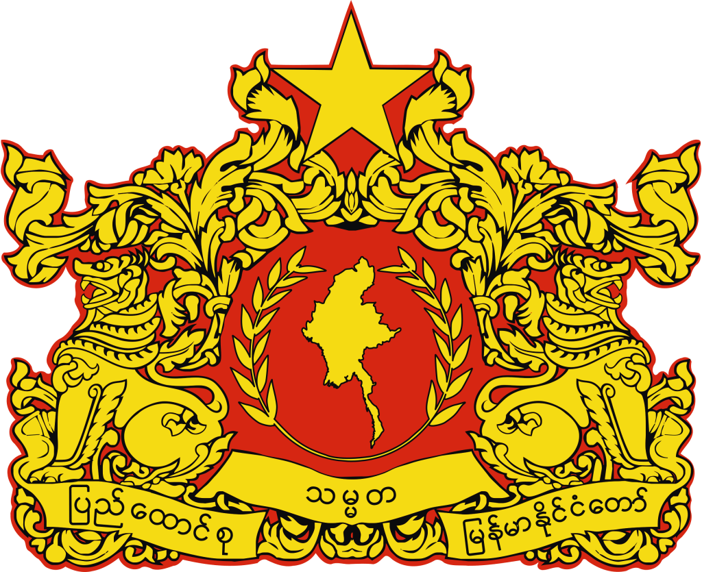
The current design of the State Seal was first introduced at the Constituent Assembly of the Union of Burma in 1947. On 19 October 1988, the State Law and Order Restoration Council enacted a law which replaces the expression “Socialist Republic of the Union of Myanmar” with the expression “Union of Myanmar”. The State Seal was modified as the country name in State Seal Law had been replaced: the words ဆိုရှယ်လစ်သမ္မတ (“Socialist Republic”) were removed. (1)
Peafowl
In Burmese tradition, peafowl is regarded as the symbol of the sun.
Lion (Leograph)
The reason of the inclusion of 3 lions in the State Seal was given as follow:
In the traditional view of ancient sages, the nature of lion gives the natures of bravery, diligence, extinguishing any size of danger with the same effort, purity and virtue. Such characteristics can make Myanmar honored and they are the ones that Myanmar citizens should imitate.
Being surrounded by three lions means defending and protecting Myanmar. In the view of astrologist monks and persons, number three means “divisible by three” (end of all evil events).
Lion and Myanmar are regarded as compatible paring according to astrology.
Lion and traditional floral arabesques are inserted and decorated, so it is assumed as giving respect to an ancient traditional Myanmar culture appropriate for the modern Union of Myanmar.
State Motto on the Circle
Ears of Paddy
Ears of paddy is the symbol for cultivating class.
Pinion
Pinion (cogwheel) is the symbol for working class.
Five – Pointed Star (Mullet)
Map of Myanmar
Traditional Myanmar Flower (Laurel)
Traditional Myanmar flower art (laurel) is included to decorate the State seal as representation of ancient Myanmar traditions which are appropriate for modern Union of Myanmar.
State Name
The then conventional long names of the State are included in the State Seals.
Current State Seal included the current conventional long name “ပြည်ထောင်စု သမ္မတ မြန်မာနိုင်ငံတော်”.
For each words, “ပြည်ထောင်စု” means “union”; “သမ္မတ” means “president”; “မြန်မာ” means “Burma/Myanmar”; and “နိုင်ငံတော်” means “State”.
When “သမ္မတ” (president) and “နိုင်ငံတော်” (State) are put together, this combination means “republic”. (1)
Credits:
(1) Wikipedia
(2) Encyclopedia Brittanica
