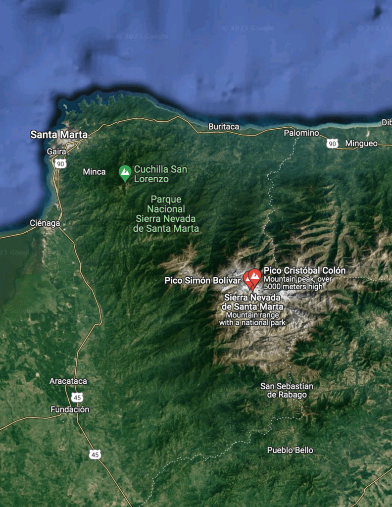
Colombia is located in the northwest of South America. It is bordered to the northwest by Panama; to the east by Venezuela and Brazil; to the south by Ecuador and Peru. It shares maritime limits with Costa Rica, Nicaragua, Honduras, Jamaica, the Dominican Republic, and Haiti.
Colombia has a land size of 1,141,748 km2 (440,831 sq mi) and it is the 25th largest nation in the world and the fourth-largest country in South America (after Brazil, Argentina, and Peru).
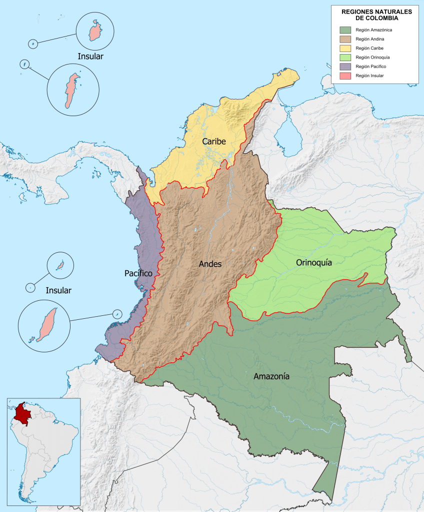
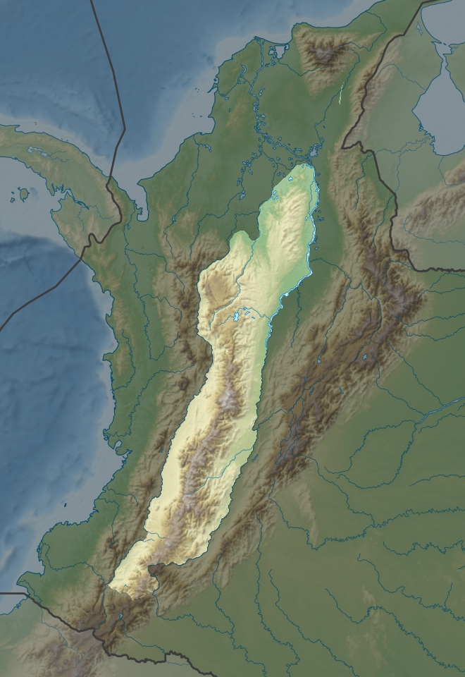
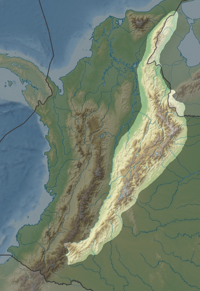
When geographers look at the natural structure of Colombia, they tend to divide from four to six distinct natural regions. For the purpose of spacing out the regions here I will use the six natural regions division. These consist of the Andean Region, covering the three branches of the Andes mountains found in Colombia; the Caribbean Region, covering the area adjacent to the Caribbean Sea; the Insular Region, comprising the islands in both the Atlantic and Pacific Oceans, the Pacific Region adjacent to the Pacific Ocean; the Orinoquía Region, part of the Llanos plains mainly in the Orinoco river basin along the border with Venezuela; and finally, the Amazon Region, part of the Amazon rainforest.
In this post I will be covering the First three. The Andean region, the Caribbean region and the Insular region.
Are you ready to travel virtually and delight in this beautiful’s country’s land? Me too! Let’s go!
Andean Region
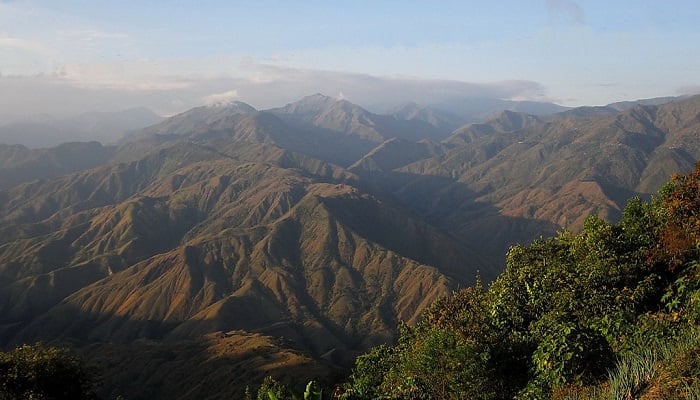
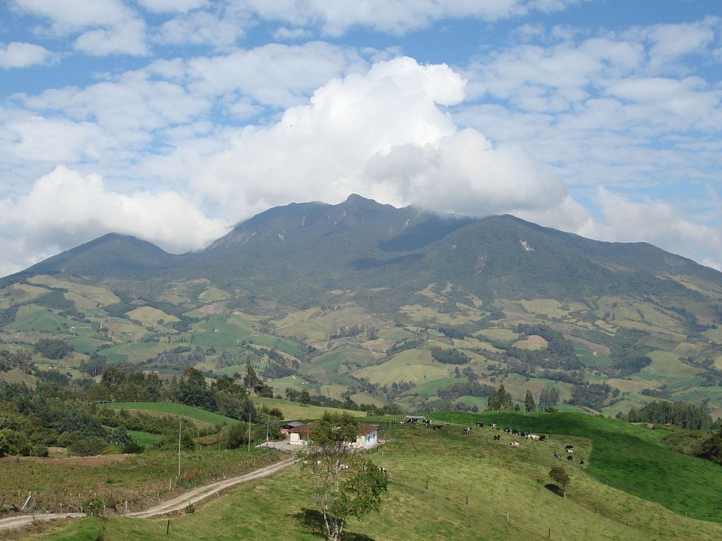
The Andes mountains form the most populous region of Colombia and contain the majority of the country’s urban centers. In the 1980’s about 78 percent of the country’s population lived in this area. Near the Ecuadorian frontier, the Andes Mountains divide into three distinct, roughly parallel chains, called cordilleras, that extend northeastward almost to the Caribbean Sea. Altitudes reach more than 18,700 ft (5,700 m), and mountain peaks are permanently covered with snow. The elevated basins and plateaus of these ranges have a moderate climate that provides pleasant living conditions and in many places enables farmers to harvest twice a year. Torrential rivers on the slopes of the mountains produce a large hydroelectric power potential and add their volume to the navigable rivers in the valleys.
Cordillera Occidental
The Cordillera Occidental is relatively low and is the least populated of the three cordilleras. Summits are only about 9,840 ft (2,999 m) above sea level and do not have permanent snows. Few passes exist, although one that is about 4,985 ft (1,519 m) above sea level provides the major city of Cali with an outlet to the Pacific Ocean. The relatively low elevation of the cordillera permits dense vegetation, which on the western slopes is truly tropical.
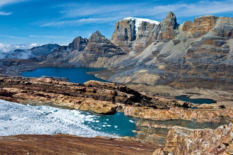
Cordillera Central
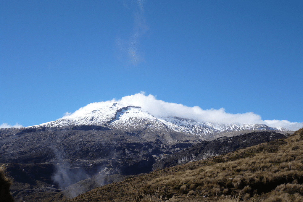
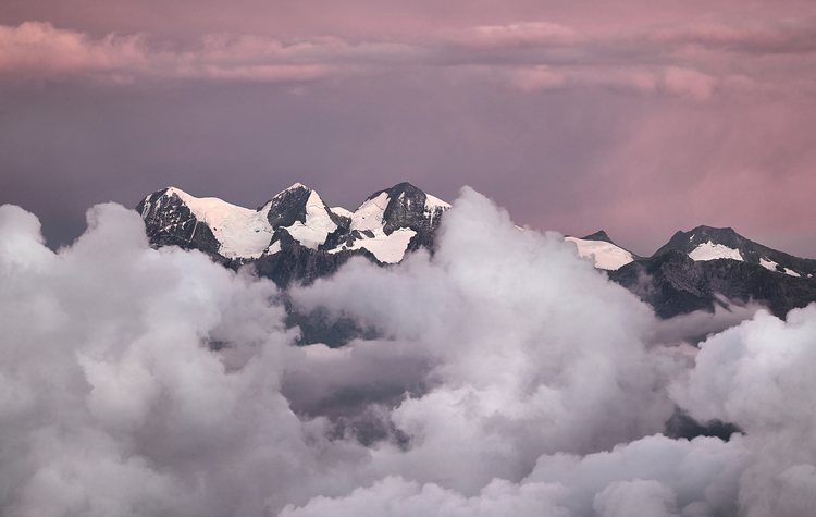
The Cordillera Central is the loftiest of the mountain systems. Its crystalline rocks form a towering wall dotted with snow-covered volcanoes that is 500 mi (805 km) long. There are no plateaus in this range and no passes under 10,825 ft (3,299 m). The highest peak in this range, the Nevado del Huila, is the highest volcano peak in Colombia and reaches 17,602 ft (5,365 m) above sea level. The second highest peak is a volcano, Nevado del Ruiz, which erupted violently on November 13, 1985. Toward its northern end, this cordillera separates into several branches that descend toward the Caribbean coast.
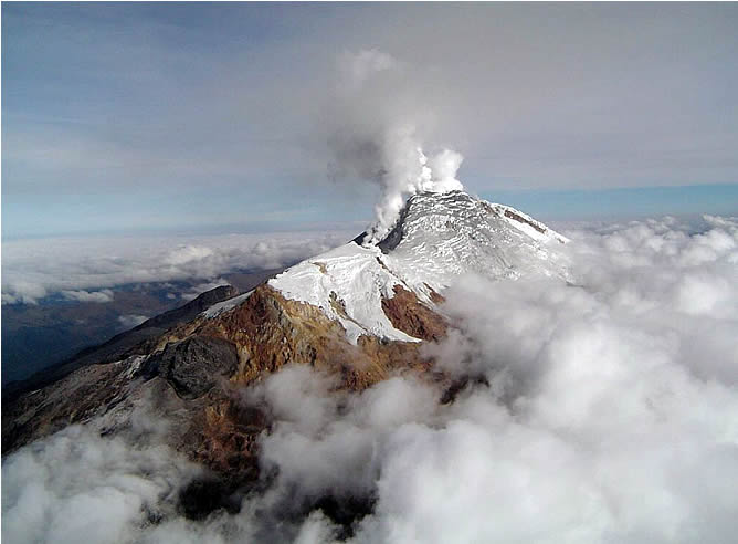
Click HERE to take a look around this area of “Los Nevados” in Google Maps. ^ ^ So beautiful!
Cordillera Oriental
The Cordillera Oriental is the widest of the three branches of the Colombian Andes. The range extends from south to north culminating in the towering Mount Cocuy (Sierra Nevada del Cocuy), which rises to 18,022 feet (5,493 metres). Beyond this point, near Pamplona, the cordillera splits into two much narrower ranges, one extending into Venezuela, the other, the Perijá Mountains, forming the northern boundary range between Colombia and Venezuela. The Perijás then descend northward toward the Caribbean to the arid La Guajira Peninsula, the northernmost extension of the Colombian mainland.


In the Cordillera Oriental, at elevations between 2,500 and 2,700 meters (8,202 and 8,858 ft), three large fertile basins and a number of small ones provide suitable areas for settlement and intensive economic production. In the basin of Cundinamarca, is where the Spanish established the town of Santa Fe de Bogotá (present-day Bogotá) at an elevation of 2,650 meters (8,694 ft) above sea level. It is the highest most populated capital in the world.
The Caribbean Region
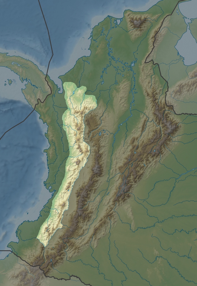
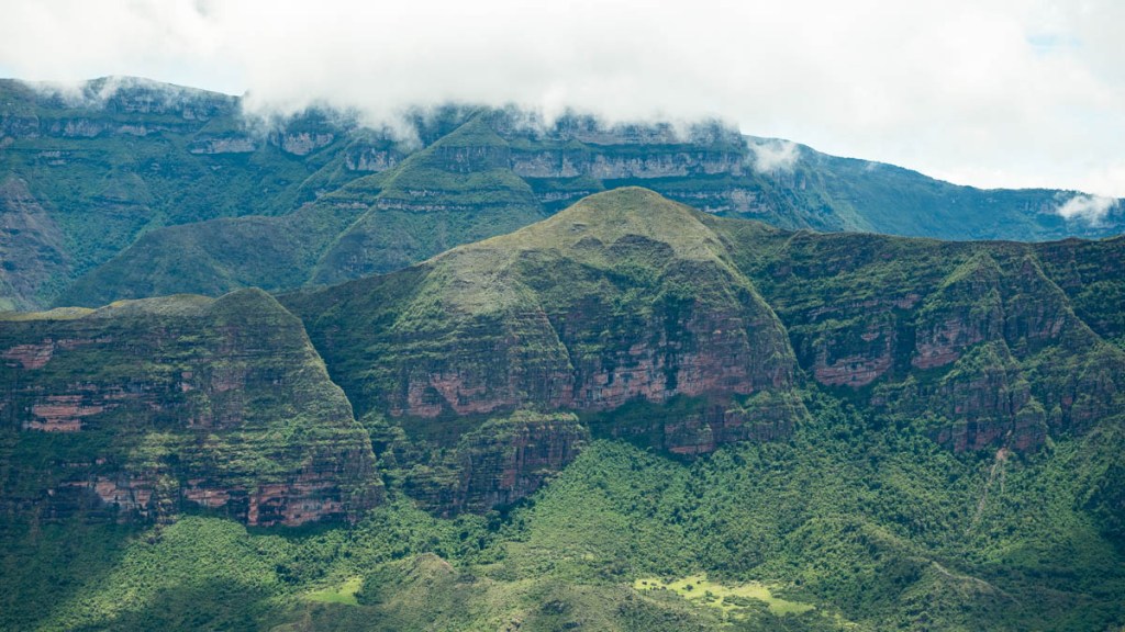
The Caribbean lowlands consist of all of Colombia north of an imaginary line extending northeastward from the Golfo de Urabá to the Venezuelan frontier at the northern extremity of the Cordillera Oriental. The semiarid Guajira Peninsula and Guajira–Barranquilla xeric scrub, in the extreme north, bear little resemblance to the rest of the region. In the southern part rises the Sierra Nevada de Santa Marta, an isolated mountain system with peaks reaching heights over 5,700 meters (18,701 ft) and slopes generally too steep for cultivation.
This is the Gulf of Urabá:
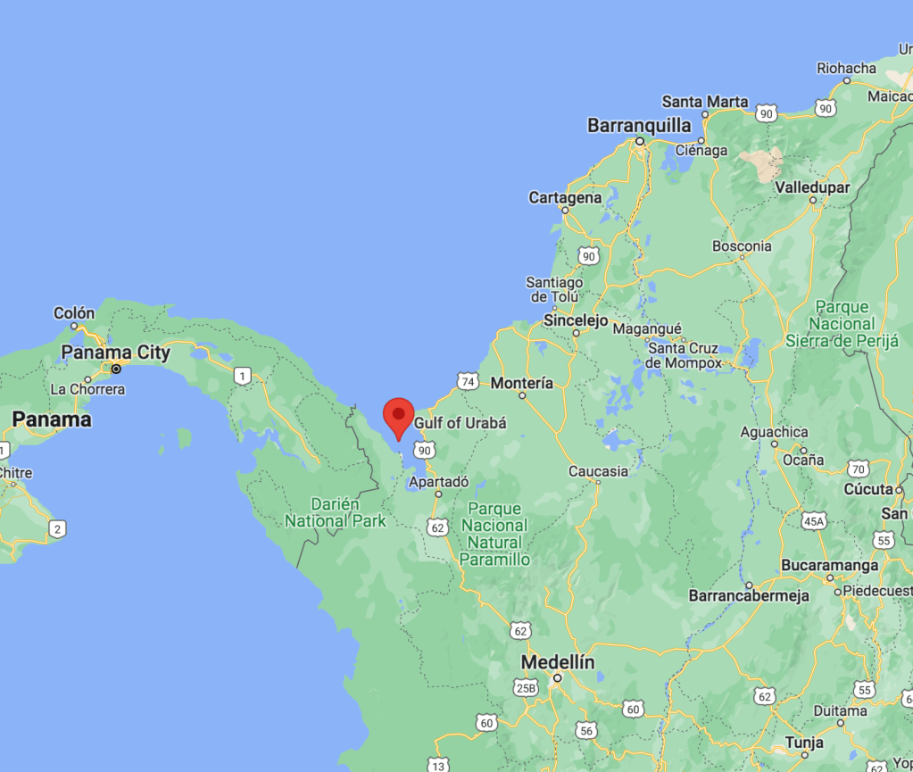
If you want to see what it looks like go HERE.
Going to the opposite side (next to Venezuela) you find “La Guajira.” It is a very dry desert like area with cacti! It is one of the areas where indigenous people live. The color of the sand is so bright!

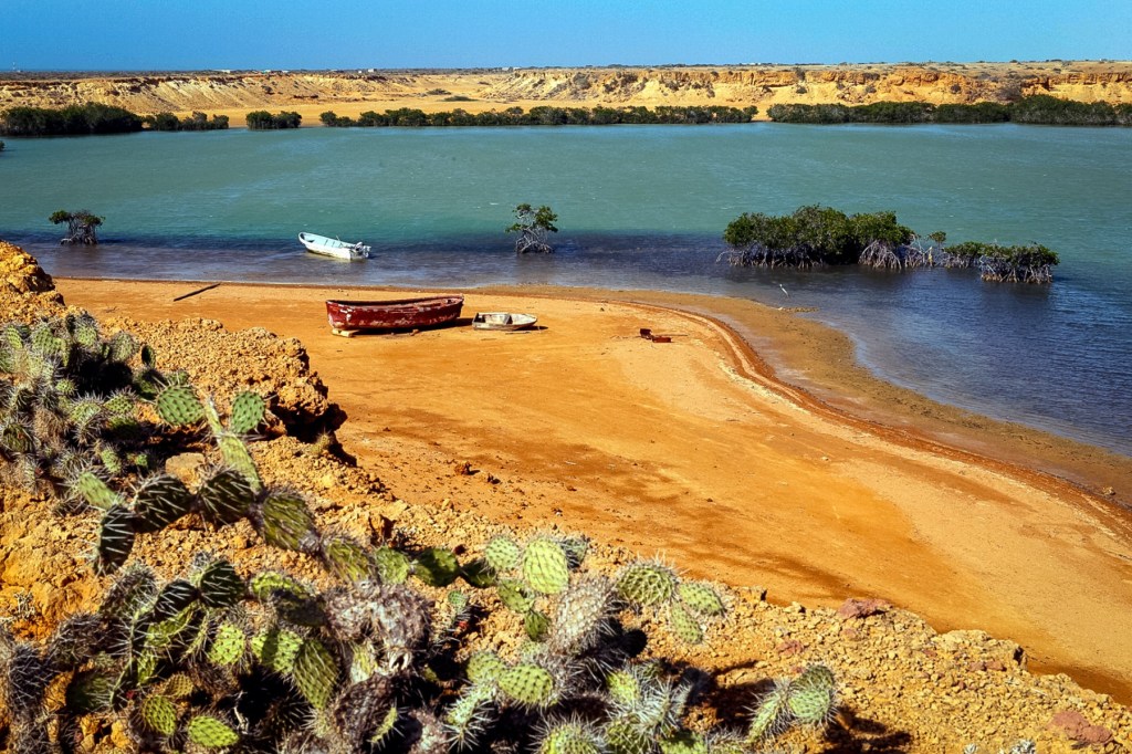
The contrast of the blue and the almost orange sand is spectacular… as a native from Venezuela, I can tell you that the brightness of the colors in the Caribbean cannot be captured by any device humankind has invented. The intensity of it hurts your eyes! Now that I live in Boston I can tell the difference…
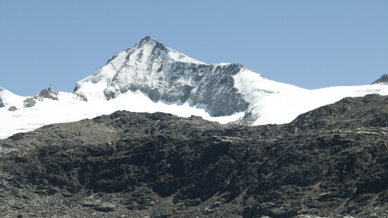
You may be wondering where is the highest peak. Well it turns out that there is a separated set of mountains that some geologists belief were part of the Cordillera Central. These are the isolated Santa Marta Mountains. They are a impressive granitic massif that ascends abruptly from the Caribbean littoral to snow- and ice-covered summits. They rise to 18,947 feet (5,775 metres)! at the “twin peaks” of Cristóbal Colón and Simón Bolívar, the highest point in the country. There is a still an ongoing discussion about which mountain is higher, so some literature says it’s the Cristóbal Colón one and some say it’s Pico Simón Bolivar and then some say they are the same height hense the twin peak reference. To take you pick for the peak! ^ ^
That is quite a plunge… from almost 19,000 feet to 0! Just WOW! This is the highest mountain range in the world by the sea!
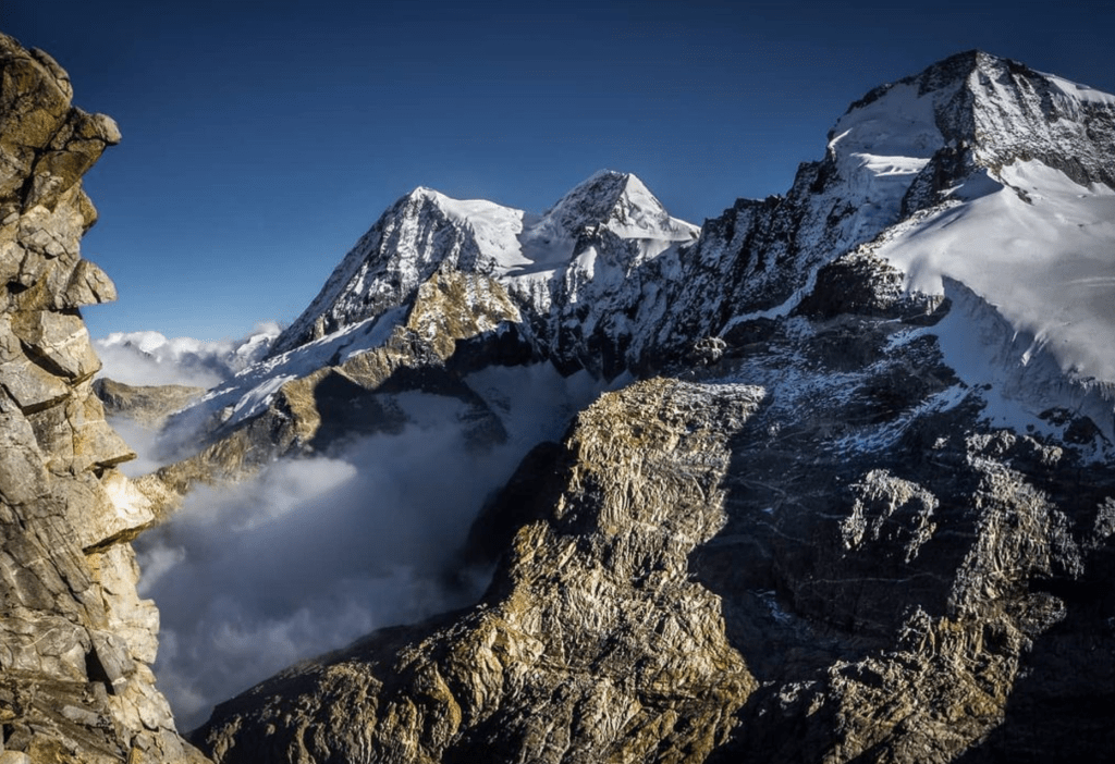
And this is a general view of the Sierra Nevada de Santa Marta:
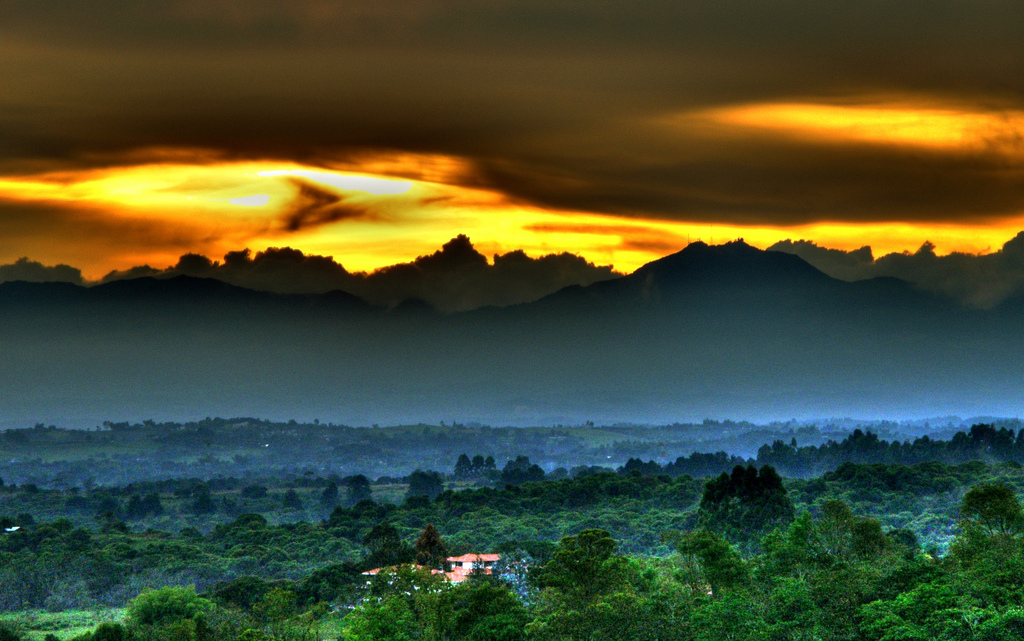
Now that is a land of contrasts! Incredible…! This Caribbean region merges next to and is connected with the Andean highlands through the two great river valleys. After the Andean highlands, it is the second-most important region in terms of economic activity. Approximately 17% of the country’s population lived in this region in the late 1980s.
Most of the country’s commerce moves through the cities of Cartagena, Barranquilla, Santa Marta, and the other ports located along this important coast. Inland from these cities are swamps, hidden streams, and shallow lakes that support banana and cotton plantations for major commodity crops, countless small farms, and, in higher places, cattle ranches. Cartagena, in reality ‘Cartagena de Indias’ is the most visited city in Colombia. I will dedicate a post to this city very soon! ^ ^
The Insular Region
The Insular Region comprises the areas outside the continental territories of Colombia and includes the San Andrés y Providencia Department in the Caribbean sea and the Malpelo and Gorgona islands in the Pacific Ocean. Its subregions include other groups of islands:
- Archipiélago de San Bernardo (in the Morrosquillo Gulf, Caribbean).
- Islas del Rosario (Caribbean)
- Isla Fuerte (Caribbean)
- Isla Barú (Caribbean)
- Isla Tortuguilla (Caribbean)
- Isla Tierra Bomba (Caribbean)
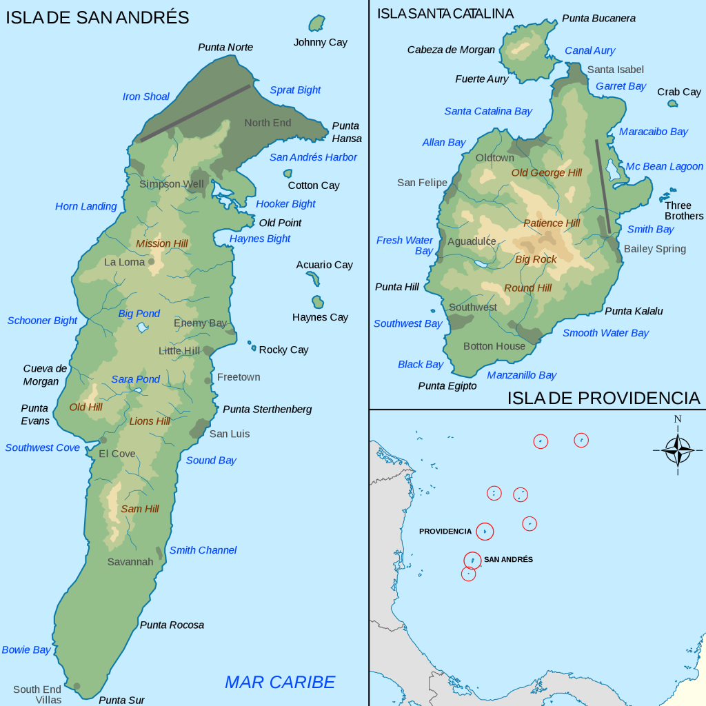
The Archipelago of San Andrés, Providencia and Santa Catalina or San Andrés and Providencia, is one of the departments of Colombia, and the only one in North America. It consists of two island groups in the Caribbean Sea about 775 km (482 mi) northwest of mainland Colombia, and eight outlying banks and reefs. The largest island of the archipelago and Colombia is called San Andrés and its capital is San Andrés. The other large islands are Providencia and Santa Catalina Islands which lie to the north-east of San Andrés; their capital is Santa Isabel.

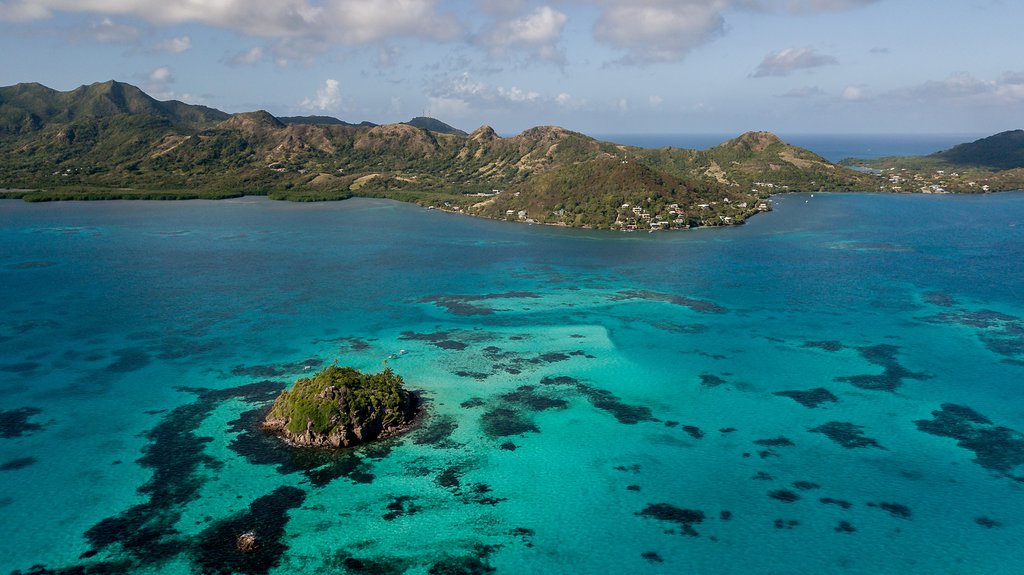
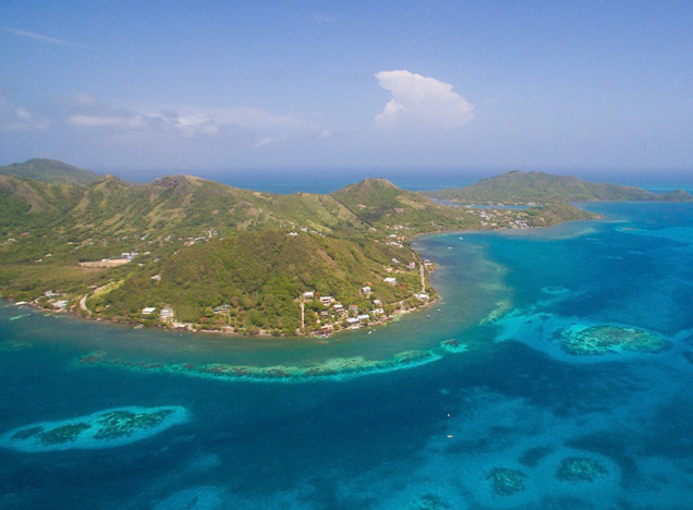
The color of the water is so bright! These photos coming up are of Providencia Island:

What better way to end this geography post than to take a plunge into a video from someone who traveled there. As I sit in Boston looking at these incredible photos with snow coming down, my wanderlust is increasing by the second. We’ve had about two days of sunshine in the last 10 days, so my Caribbean body is being called there!!! ^ ^ How about you?
Sigh…
