Hi! Ready to continue our virtual trip through the land of this beautiful country? OK! Here we go!
In Part 1, we went to the Andean Region, covering the three branches of the Andes mountains found in Colombia; the Caribbean Region, covering the area adjacent to the Caribbean Sea and last we saw its Insular Region, comprising the islands in both the Atlantic and Pacific Oceans. Today we will take a look at its Pacific Region, the Orinoquía Region, part of the Llanos plains mainly in the Orinoco river basin along the border with Venezuela; and finally, the Amazon Region, part of the Amazon rainforest.
The Pacific Region
In this region there are the very narrow and discontinuous Pacific coastal lowlands, which are backed by the Serranía de Baudó, the lowest and narrowest of Colombia’s mountain ranges. The Serranía del Baudó is separated from the West Andes by the Atrato valley where the Atrato River flows and Quibdó is located. From the south the range extends from the Baudó River north and slightly west along the coast into Panama terminating at the Golfo de San Miguel. The range is called Serranía del Sapo when it is in Panama. Technically the landform extends south of the Baudó River down to Malaga Bay, but the area has been eroded into low hills and marshlands. (1)


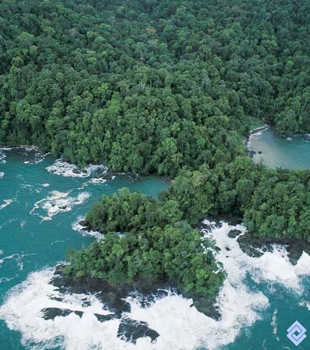
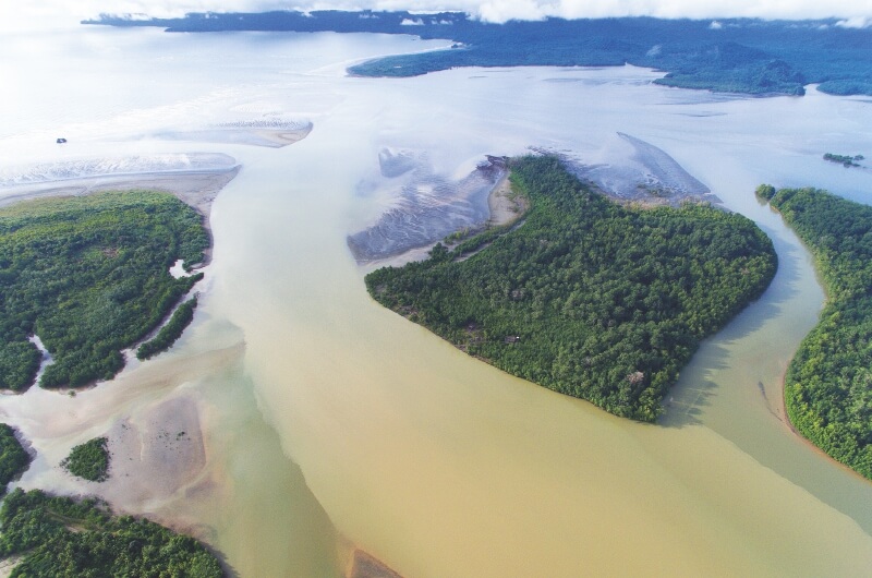
From Cabo Corrientes north to Punta Ardita and on into Panama the Baudó Mountains meet the ocean in steep cliffs, rising up to as high as 70 m (230 ft), with small indentations in the coast providing small pocket beaches, some sandy, but most are shingle or cobble. However, near river mouths the coast has been eroded and there are wide sandy beaches, tidal flats and even mangrove swamps.


For an incredible 360 view of the last photo view go HERE and then check HERE.
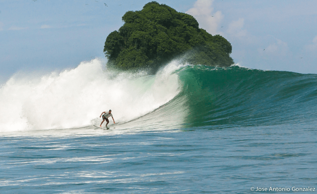
Yes… there you can catch amazing waves as a surfer or windsurfer… imagine that you can even hang out with whales as you do it!
Incredible… !
Orinoquía Region
This area is located to the east of the Andes region and includes about 699,300 square kilometers or three-fifths of the country’s total area. The entire area, known as “Los Llanos” or eastern plains in English, was home to only two percent of the country’s population in the late 1980s. This term of “los Llanos” can only be applied only to the open plains in the northern part, particularly the Piedmont areas near the Cordillera Oriental, where extensive cattle raising is practiced.
Orinoquia is a rarity in our world, an extense natural land rich in biodiversity, untouched by humans. Sadly as Colombia is recovering from years of violence, the government has set its eyes in developing this land. ” The 2016 peace accord has spurred billions of dollars in investments to propel such growth. Although plans are still taking shape, up to 14 million hectares—more than half of the region—could be converted into large-scale or intensified agriculture, mostly soybean and palm oil production as well as cattle.” (2)
This is a map of the region:
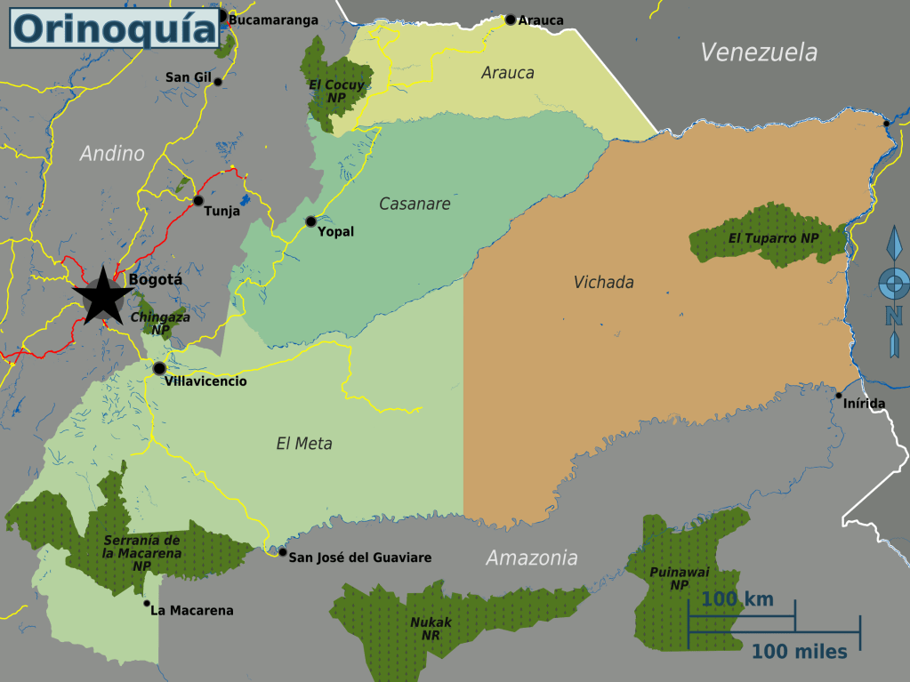
Of all these subregions in Orinoquía, El Meta is the area that is currently most developed as it is near the capital Bogotá. The main attraction here are the haciendas for rent around Villavicencio, which are wildly and rightly popular with Bogotanos looking to escape their high-altitude, colder climate for a weekend or week. The rentals are cheap, and the houses/farms are beautiful, generally with pools in the courtyards. A great escape! This region is largely unknown to international travelers, and most guidebooks to Colombia don’t even mention it.


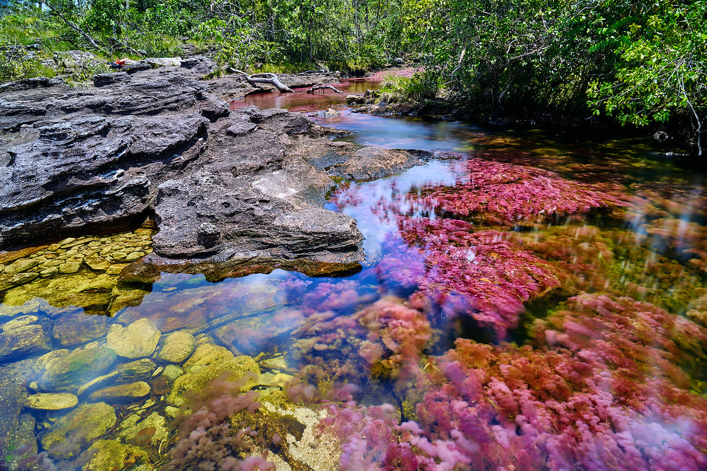
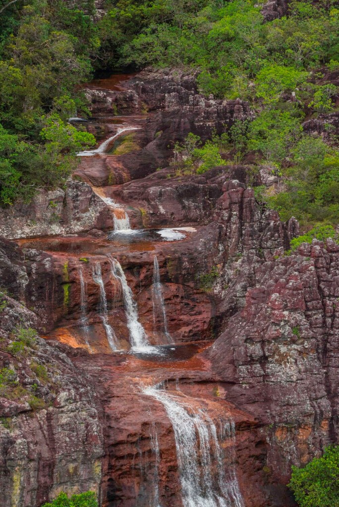
The most amazing sight in El Meta, and really one of the most amazing sights in all South America, is Caño Cristales, a.k.a. the River of seven colors, a.k.a the most beautiful river in the world. In the period of the year between the rainy and dry seasons, the algae of this always beautiful river turn bright red, leading to an explosion of colors.

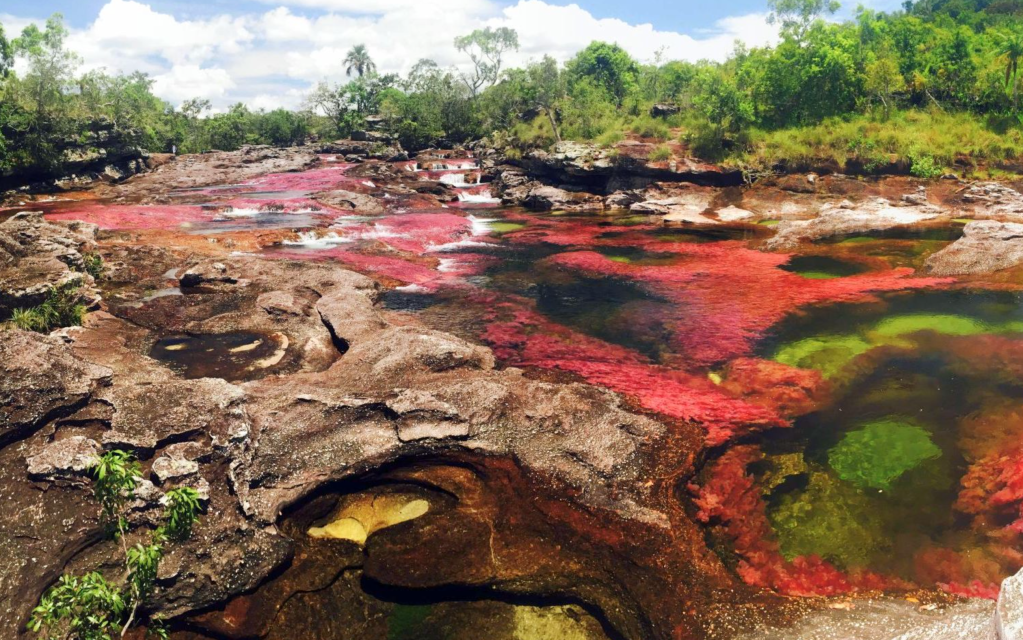


I can only imagine how beautiful this must be in person. The reflection of all those colors! I wanted to see it as live as possible… so here is a video of this region:
And can this possibly get any more beautiful? Well as we are talking about South America it can, and it does. There is no word to even begin to describe the beauty, richness and grandiosity of the next region:
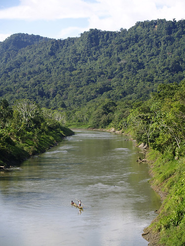
The Amazon Region
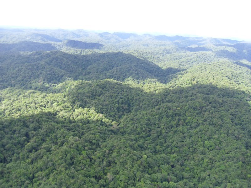
The Amazon region covers about 35% of Colombia’s territory. It is about 186,487square miles (483,000 km²). It includes the departments of Amazonas, Caquetá, Guainía, Guaviare, Putumayo and Vaupés.
One thing that called my attention in the Amazon Department was the largest national park of Colombia and the largest rainforest national par in the world: Chiribiquete National Park. It is around 17,000 square miles and declared a World Heritage Site in 2018. To give you a better idea of the immensity of this place, this park alone is as big as Switzerland.
Chiribiquete National Park is made of isolated table mountains that are part of the western edge of the Guiana Shield. The Guiana Shield It is a 1.7 billion-year-old Precambrian geological formation in northeast South America that forms a portion of the northern coast. The higher elevations on the shield are called the Guiana Highlands, which is where the table-like mountains called ‘Tepuis’ are found. It is one of the few places where the fauna and flora of the Guiana Shield, Orinoco savannas, the Andes and the Amazon rainforest converge. This leads to incredible biodiversity in the pristine and remote rainforest with Tepuis that reach up to 1,000 meters in height.
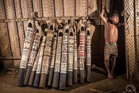
The area is largely unexplored which makes it one of the most important wilderness areas in the world. According to the government of Colombia it has 70% of the mammals, 35% of the birds, 51% of the reptiles, 40% of anfibians and 70% of fish of Colombia! (3) Furthermore, the presence of indigenous groups still living in isolation in this area makes Chiribiquete also a cultural heritage that was recognized by UNESCO as a mixed World Heritage site.


And this incredible place also hosts important archaeological evidence in the form of rock art. More than 600,000 traces of around 75,000 petroglyphs and pictographs have been discovered in the mountain chain!!! The oldest of which may date to 20,000 years. The rock art has been produced until the 16th century CE. The rock paintings were first recorded by the American botanist Richard Evans Schultes in the 1940s. Later investigations were carried out by Thomas van der Hammen.


As much as I would love to see such a beautiful place, I’m happy to write that as a visitor one can only fly over it.
Last thing I will share with you is something I read about this place that left me further in awe. This park’s land mass helps to keep 323 million tons of carbon from escaping into the atmosphere. Imagine that?! And this is only a tiny piece of the entire Amazon that has 2.1 million square miles. The Amazon is the lung of the world… we all must do our part to preserve it…
I feel so tiny…! ^ ^
CREDITS
(1) Wikipedia. Geography of Colombia
(2) The Nature Conservancy. Article: The World’s Eyes Are Watching Colombia’s Orinoquia.
(3) Conde Nast Traveler: Abre el Parque Nacional de Chiribiquete, la joya oculta de Colombia

Excelente
LikeLike